 Here the great Erie Canal has defied nature, and used it like a toy; lock rises upon lock,
and miles are cut in the solid stone.
Here the great Erie Canal has defied nature, and used it like a toy; lock rises upon lock,
and miles are cut in the solid stone.
-- Caroline Gilman from The Poetry of Travelling in the United States, 1838
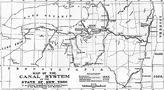
The enormous changes and expansions that the Erie Canal underwent in response to its overwhelming popularity are documented in thousands of engineering maps and drawings created over the course of the canal's enlargement. These survey maps and structure drawings served as a means of visual communication between the designers, engineers, builders, and canal authorities. They illustrate the hundreds of new locks, aqueducts, bridges, culverts, waste weirs, dams, and other structures built for the canal between 1835 and the end of the century.
Engineering the Erie Canal required careful consideration of a great many factors. A canal must be level and changes in its water level must be quantum, not gradual. Bridges are necessary for all paths that cross a canal, and canals require aqueducts in order to cross other bodies of water. Canals require careful maintenance to guard against breaks and must have constantly regulated supplies of water. Flooding or ice can devastate a canal that does not meet exacting standards of design, construction, and maintenance. Lock operation, water supply and regulation, bridge operation, boat weighing and toll collection, dredging, and patrolling must all be carefully planned.
The first builders of the Erie Canal faced these enormous engineering challenges at a time when there were almost no professional engineers in the United States. The principal engineers of Clinton's Ditch were not professionally trained engineers when they began the project. Nevertheless, they were able to construct a canal so successful that it outgrew itself almost immediately. During the Enlargement, the canal was deepened, widened, and most of the original single locks were replaced with double locks to enable traffic to pass in both directions simultaneously. By 1845 over a million tons of goods were carried on the canal each year. During the Enlargement, many engineers and designers were trained by the newly-formed engineering programs at Rensselaer Polytechnic Institute in Troy and Union College in Schenectady. More than thirty Union College graduates were active in the Erie Canal Enlargement.
Thousands of survey maps and structure drawings were prepared during the years of the Erie Enlargement and for subsequent additions and repairs. They served as a means of visual communication between the designers, engineers, builders, and canal authorities. These drawings illustrate the hundreds of new locks, aqueducts, stop gates, bridges, culverts, waste weirs, weigh locks, guard locks, dams, lock tenders' houses, and other structures built for the canal between 1835 and the end of the century. Preserved today in the New York State Archives, they constitute one of the most extensive and aesthetically striking collections of historic engineering drawings in the world. The drawings exhibited in Making It Work provide an introduction to these extraordinary documents and to the many complex engineering structures of the Erie Canal that they illustrate.
http://www.eriecanal.org/UnionCollege/Making_It_Work.html