
Home | Canal System | Historical Documents | 175th Anniversary | Images | Maps | Tour | Traces | Locks | Boats | Books and Videos | Music | Links

Not all old Erie Canal structures are maintained by the State of New York or interested historical groups. Some suffer from benign neglect, and just slowly deteriorate. Some are used as dumps. Some are in private hands and are utilized however the owner wishes. This page illustrates some of these traces.
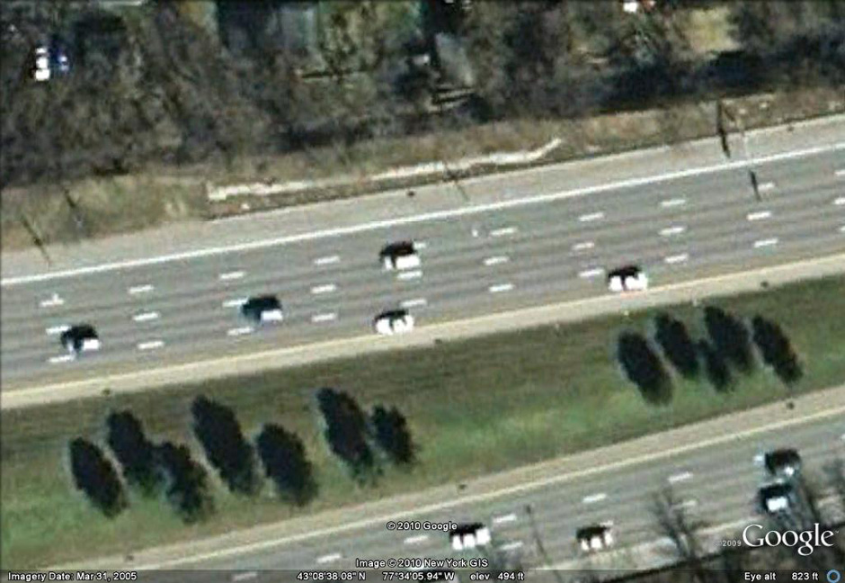
All that remains of Enlarged Erie Canal Lock No. 65 is the north wall of the north chamber. It is located on the north side of Interstate 490 opposite Cobbs Hill Park. Also called Reservoir Lock because of its proximity to the Cobbs Hill Reservoir, it was a double lock, lengthened at the foot, and had a lift of 10.03 feet to the west. A sign on the lock wall reads "Original Erie Canal Lock - Built 1852".
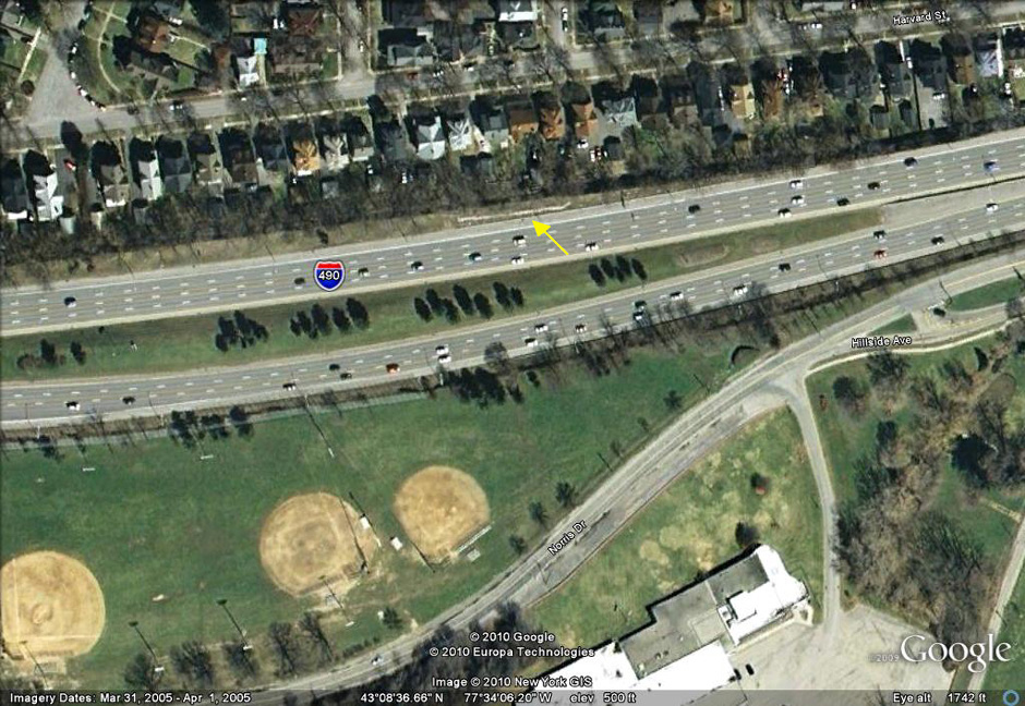 |
Left: Google Earth view of the remains of Enlarged Erie Canal Lock No. 65 ; Right: Google Earth closeup of the remains of Enlarged Erie Canal Lock 65. |
 |
 |
 |
 |
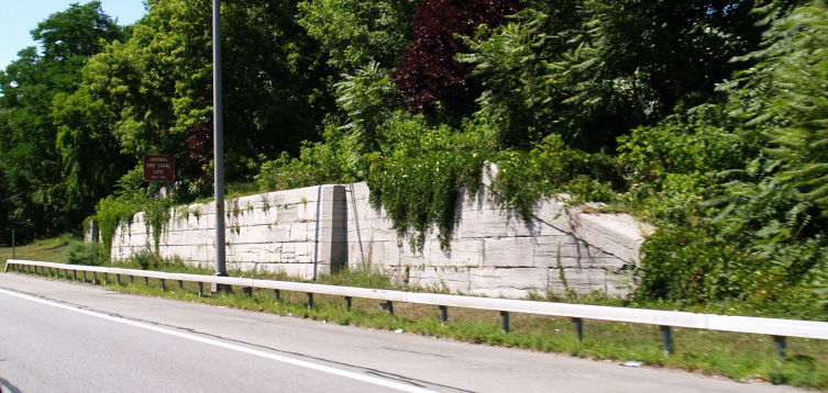
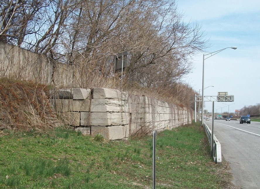
| Lock No. 65, north wall of the north (towpath) chamber, alongside I-490 west in Rochester, NY -- Photograph by Fred Wehner, August 2007. | Another view of the remains of Lock 65, looking east at the north wall -- Photograph by Philip Campbell, April 2010. | Looking northwest at the western door recess in the north wall -- Photograph by Philip Campbell, April 2010. |
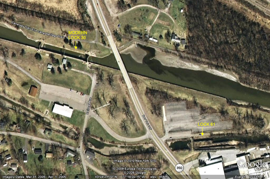
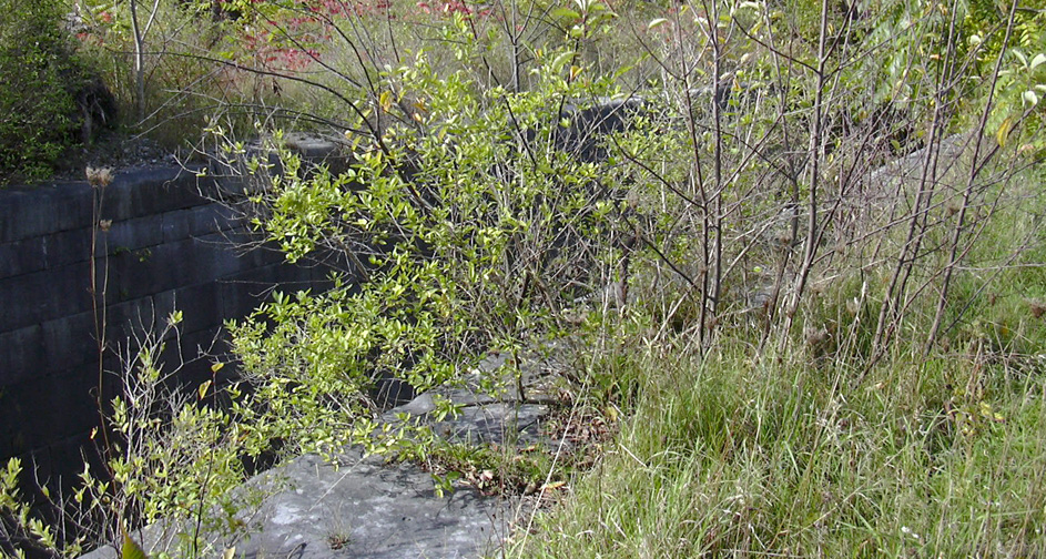
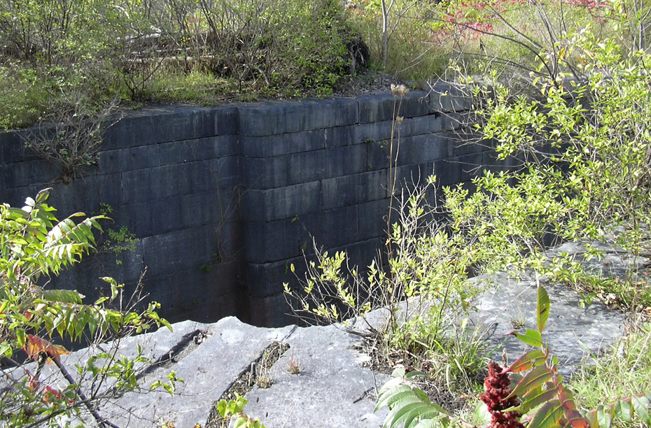
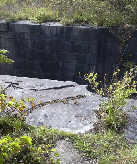
Enlarged Erie Canal Lock No. 61 (also called the Upper Macedon lock) is located at the eastern edge of the business district of Macedon, N.Y., just north of the junction of Route 31 and Route 31F/350, and just south and across the road from Lock No. 30 of the present Erie Canal. The lock is a double-chamber lock, with the north chamber double-length, and had a lift of 6.69 feet to the west. West of the lock and Route 31F/350 is an undisturbed stretch of the Enlarged Erie Canal.
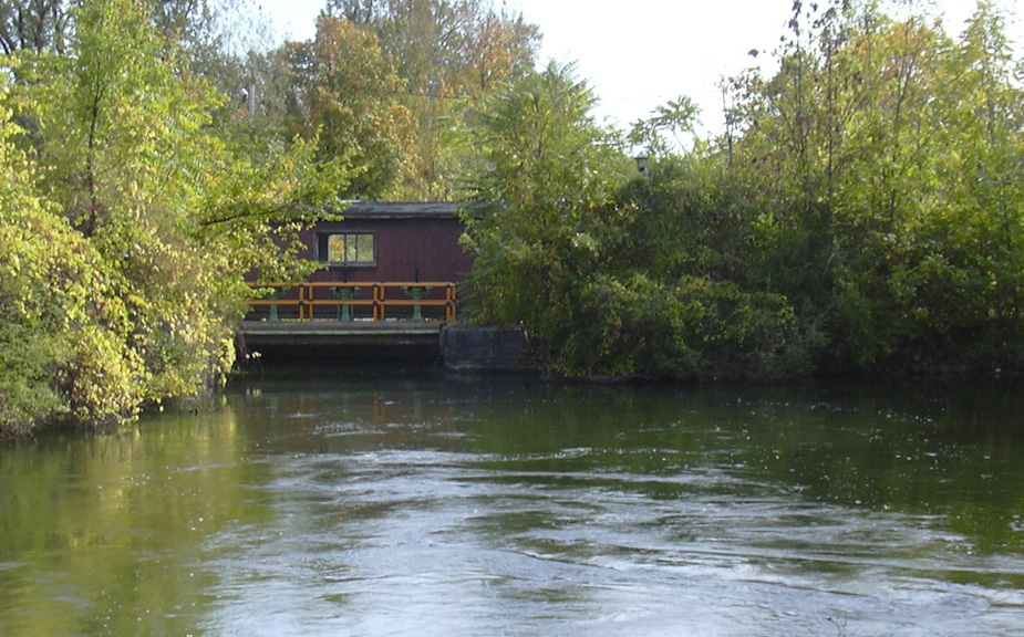
Lock No. 61 is currently used as a spillway for the present Lock No. 30. The area around it is not maintained, and the growth of brush makes it difficult to see. In addition, a pedestrian bridge has been built across the western end of the lock, to serve as a walkway for employees to cross the old canal bed from a parking lot to the adjacent plastic films plant.
 |
 |
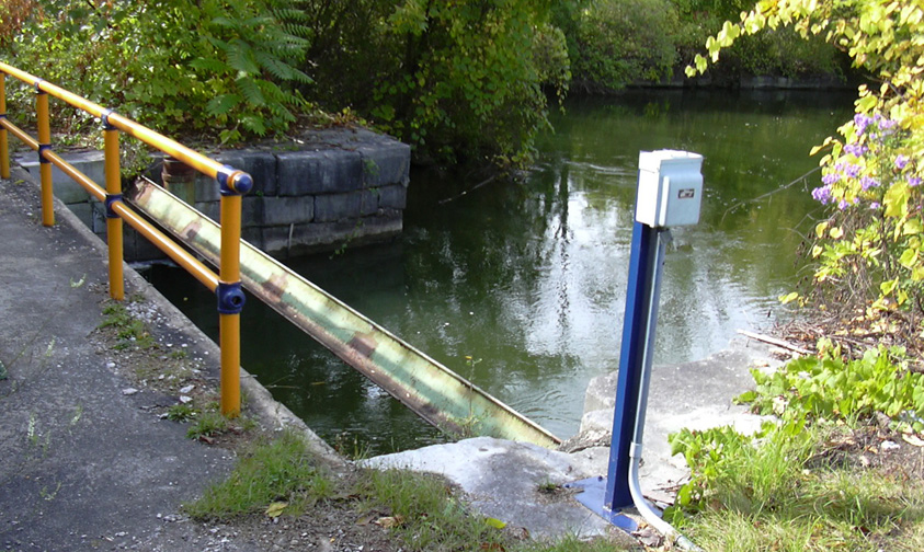 | |
| Google Earth view of current Lock No. 30 (upper left) and Enlarged Erie Canal Lock No. 61 (lower right), Macedon, N.Y. | Looking east at Enlarged Erie Canal Lock No. 61 from Rt. 31F/350 in Macedon. The pedestrian bridge almost entirely hides the lock. | The western end of Lock No. 61. To the left is the bridge across the lock. The electrical box presumably controls the lock gate which controls the water level. | |
 |
 |
 |
 |
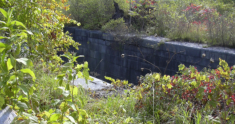
| A portion of the north chamber of Lock No. 61, looking southeast. | Another portion of the north chamber of Lock No. 61, looking southwest. | A portion of the north chamber of Lock No. 61, looking south, showing on the far side a recess for one of the gates when in the open position, and on the near side the traces where a metal bracket which held the gate pivots used to be located. | |
The remains of the Port Byron Aqueducts, both the original Clinton's Ditch aqueduct (1820) and the Enlarged Erie Canal aqueduct (1858), are located in the village of Port Byron, N.Y., in the Town of Mentz and spanned the Owasco Outlet.
The remains of the Clinton's Ditch Port Byron aqueduct consist of the easternmost arch of four. The aqueduct was built entirely of stone. It is located just south of Route 31, behind the parking lot of a church. Part of the arch is actually under part of the parking lot pavement. The pictures below were taken in early April 2010.
 |
 |
 |
| The easternmost arch, looking north. | Location of the Clinton's Ditch Port Byron Aqueduct, looking southeast from the Route 31 bridge. | The easternmost arch, looking northeast. |
The remains of the Enlarged Erie Canal Port Byron aqueduct consist of parts of the two ends, partially obscured by brush, and located approximately a quarter mile north of Route 31. Originally, the aqueduct was 98 feet long, and had 4 arches. The pictures below were taken in early April 2010.
 |
 | |
| The western pier, looking west across the Owasco Outlet ; Right: detail of the heelpath (south) side. | ||
 |
 |
 |
| The eastern pier, looking south. | The eastern pier, heelpath (south) side, looking north. | |
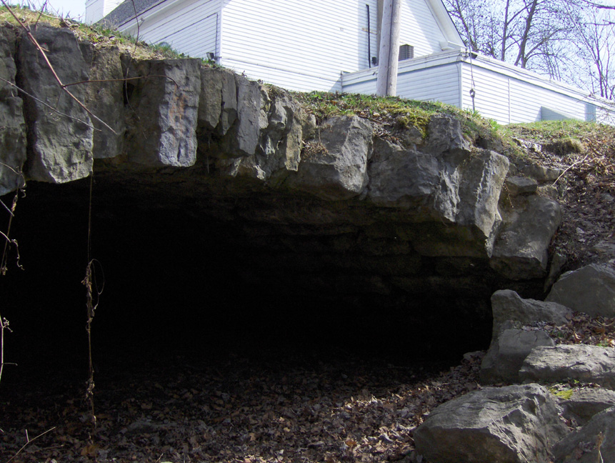
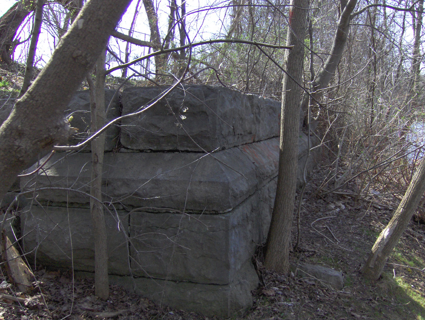
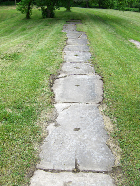
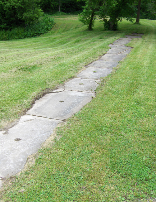
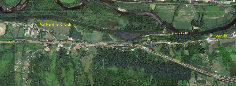
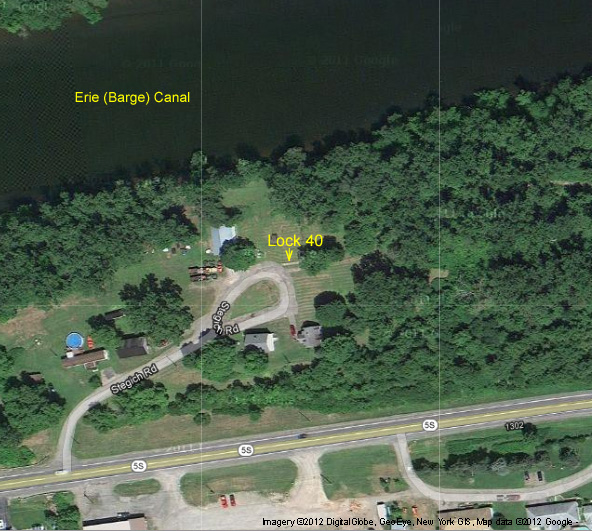
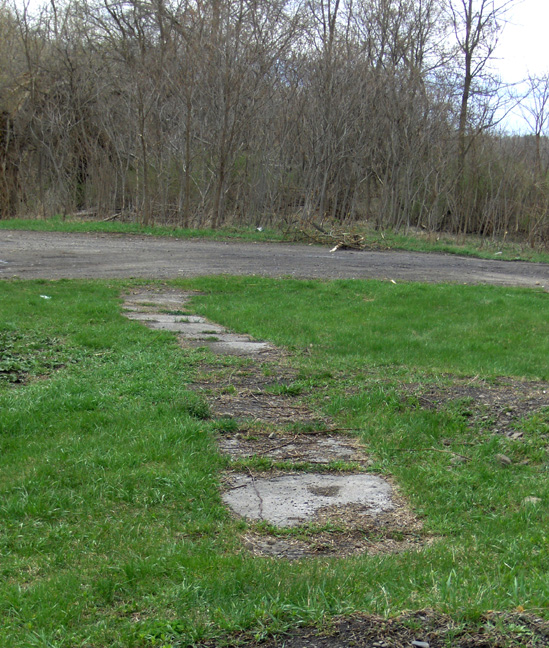
Enlarged Erie Canal Lock No. 40 is located in Jacksonburg (mistakenly called Jacksonville by Whitford), in Herkimer County about 3 miles east of Mohawk and Herkimer on Stegich Road, just off Route 5S. The lock was a double-chamber lock, with an 8 foot lift. It was originally built about 1840-1841, with the south chamber double-length, lengthened in 1891.
At present, the lock is buried, with only the top of the north wall of the north chamber visible. Stegich Road is a private road, and the lock is located on private property, carefully maintained by the owner. Clinton's Ditch Lock No. 7 was located a short distance northwest, and Culvert 71 is located just to the west.
The pictures below were taken in June 2012.
 |
 |
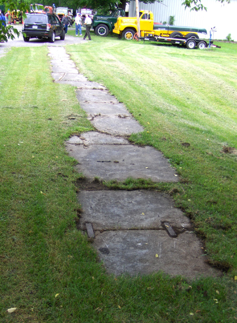 |
| Lock No. 40 - north wall, north chamber, looking like a
sidewalk. Left: looking east ; Center: looking northeast ; Right: looking west. Clinton's Ditch Lock No. 7 was located approximately where the garage in the background stands. | ||
 |
 |
 |
| Google Earth view of the Jacksonburg area. | Google Earth view of Lock 40 and vicinity. | Enlarged Erie Canal Culvert 71 (exit) just west of Lock No. 40. |
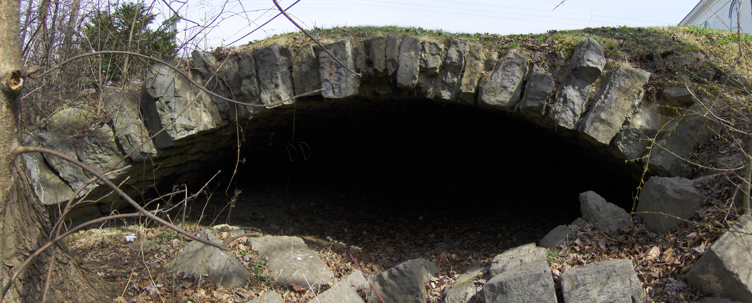
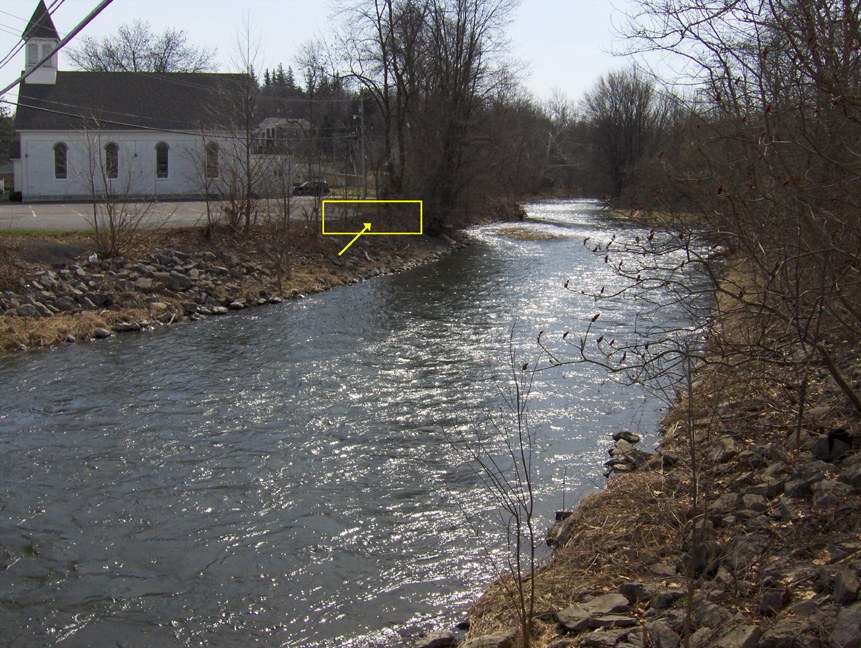
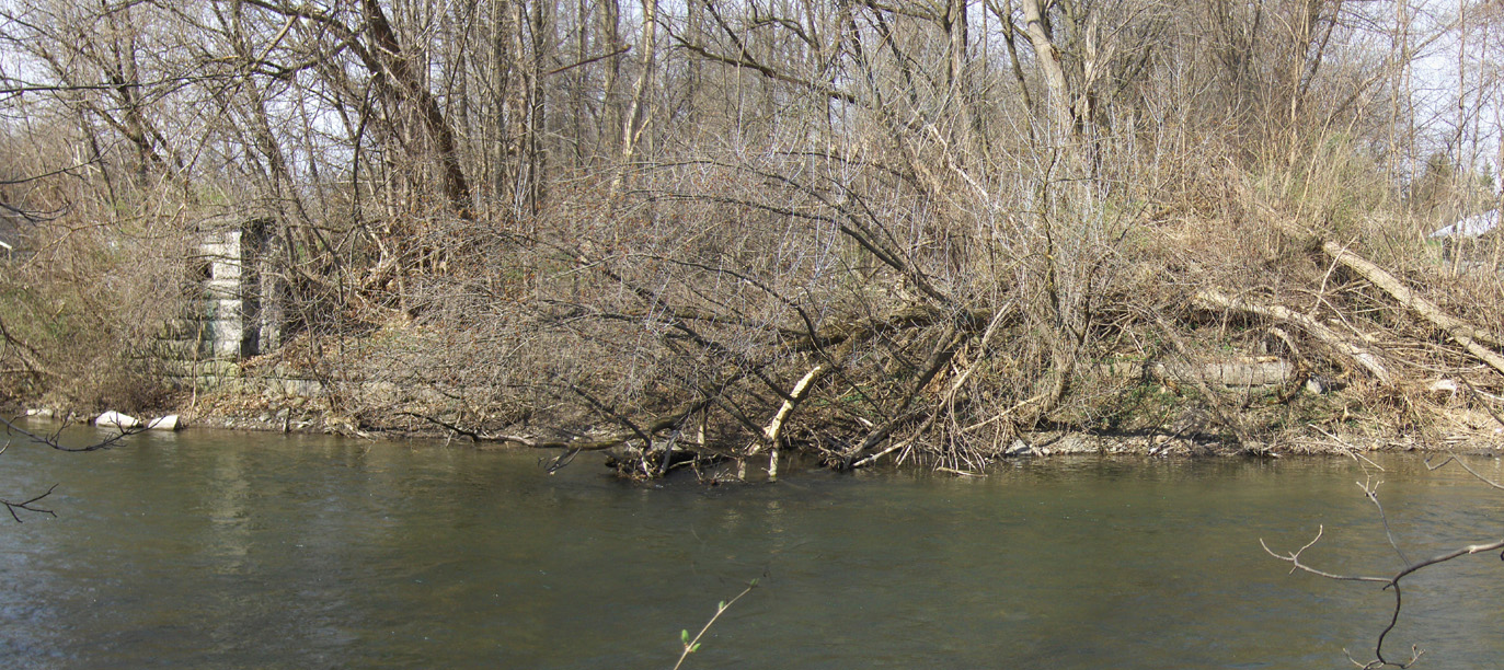
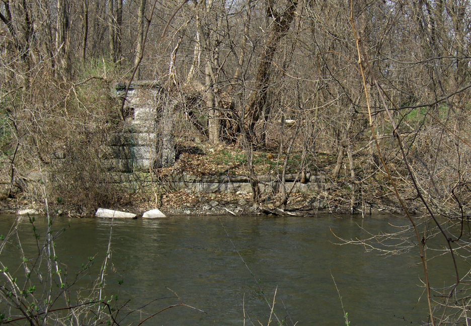
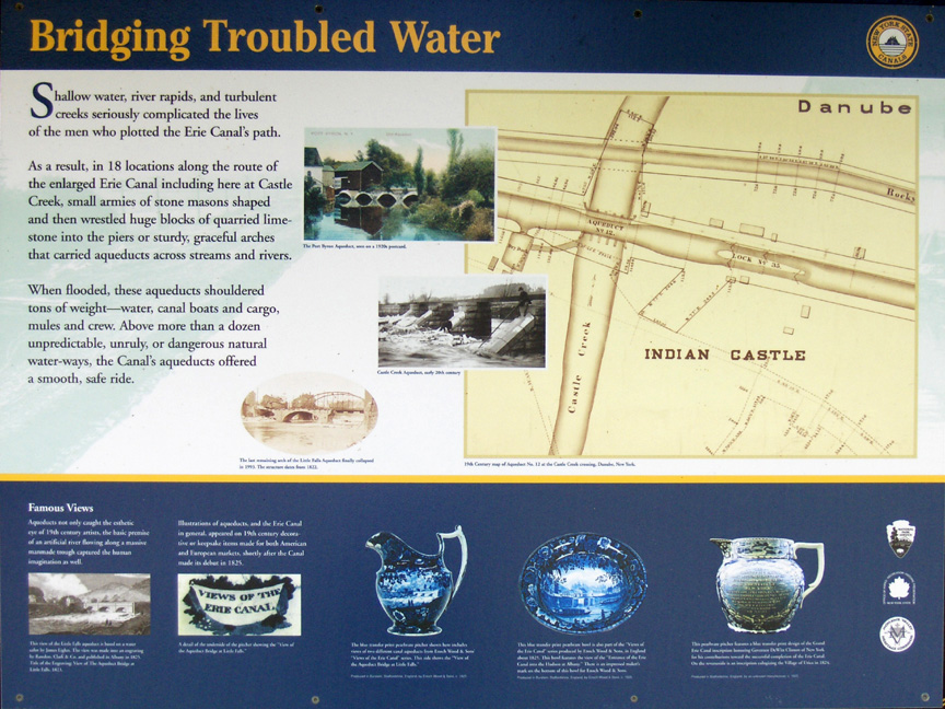
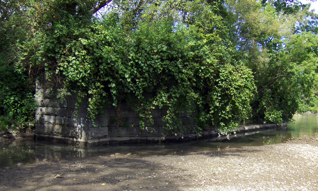
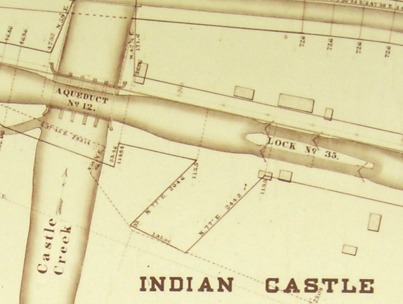
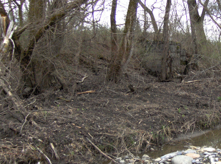
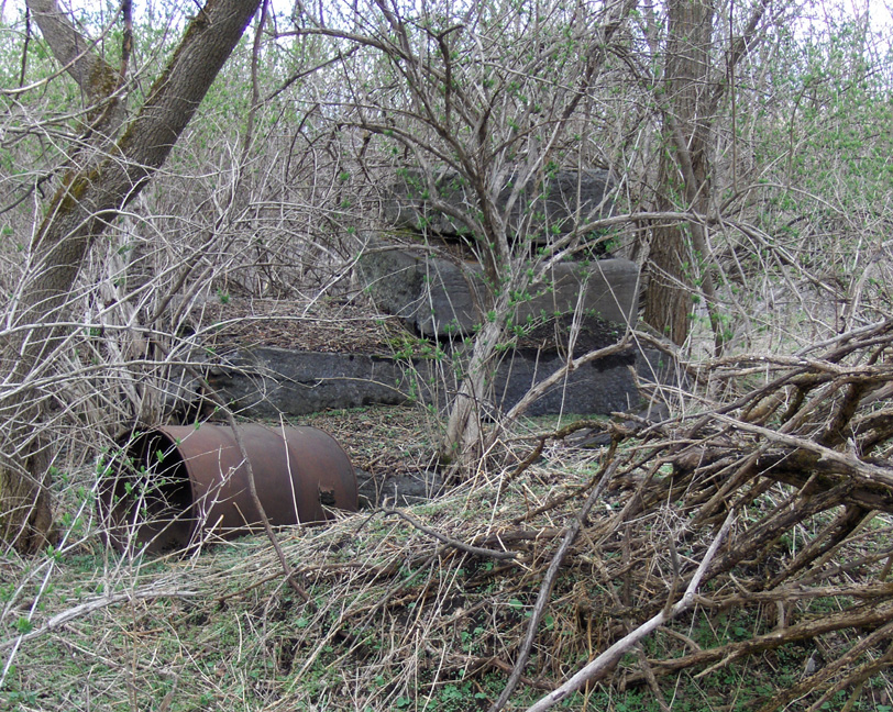
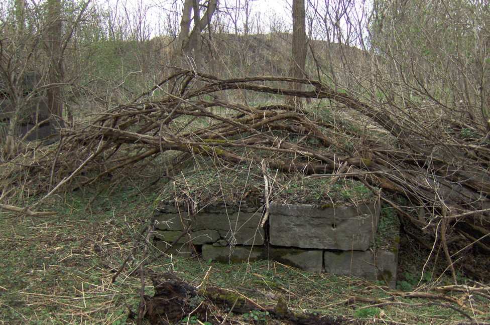
The Castle Creek Aqueduct, also known as Eastern Division Aqueduct No. 12, is located just east of the village of Indian Castle, approximately 4 miles southeast of Little Falls, N.Y. Originally, the aqueduct was 128 feet long, and had 5 arches. At present, all that remains is the western end, largely obscured by brush, and fragments of the eastern end. The surrounding area is used by the Canal Corporation for a disposal area for the spoils of dredging. The nearby remains of Lock No. 35 are buried just east of the creek, now called Nowadaga Creek.
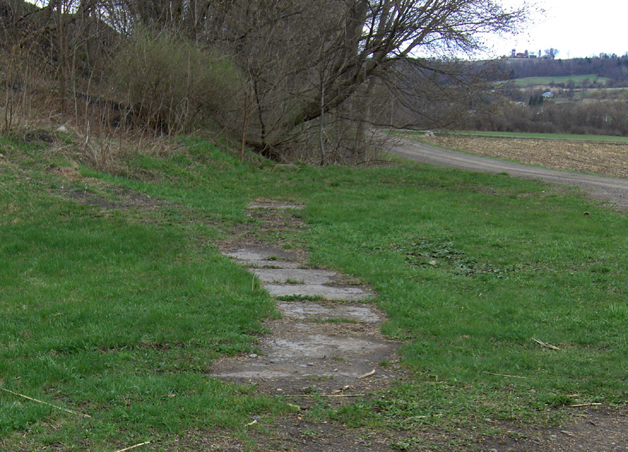
The aqueduct can be accessed from a parking area on Canal Lock Road. The parking area serves a hiking trail, and there is an interpretive sign (see below) on the trail just across the creek. Just past the sign is a farm road which extends to the north, eventually leading to the junction of the creek and the modern canal, where the aqueduct remains are located. The pictures below were taken in late August 2008 and April 2009.
 |
 |
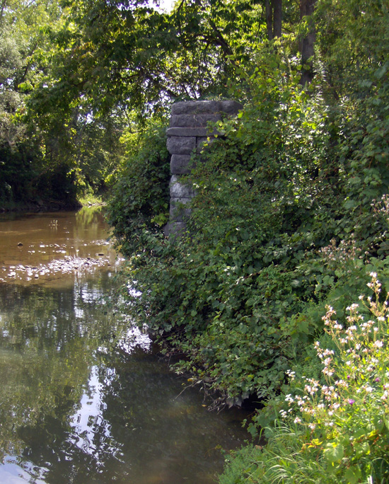 |
| Castle Creek Aqueduct interpretive sign. | Remains of the western end of the Castle Creek Aqueduct Left: Looking west ; Right: Looking south from the west bank. | |
 |
 |
 |
| Detail from the Castle Creek Aqueduct interpretive sign. | Castle Creek Aqueduct western end, looking west. | Southeast pier, looking southeast. |
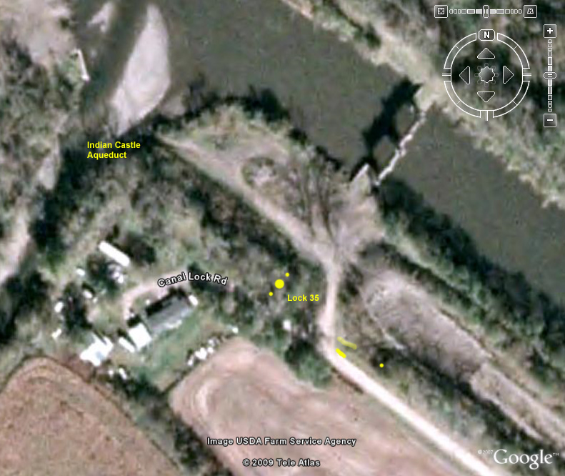 |
Google Earth view of the location of the Indian Castle Aqueduct (upper left) and Enlarged Erie Canal Lock No. 35 (lower middle) -- The large yellow dot and flanking smaller dots are the approximate location of the western end of Lock 35 ; the small dot on the right is the eastern end of the north wall of the southern chamber extension ; the solid line is the visible portion of the south wall of the southern chamber ; the lighter line is the visible portion of the north wall. |
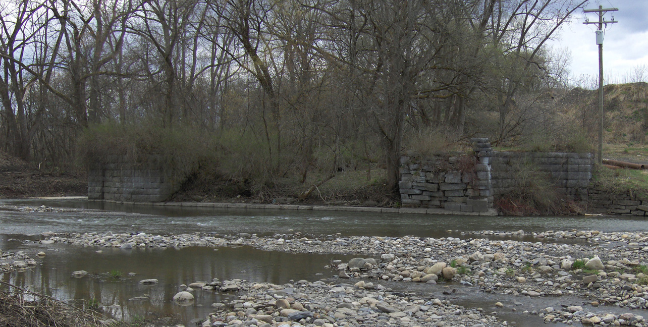
Enlarged Erie Canal Lock No. 35 (also called the Indian Castle lock) is located just east of the village of Indian Castle, approximately 4 miles southeast of Little Falls, N.Y. The lock is located north of the end of Canal Lock Road, off N.Y. Route 5S, and just east of the Castle Creek Aqueduct (see the map above).
The lock was a double-chamber lock, originally built around 1850, and lengthened in 1888. It had a lift of 7.5 feet to the west, with the south chamber double-length at the foot (eastern end). It was abandoned with the opening of the modern Barge Canal in 1918. With the exception of the remnants pictured below, the lock is buried, with a road across it to the Canal Corporation's dredging spoil piles.
 |
 |
 |
| Lock 35 -- western end of the north wall of the north chamber, looking north. | Western end of the central divider, looking east. Note that a bit of the western end of the north wall of the north chamber can be seen to the left. | Eastern end of the north wall of the extended southern chamber, looking west. |
 |
 |
 |
| Not a sidewalk, but a portion of the north wall of the
southern chamber Left: looking east ; Right: looking west. |
Looking like curbing, a portion of the south wall of the southern chamber, looking south from what would have been the inside of the lock chamber. | |
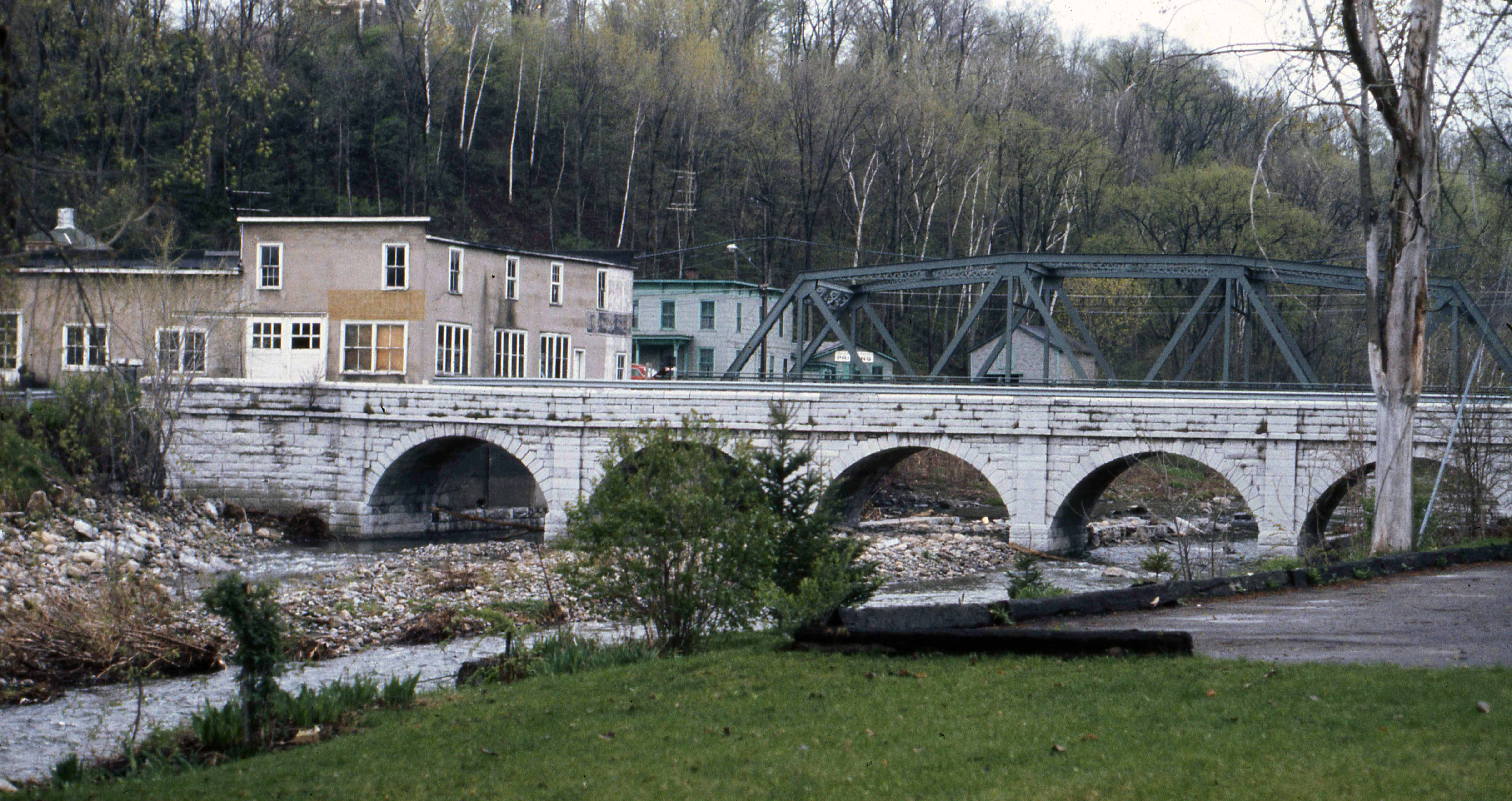
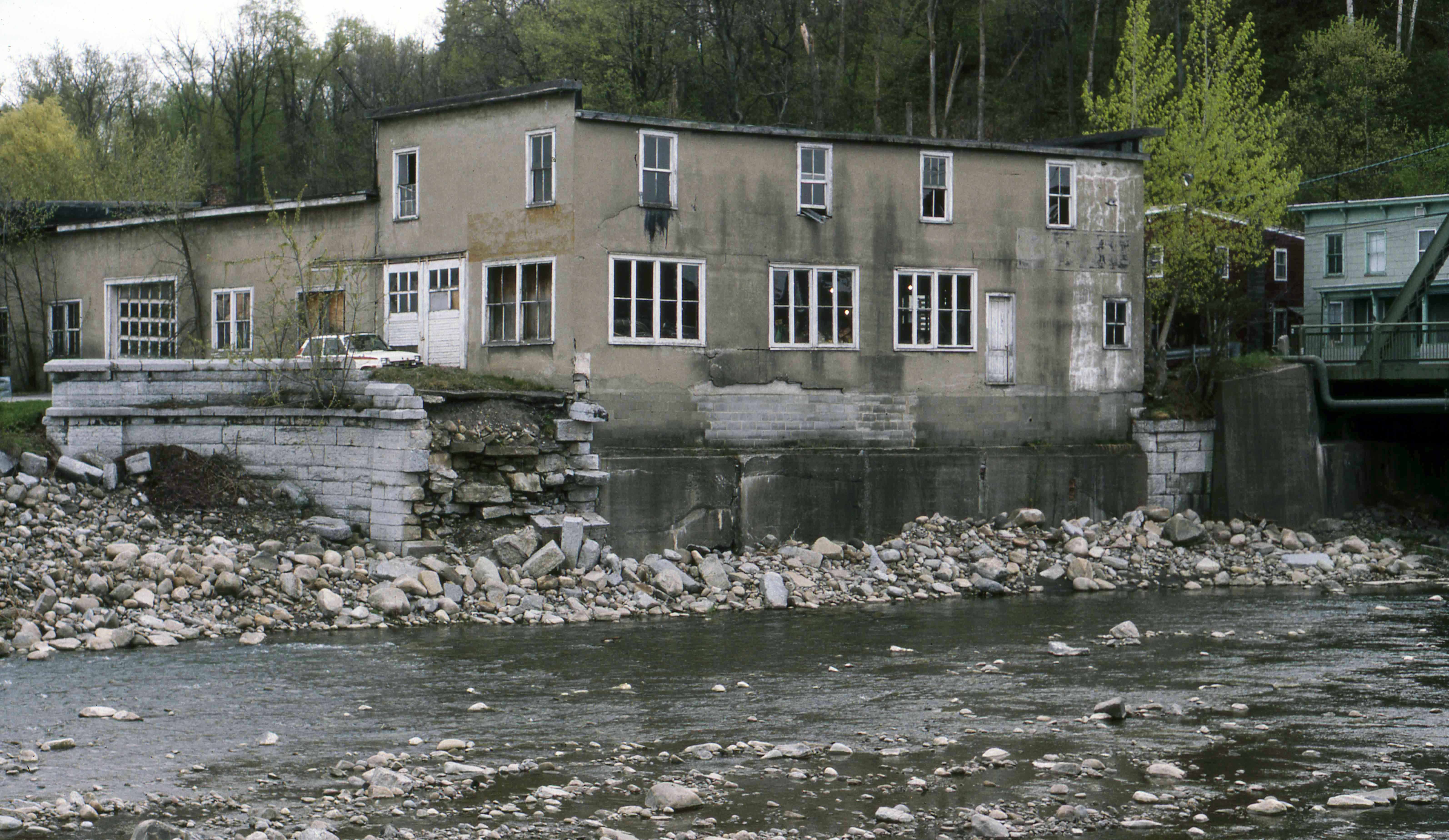
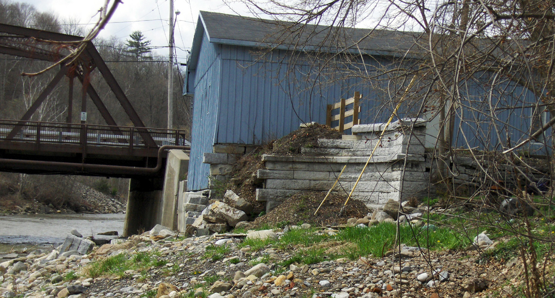
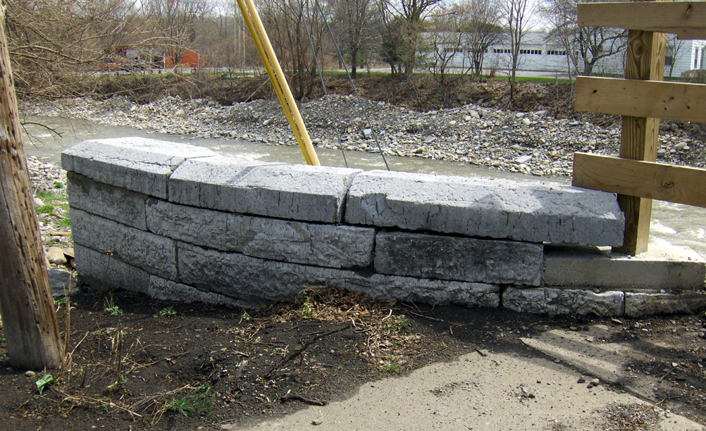
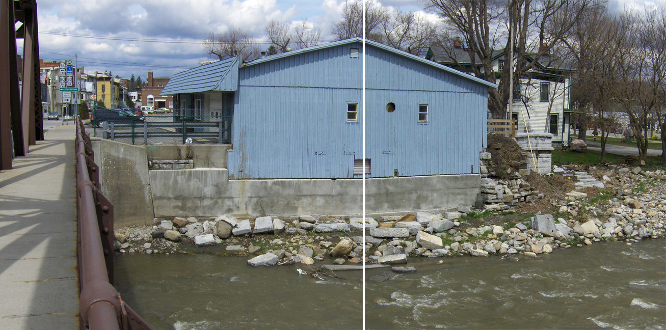
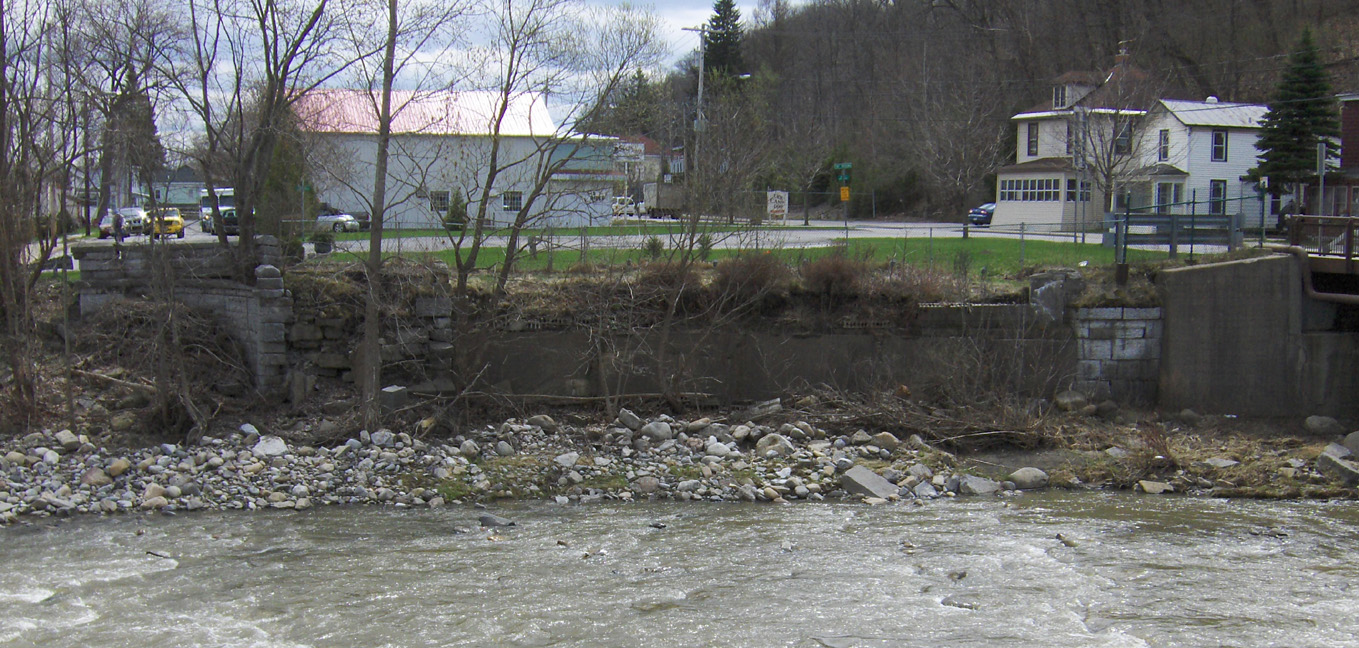
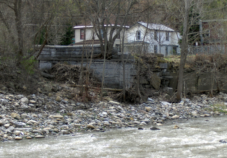
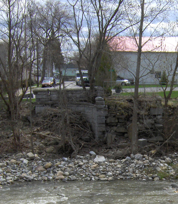
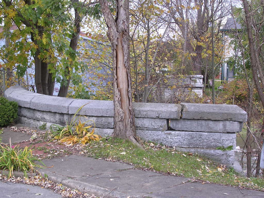
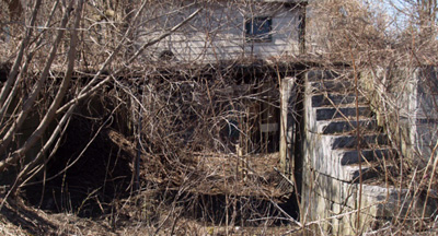
The Otsquago Creek Aqueduct is located in the center of Fort Plain, adjacent to the current N.Y. Route 5S bridge. The first contract was let in 1838 and excavation and masonry work were well underway by 1841. Unfortunately, all work came to a halt with the Stop and Tax Act of 1842, not to resume until several years later, the aqueduct finally being put into service in 1848. Originally, the aqueduct was 126 feet long, and had 5 arches. The aqueduct was swept away by the flood of October 1981. At present, all that remains are fragments of the eastern and western ends. A building is built within the prism of the western end, using the end of the aqueduct for part of its basement foundation.
 |
 |
| The Fort Plain Aqueduct, looking southeast -- photograph taken by Tom Grasso in
May 1973 [CSNYS] |
The remains of the eastern end of the Fort Plain Aqueduct -- photograph taken by Tom Grasso in May 1987, after the bulk of the aqueduct was swept away by the flood of October 1981. [CSNYS] |
The pictures below were taken in late April 2009.
 |
 |
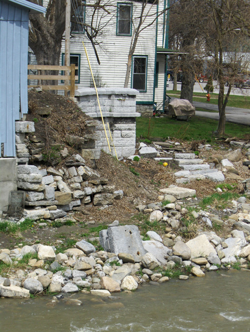 | |
| The northwest pier, looking south from the creek bed. Note the building built in the former canal prism. |
The northwest pier. Left: looking northeast from current street level ; Right: looking west from the east bank. | ||
 |
 | ||
| The western end, looking west from the Rt. 5S bridge. | The eastern end, looking east from across the creek. | ||
 |
 |
 |
 |
| The northeastern pier from across the creek. Left: looking southeast ; Right: looking east. |
The northeastern pier from the current street level. Left: looking west ; Right: looking southwest. These two pictures taken by Howard Ohlhous in October 2006. | ||
Enlarged Erie Canal Lock No. 32 is located in Fort Plain, N.Y. at the east end of town on Route 5S. The lock is a double-chamber lock originally built about 1850, with the south chamber double-length, lengthened in 1888. Lock No. 32 currently has a garage and house built atop it. The lock runs through the basements of both the garage building and the house to the west and across the front yard of the house.
The following two pictures were taken in April 2007 by Fred Wehner. For larger versions of these pictures as well as more pictures of the lock, go to The Travels of Tug 44 page.
 |
 |
| Lock 32 -- east entrance to the extended south chamber, which runs through the basement of the garage. | Lock 32 -- The lock continues across the front yard of the house, looking like a pair of sidewalks running to the carwash next door. |
Enlarged Erie Canal Lock No. 16, Harmony Mill, Cohoes, N.Y. -- Lock 16 is a short distance north of Vliet St. behind Harmony Mills no. 1.
It is filled in, with only the top capstones visible.
For other pictures of Lock 16, see The Travels of Tug 44 page.
 |
 |
| Lock 16, Harmony Mill, Cohoes, N.Y. after it was abandoned, looking west. -- 1950? [CSNYS] |
The remains of Lock 16 at Cohoes -- taken 2007? by Fred Wehner. |
http://www.eriecanal.org/other.html