HISTORY OF THE BARGE CANAL
OF NEW YORK STATE
BY NOBLE E. WHITFORD
CHAPTER VIII
THE ADDITION OF ANOTHER BRANCH -- THE CAYUGA AND SENECA CANAL
Survey of 1905 to Cayuga Lake -- What Existing Arrangement Would Mean -- Report of 1905 Survey -- Agitation Renewed in 1909 -- Improvement Recommended by Superintendent Stevens -- Paper Read at Waterways Meeting -- Senate Asks for Estimate and Report -- State Engineer Williams Replies -- Explanation of Names -- Estimates of Costs -- Possibility of Separate Seneca Lake Branch -- State Engineer Recommends Survey -- Legislature Passes Bill Authorizing Improvement -- Governor Approves, Choosing between Two Referenda -- Survey also Ordered -- Authorizing Law Leaves Choice of Seneca Route Open -- Survey Parties Soon in Field -- Seneca Routes Investigated but Old Line Chosen -- First Contracts Let in 1910 -- Amendment of 1911 Adds Branch between Watkins and Montour Falls.
When the State Committee on Canals made its report to the Governor in 1900, recommending the improvement of the New York State canals, it gave as one of its conclusions that the Cayuga and Seneca and the Black River canals should be retained as navigable feeders but that they should not then be enlarged. This advice was followed throughout the period of agitation and eventual authorization and also until construction had begun on the three main branches, but soon thereafter it appeared that the people of the finger-lakes region desired a share in whatever benefits the new canal might bestow and were trying to have their waterway included in the scheme of improvement.
The first effective move in this direction was a bill in the 1905 Legislature directing the State Engineer to make a survey, together with plans and estimates, for a canal from some point on the main waterway near Seneca river to Cayuga lake. We have seen already how this survey fitted in with a plan to change the alignment of the Erie canal in this vicinity; how this plan began with an attempt to avoid certain difficulties at Savannah by altering the line for a few miles and grew until it embraced a stretch of about forty-three miles, extending from Fox Ridge to Macedon. This change of alignment was made, it will be recalled, by amending the Barge canal law in 1907. A potent factor, it will also be remembered, was the consideration that it brought the Erie channel five miles nearer the foot of Cayuga lake. At the time of making this first survey and during the two years or more of studies and deliberations on the contemplated change it was realized that the two schemes were closely interdependent and that in deciding either question its effect upon the other must be regarded of prime importance.
The people living near the Cayuga and Seneca canal brought forward many forcible arguments in their appeals for enlarging this waterway and some of these will appear a little later. But for our understanding of the situation as it then stood -- what would happen if no improvement should be made by the State, how, aside from being denied participation in a larger channel, all navigation of the canal would be subjected to greater inconvenience than in the past -- we must remember that the Barge canal deviates in general from the old channel, in some places by a distance of several miles, and we must know in particular that in this vicinity the two lines were wide apart for many miles and under the arrangement of the original law the only connection between the Cayuga and Seneca canal and the new Barge channel would be by way of the existing Erie canal from Montezuma to Syracuse and thence down the existing Oswego canal to its entrance into the Seneca river, in all a distance of about 39 miles. We must know also, in order to perceive one important reason for both changing the Erie route and making direct connection with the Cayuga and Seneca branch, that it would have been necessary to keep open these portions of the existing Erie and Oswego canals simply for supplying an outlet for the Cayuga and Seneca canal and that except for this need they might be abandoned after the Barge canal improvement should be completed.
The report of the survey to Cayuga lake, which is dated March 26, 1906, showed three estimates, $2,677,000, $1,918,000 and $1,647,000, which were for channels having 12, 9 and 7 feet depth of water, respectively. The estimate for the 12-foot channel was an estimate, of course, for a waterway of Barge canal dimensions. One lock would be required and this was estimated along Barge canal lines, having the same length and width but a depth corresponding with the three respective depths of channel. It had been found that before deep water could be reached a channel of considerable length would have to be excavated into the north end of Cayuga lake. The distances were 7 miles for the 12-foot depth, 3 1/2 miles for the 9 foot depth and 2 1/3 miles for the 7-foot depth.
At the time of making this survey the change of route in the new Erie branch was still under deliberation and so the estimate contemplated a line from a junction about a half mile west of Fox Ridge to deep water in Cayuga lake. No specification as to size of the proposed channel appeared in the authorizing act, this question being left to the discretion of the State Engineer. Mr. Van Alstyne held the position of State Engineer at the time and his decision, as we have seen, was the submission of estimates for three sizes, a plan which permitted a study of comparative costs. A depth of twelve feet was the Barge canal size, one of nine feet was what the existing Erie was supposed to be, while seven feet would be no increase over the existing Cayuga and Seneca depth, but a new location was chosen, the same for all three depths, and this in general followed the river but slightly above it. The law ordered a survey only to Cayuga lake and that was as far as it was carried, but the idea of extending eventually throughout the whole length of the canal whatever improvement should be made was evidently in the minds of those concerned. In fact the report of the State Engineer treated somewhat of the benefits of having direct water communication with the heads of Cayuga and Seneca lakes, both close to the coal fields of Pennsylvania, and also of providing access to water by salt-producing works on each lake and to some building stone quarries and a cement plant on Cayuga lake.
It was not until 1909 that agitation for an improved Cayuga and Seneca canal was vigorous enough again to catch the public eye. Doubtless the friends of the project had been working quietly. Such matters seem usually to move rather slowly and three years had now elapsed since State Engineer Van Alstyne had presented his report of the first survey to the Legislature, but during the session of 1909 events moved swiftly and before it closed the success of the issue had been accomplished so far as it could be till the people passed upon it at the ensuing general election. During the period of apparent quiescence, however, the route of the main canal had been changed by legislative amendment and now its nearest point was only four miles from the foot of Cayuga lake.
In his report to the Legislature in January, 1909, Superintendent of Public Works Stevens made a strong plea for including this canal in the number of those to be improved; he enumerated some of the prospective benefits and called attention to the possibility of adding the two lakes with their eighty miles of natural navigation amidst important industries to the Barge canal system by building only about twenty-four miles of waterway. While he had not the data upon which to base an accurate estimate he thought the portion between the new Erie junction and Cayuga lake could be built for $1,750,000, and that from Cayuga lake to Seneca lake for $4,000,000.
At about this time there occurred a conference of waterway advocates in Brooklyn, assembled for the purpose of organizing what became the New York State Waterways Association, a body which from its founding has been the channel through which concerted public action has endeavored to advance the interests of the canals, a body, moreover, made up of representatives from many of the same commercial organizations which have backed the canals during the thirty-five years that the later series of improvements has been going on. The Cayuga and Seneca project was placed before this conference in a paper read by Jared T. Newman, who had just served Ithaca as mayor. One or two of Mr. Newman's statements will suggest why the arguments for this improvement prevailed. There was a single cement plant on Cayuga lake, said he, which had a capacity of one thousand barrels a day and bade fair to produce that amount in 1909. But the cement industry in that vicinity was still in its infancy. Gypsum was also produced in large quantities on Cayuga lake. But more important than these was the production of salt. Already Tompkins county, on Cayuga lake, and Schuyler county, on Seneca lake, in the order named, stood next to Livingston and Wyoming in the quantity of salt produced in the state, Onondaga, the original large salt producer coming after Schuyler. "As a matter of fact," to quote Mr. Newman's language, "layers of solid salt 248 feet in aggregate thickness underlie Ithaca and Watkins -- a quantity sufficient to supply the world, and more available to tide-water than any other large deposit. The estimated output of salt and cement for the year 1909 from the plants along the two lakes is 500,000 tons, while the total tonnage by boat last year was only about 81,000 tons."
The immediate result of the recommendations made by the Superintendent of Public Works was a Senate resolution, dated February 4, calling on the Superintendent and the State Engineer for an estimate of probable cost and such other information as would enable the Legislature to make an intelligent study of the whole question and also come to a decision as to what step, if any, it should take in inaugurating the suggested improvement.
The State Engineer, Frank M. Williams, replied to this request. Such data as were available were filed in his office and chief reliance had to be placed on this information, since a speedy answer was required and no time was allowed for adequate surveys. Mr. Williams' report was dated March 27 and in it we find that he divided the project into two parts, one the section from new Erie canal to Cayuga lake and the other from Cayuga lake to Seneca lake. For the former section the survey made in 1905 furnished sufficient data, but for the latter section little was at hand upon which to base an estimate for constructing a channel of Barge canal dimensions. But from the best information obtainable, from comparison with somewhat similar work already under contract on the Barge canal improvement and from a few such hurried surveys, sounding for rock and personal examinations as could be made an estimate was prepared. As the State Engineer said, however, this could at best be regarded as only approximate.
Parenthetically it may be said that the division of the Cayuga and Seneca canal into two parts was a feature in the history of the waterway which did not appear until just about this time but which presently led to a confounding of names. All through its existence up to this time it had been known as the Cayuga and Seneca canal but the act of 1909 called it the Cayuga and Seneca canals. This was not an inadvertent error; the law described separately and with exactitude the routes which it designated the Cayuga canal and the Seneca canal. The reason for this change and the circumstances leading to it are easy to discern. The entering wedge in the attempt to connect the Cayuga and Seneca branch with the Barge improvement was the survey of 1905 and this included only the portion to Cayuga lake. The Superintendent of Public Works in his rough estimate of cost naturally separated the part based on an actual survey from that which was more or less of a guess. The State Engineer was compelled to make a like division for a somewhat similar reason, but also, as will appear presently, he thought that he might be able to find an advantageous connection between Seneca lake and the new Erie canal by going directly north and not diverging easterly to Cayuga lake, as ran the course of the existing canal. But investigation showed the old route to be better and the Barge canal improvement has followed a route not separated widely from the old canal. Indeed the difference in alignment is less than on much of the Erie branch, since portions of the old Cayuga and Seneca were already river canalizations. There seems to be no sufficient reason, therefore, for changing from the old name. It may hark back to a style not common nowadays in assigning names to new enterprises, but that is of small account. This is the same waterway that was built in 1825-28, any changes since that time having been essentially nothing but enlargements, and it is best that its identity should be preserved. To this end we are careful to use the original name in the present volume. In general the same rule has been followed in all publications of the State Engineer's department. Moreover, although the phrasing seems well advised for various recent projects, we steadfastly abstain in this instance from that hyphenated modernism employed by some persons, the Cayuga-Seneca canal.
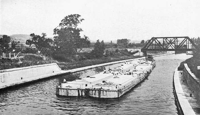
Approach walls to a lock. All locks have approach walls, some long, others comparatively short. In the river lines guide piers often supplement the upper approach walls. The lock in the view is the second of the Waterford series. The fleet, consisting of six barges of old canal size and a tug, nearly fills a Barge canal lock and may be passed at a single lockage.
State Engineer Williams' estimate, in his report to the Legislature, was based on a channel of Barge canal dimensions. Furthermore the same essential features of construction were adopted. It would be a serious error, he said, to sacrifice on this canal, for the sake of economy, the rules of good curvature and alignment and the standards of stability and completeness established on the main waterway. At one particular locality, however, a saving could be effected. The existing canal circled the north end of Seneca lake in a land line, continuing for about two and a half miles beyond the point where access to the lake was first possible. Because of new methods of propulsion inherent to Barge canal navigation, direct entrance into the lake would entail no hardship on boatmen and so this shorter course was planned. The estimated cost for the section from the Erie branch to deep water in Cayuga lake, a distance of 10.8 miles, was $1,565,543. The extension from a point on this line to deep water in Seneca lake was 13.7 miles long and was estimated to cost $6,528,233, making the total for the whole canal $8,093,776.
The State Engineer added that he had some reason for believing that there might be found a route from Seneca lake to a junction with the main Barge canal which could be built at less expense than would be involved in canalizing the Seneca river along the existing canal. He recommended the appropriation of $40,000 for making surveys from which to prepare detailed plans and accurate estimates and also contract drawings for such portions of the work as should be undertaken first. This preliminary work would occupy about a year and its accomplishment, in anticipation of a speedy authorization for the improvement, would hasten the completion of the canal of course by that much time.
A bill to enlarge the Cayuga and Seneca branch to Barge canal dimensions and carrying an appropriation of $7,000,000 was passed by the Legislature of 1909. It was one of the thirty-day bills left in the hands of the Governor after adjournment. In the natural course of events it was necessary for a bill of this character to run the gauntlet first of the Governor's endorsement and then of the people's approval at the ensuing general election, but this particular bill was subjected to a more severe test. The Legislature had complaisantly yielded to other strong influence and had left with the Governor also a bill for the issue of bonds to the amount of $2,000,000 for pensioning Civil war veterans, despite the constitutional restriction that only one measure carrying a bond issue might be submitted at any one election. Thus the Governor not only was compelled to determine the advisability of the propositions but was placed in the dilemma of choosing between them, and both were strongly endorsed by large and influential organizations. Moreover the advocates of each bill were necessarily forced to seem to be the opponents of the other.
To help him decide the difficult question Governor Hughes gave a hearing at which both measures might be argued. The veterans were well represented by delegations and spokesmen and their strong plea was that the canal scheme could wait while the rapid rate of depletion in their ranks called for immediate action. For the canal there spoke George Clinton of Buffalo, Jared T. Newman of Ithaca, and Henry B. Hebert of New York. Canal delegations were present and others were to have spoken but time forbade. The argument which seemed to hold the Governor's attention closest and make the strongest impression on him was that advanced by Mr. Clinton, who held that the pension bill was unconstitutional and even if approved by the people would not become operative and afford the desired relief.
The Governor signed the canal bill and it became chapter 391 of the Laws of 1909. We need not examine its provisions in detail. In general the act closely resembled the law which authorized the improvement of the Erie, Champlain and Oswego canals and in many features it was identical with the earlier law. The supply bill of 1909 contained an item of $20,000 for making a survey of the Cayuga and Seneca project and this too received the Governor's approval.
But there is one clause in the new law which we must notice. As we have seen already, the act separated the canal into two parts. One extended from near the confluence of the Seneca and Clyde rivers to deep water in Cayuga lake and was called the Cayuga canal; the other began at a junction with the Cayuga route and went to Seneca lake, being denominated the Seneca canal. After describing these two courses, the law provided for an alternative route, which would stretch northerly from Seneca lake and join the Erie canal in the vicinity of Lyons. This latter route might supersede the easterly line to Cayuga lake along the existing canal. The act placed on the State Engineer the duty of making the necessary surveys and estimates to show comparisons of cost and desirability, and laid on the Canal Board the responsibility of making the final choice between routes.
With a fund available for surveys without waiting for the whole appropriation to be approved by the electorate, parties under the immediate direction of Deputy State Engineer H.W. De Graff were in the field by the first of June and before the end of the calendar year the surveying and mapping had been almost completed and computations were being pushed. Information was at hand for beginning contract plans as soon as the choice of routes should be made. The referendum was carried by a majority of 69,097. Four constitutional amendments voted on at the same time were also approved and of the five measures the canal project stood second both in the number of votes cast for and against it and in the size of its majority.
The possibility of finding better alignment than that of the existing canal led to very thorough investigations, especially along the prospective line running north from Seneca lake, some twelve schemes having been studied. These included routes by way of Canandaigua outlet and also through a chain of small lakes and streams two or three miles to the east of this outlet, with termini at either Geneva or Seneca lake outlet on the south and at Lyons or Creagers bridge on the north, with both constantly descending levels from the lake to the Erie canal and also summit levels and a consequent water-supply midway. On the line east from Seneca lake a possible course other than along the existing canal was examined. This route followed Seneca outlet nearly to Waterloo but diverged thence to the south, avoiding the built-up portions of Waterloo and Seneca Falls and reaching Cayuga lake several miles above its foot, at a point directly east of Seneca Falls. The route selected, however, followed substantially the line of the existing canal, which was also largely the channel of the natural outlet of Seneca lake.
After the route had been determined the preparation of contract plans advanced steadily. The close of 1910 saw contracts in force for constructing a lock and controlling works at the foot of Cayuga lake and for excavating 17 miles of channel. This included all the channel except about seven miles, this portion being chiefly the stretch between Waterloo and Seneca Falls.
By an amendment in 1911 (chapter 453) the route was extended from Watkins, at the head of Seneca lake, to Ayres street in the village of Montour Falls. This addition constituted the lake level of the old Chemung canal, a stretch of 2 3/4 miles, extending from the lake to within a few feet of the remains of the first of the old locks. The Chemung canal was abandoned at the close of navigation in 1878. By an act of 1887 the lake level was again made a part of the State canal system and within a year or two thereafter had been repaired and reopened to navigation. But it did not remain open long, since a near-by creek, which is subject to violent floods, broke through a bank and filled the channel with bars for a considerable distance. It was this reopened portion of the Chemung canal which the amendment of 1911 made a part of the Cayuga and Seneca branch of the Barge canal. Although the amendment thus lengthened the canal, it provided no additional funds for the increased construction.
http://www.eriecanal.org/Texts/Whitford/1921/chap08.html