
Home | Canal System | Historical Documents | 175th Anniversary | Images | Maps | Tour | Traces | Locks | Boats | Books and Videos | Music | Links

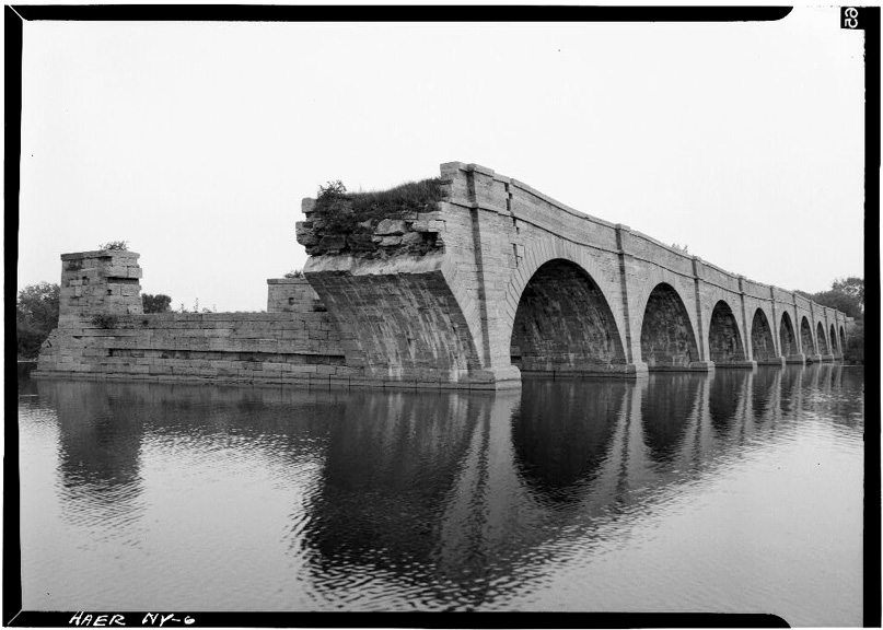
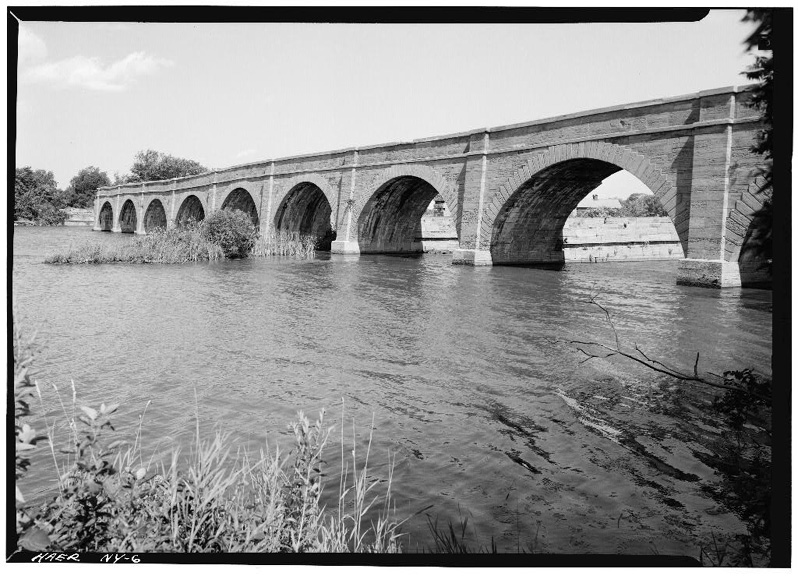
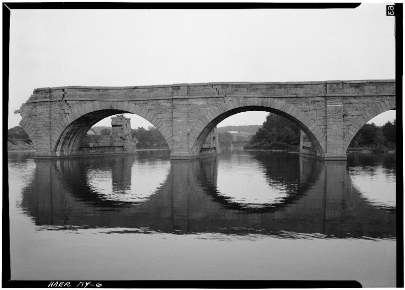
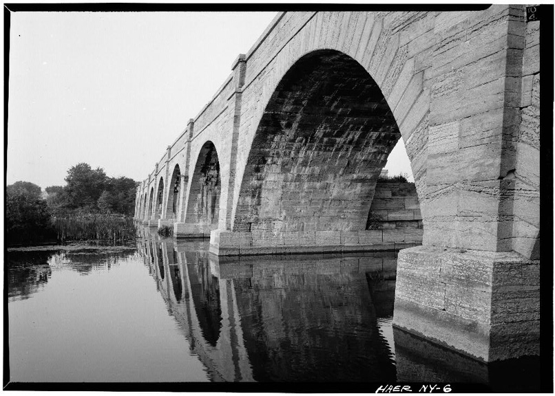
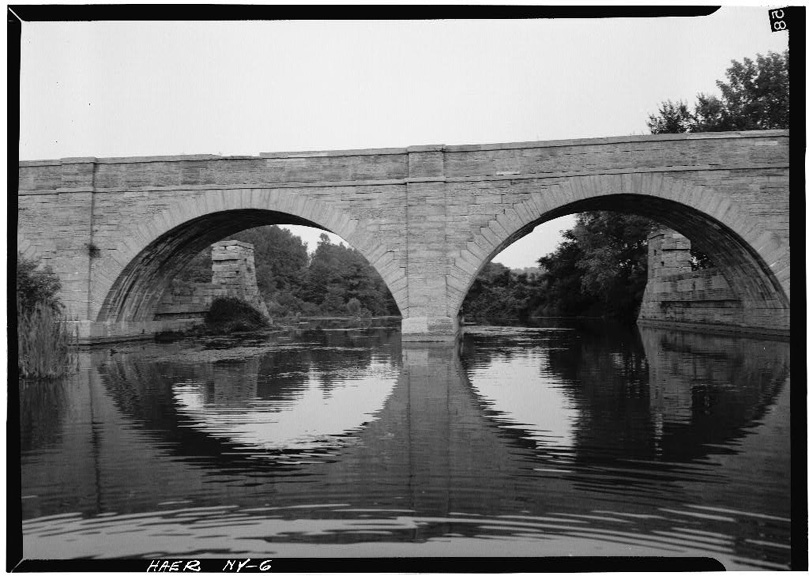
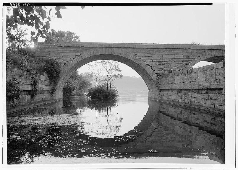
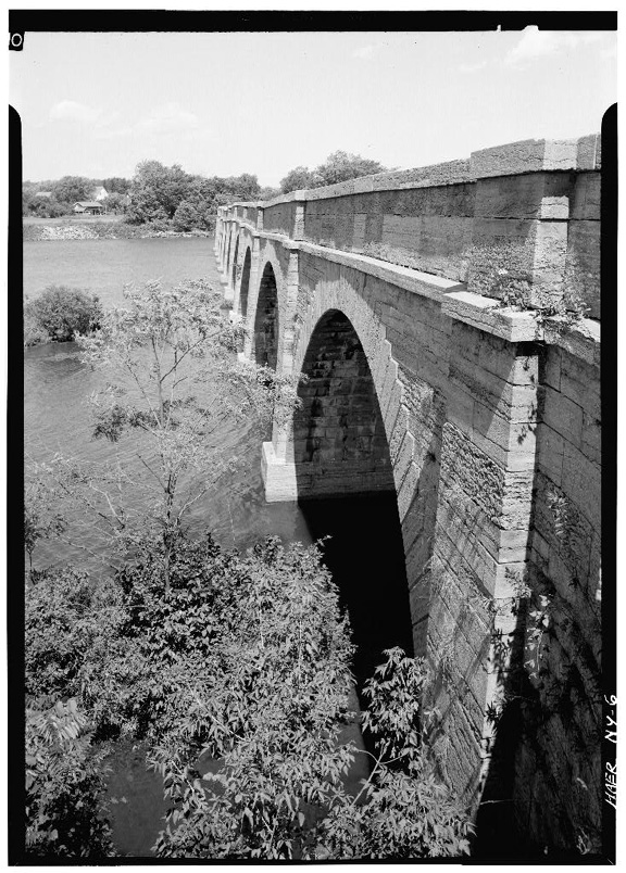
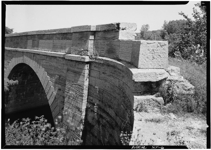
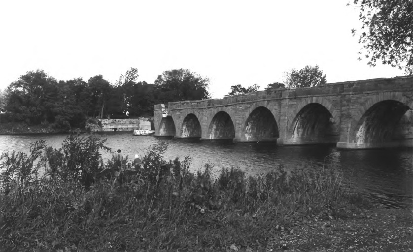
The Schoharie Creek Aqueduct spans Schoharie Creek four-tenths of a mile south of its confluence with the Mohawk River, and between locks No. 30 and No. 31. The Aqueduct is 624 feet 3 inches in length, consisting of 14 stone arches for the towing path on the northwest side, thirteen piers on the southeast side, and two abutments at the ends. The flume was made of heavy timbers and planks and a timber trunk for the boat channel. It was designed in part by John B. Jervis and built by Otis Eddy. It replaced the slackwater crossing of the creek afforded by a series of dams, all of which proved inadequate to cope with the annual flooding of the creek. Construction of the aqueduct was begun in 1839. It was completed in 1841, and was put into service in 1845. A new timber trunk was built in 1855 and again in 1873.
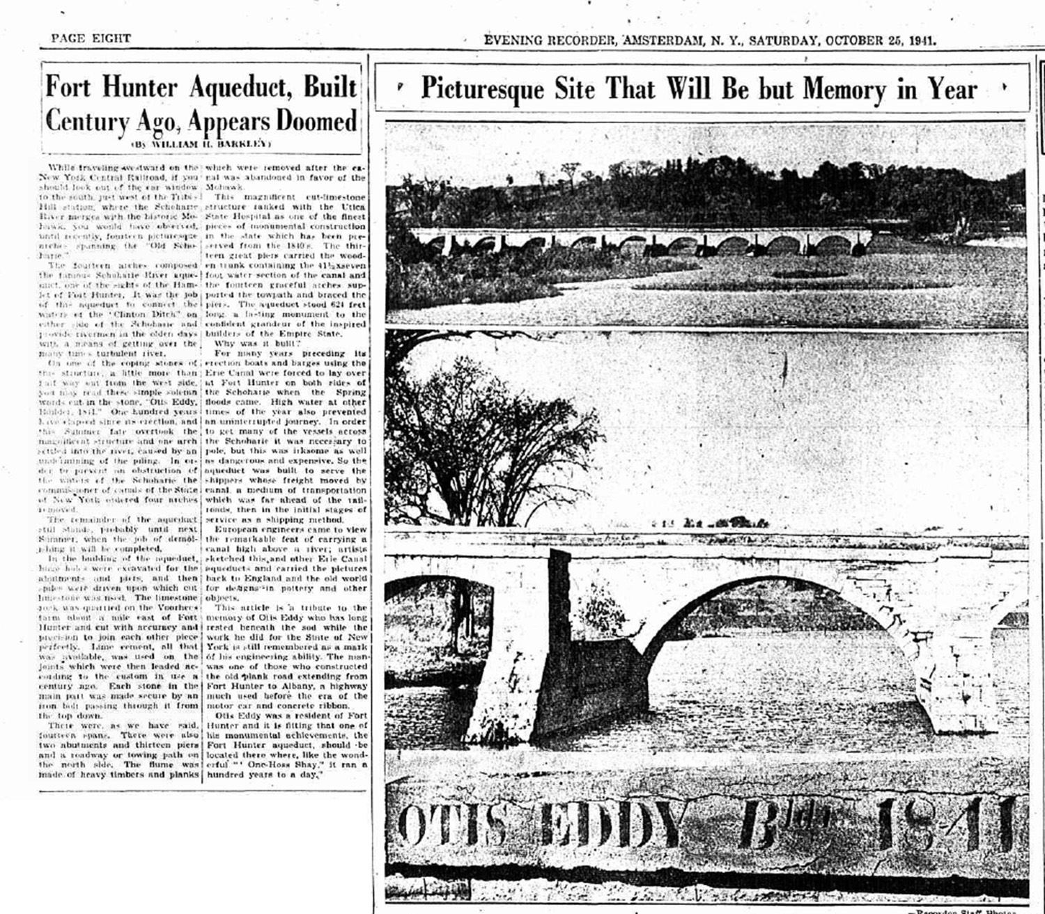
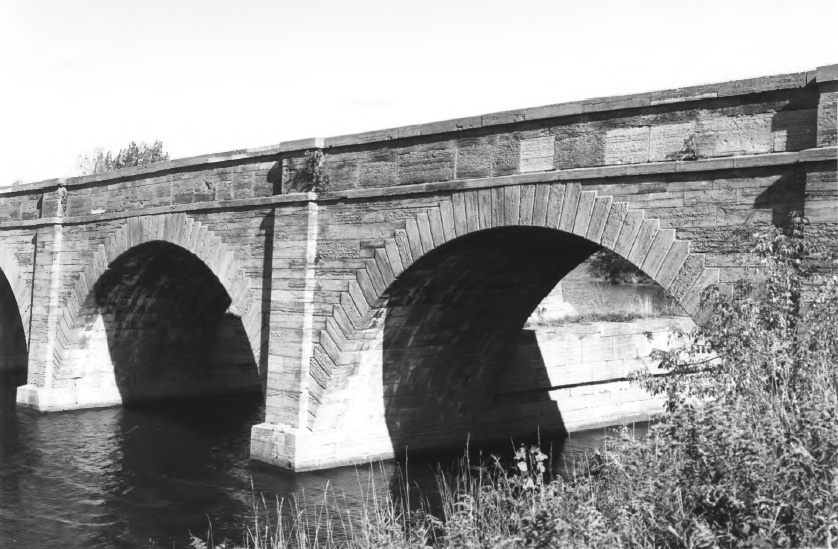
"In the building of the aqueduct, huge holes were excavated for the abutments and piers, and then piles were driven upon which cut limestone was used. The limestone was quarried on the Voorhees farm about a mile east of Fort Hunter and cut with accuracy and precision to join each other piece perfectly. Lime cement, all that was available, was used on the joints which were then leaded according to the custom in use a century ago. Each stone in the main part was made secure by an iron bolt passing through it from the top down." [From the Evening Recorder, Amsterdam, N.Y., October 25, 1941]
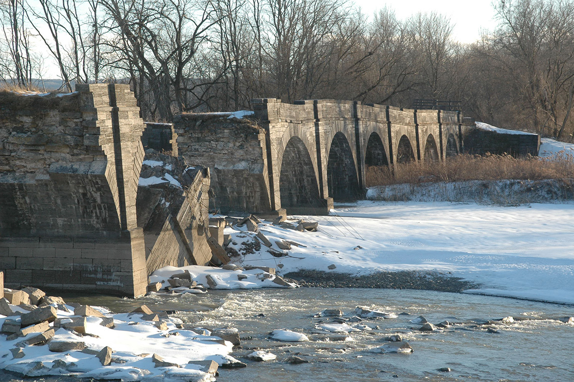
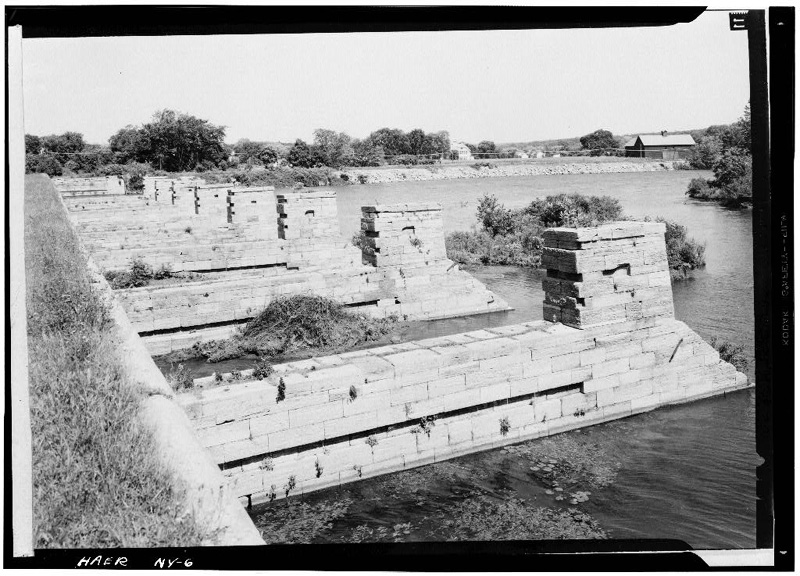
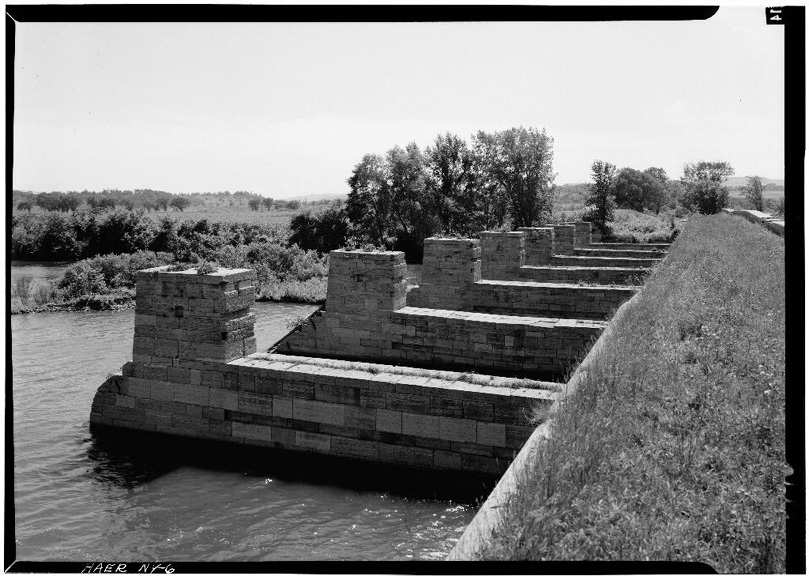
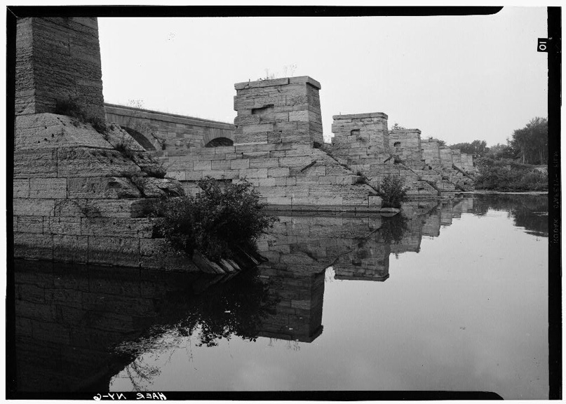
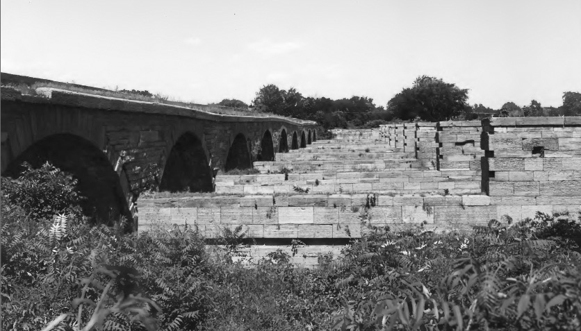
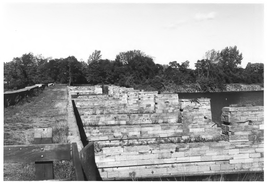
The aqueduct is now only partially intact. The wooden trunk of the aqueduct (which carried the water), no longer needed, was removed in c.1915/1916. In the summer of 1941, one arch fell into the river, "caused by an undermining of the piling. In order to prevent an obstruction of the waters of the Schoharie the commissioner of canals of the State of New York ordered four arches removed." [From the Evening Recorder, Amsterdam, N.Y., October 25, 1941]. Additional arches collapsed during a 1977 flood, prompting repairs in 1978 to install cables that secured the structure (see Aqueduct as it appears after stabilization below). The cables failed in 1998, and the furthest northeast of the remaining arches collapsed on August 16, 1998, threatening the stability of the rest. Compare the HAER images below with the 2006 and 2010 photos on the second Schoharie Creek Aqueduct page.
In late 2022, the New York State Office of Parks, Recreation, and Historic Preservation announced that construction had begun on a $1.7 million project to stabilize the Aqueduct. The stabilization project involved extensive repairs to the aqueduct's foundation and structure. The project was completed on schedule on May 2nd, 2023. For photographs of the stabilization work, see the Stabilization of the Schoharie Creek Aqueduct, 2023 page.
See also the NYSOPRHP Schoharie Crossing page.
 |
 |
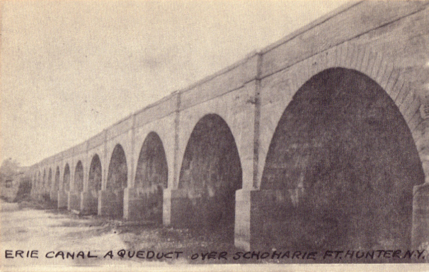 |
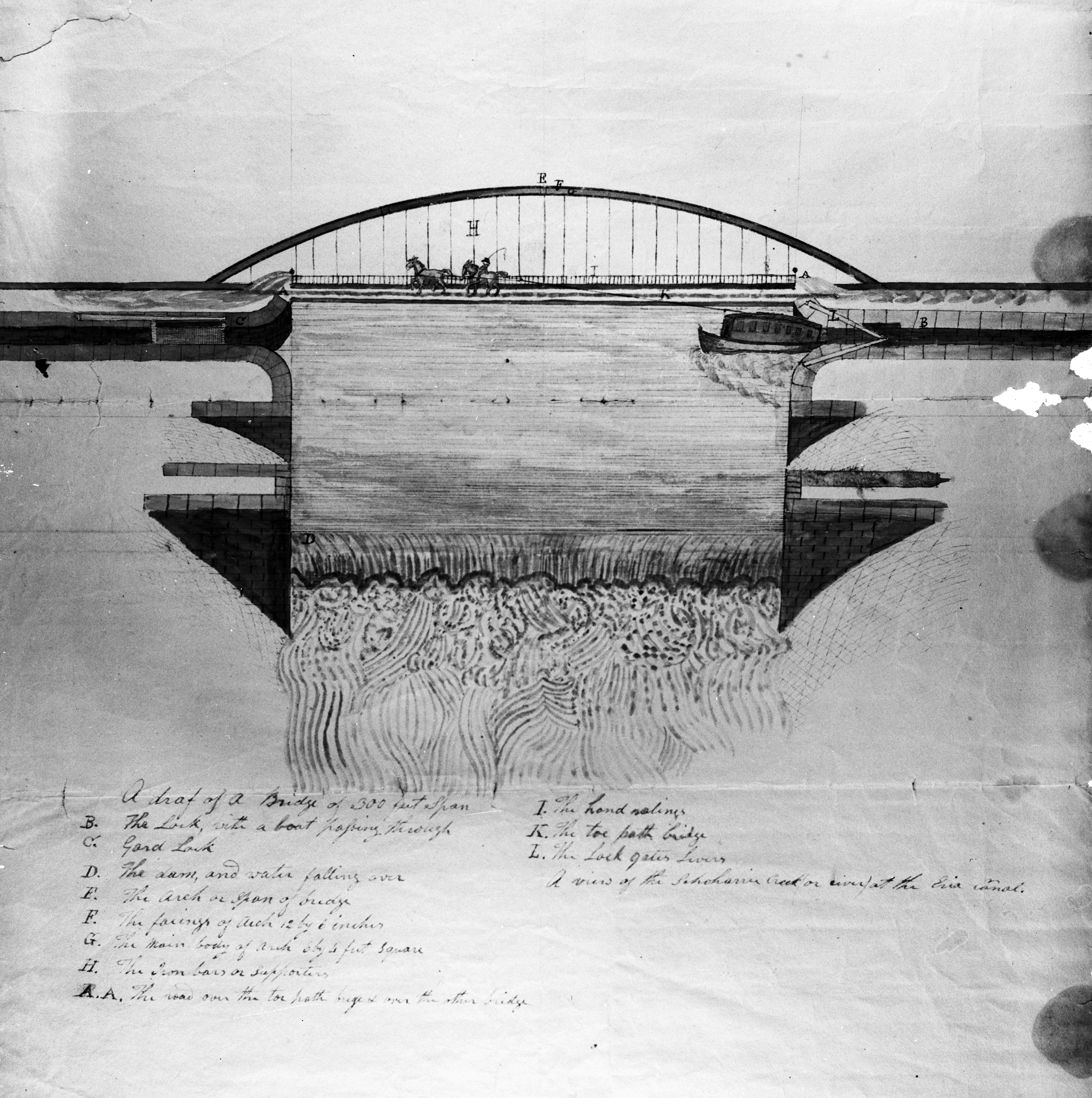
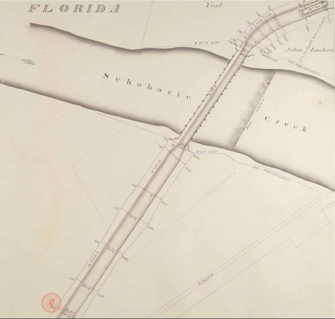
| Schoharie Crossing - Plan of slackwater canal crossing of Schoharie Creek, with a bridge serving as the towpath [CSNYS] | Map of Schoharie Creek Aqueduct over Schoharie Creek -- date and source unknown. | "Erie Canal Aqueduct over Schoharie, Ft. Hunter, N.Y." -- RPPC ; date unknown (1910?) |
 |
 |
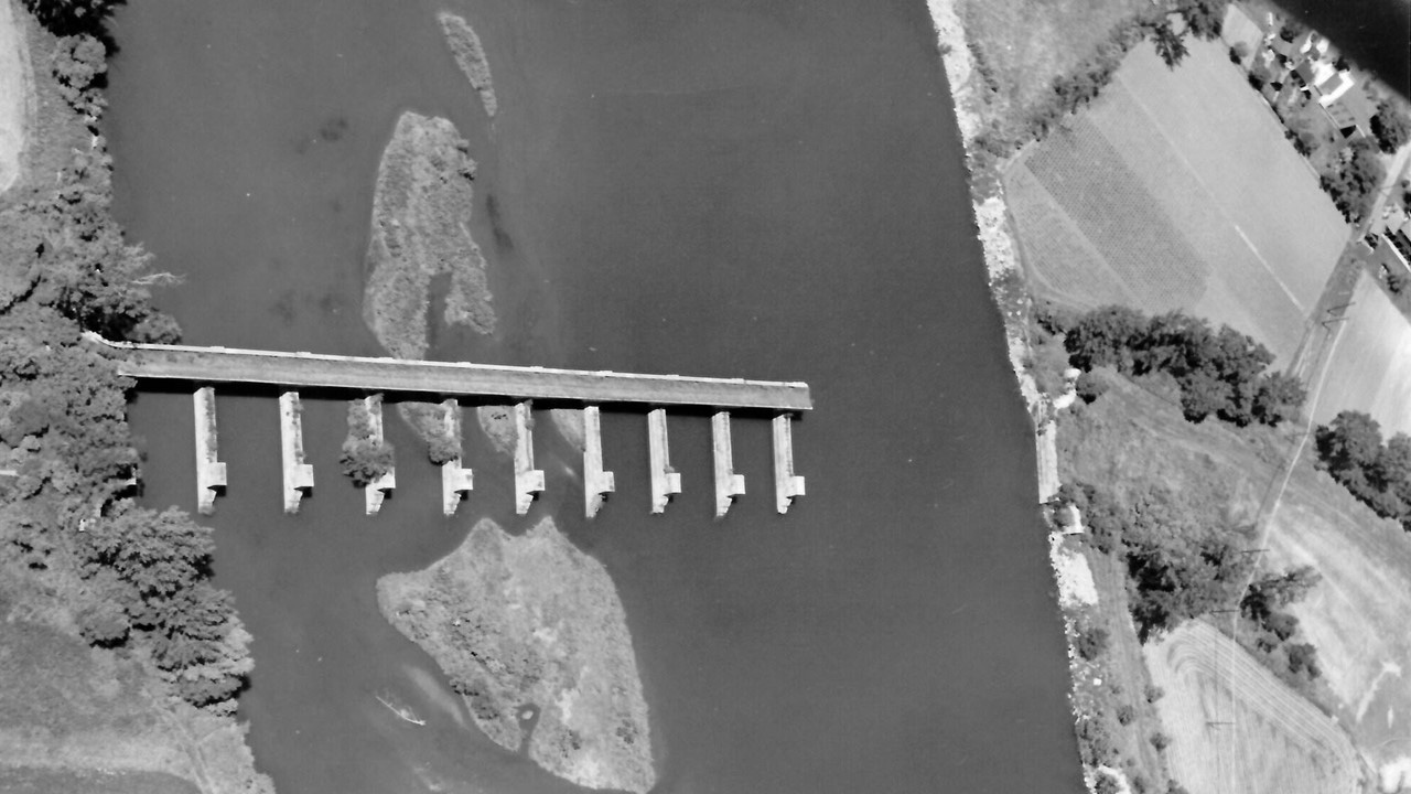 |
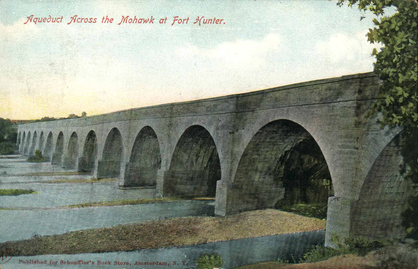
| "Aqueduct Across the Mohawk at Fort Hunter" (pub. for Schoeffler's Book Store, Amsterdam, N.Y.) -- Postcard ; not postmarked ; approximately 1910? [CSNYS] -- Location incorrect ; actually across Schoharie Creek. | "Fort Hunter Aqueduct, Built Century Ago, Appears Doomed" - from the Evening Recorder, Amsterdam, N.Y., October 25, 1941. | Aerial view of the Schoharie Creek Aqueduct, taken in 1950 -- from the Clarke Blair collection at Schoharie Crossing State Historic Site. |
 |
 |
 |
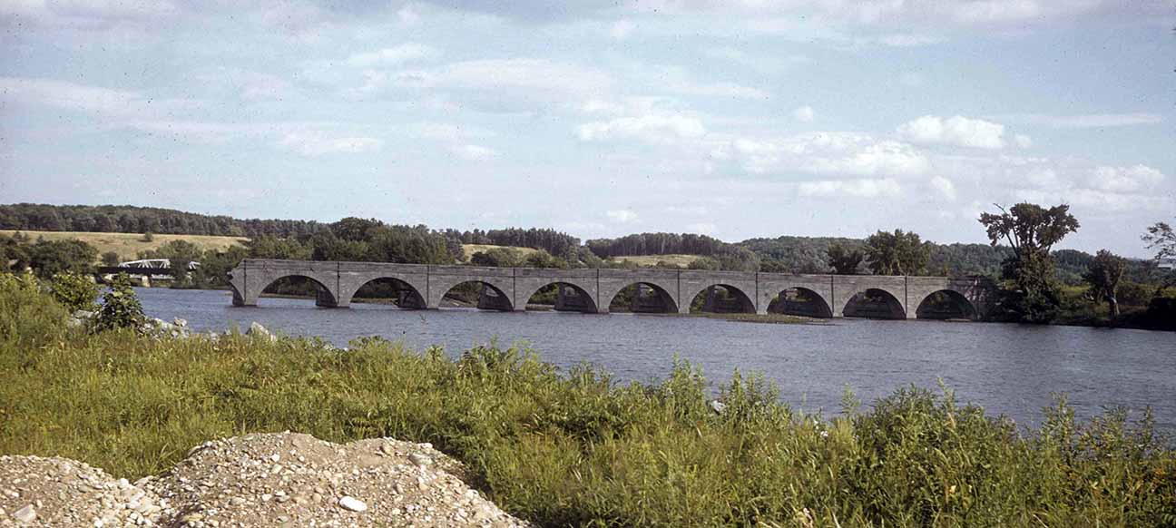
| The Schoharie Creek Aqueduct, looking south -- Photograph ; 1952? [CSNYS] | The Schoharie Creek Aqueduct (1841) and the site of the Schoharie
Creek Dam (1820), looking north -- from: A Preliminary Proposal for a New York State
Canal Museum and Lock Restoration Project, 1955 -- facing leaf 7. |
Schoharie Creek Aqueduct, May 31, 1957 - looking southwest. [CSNYS] |
 |
 |
 |
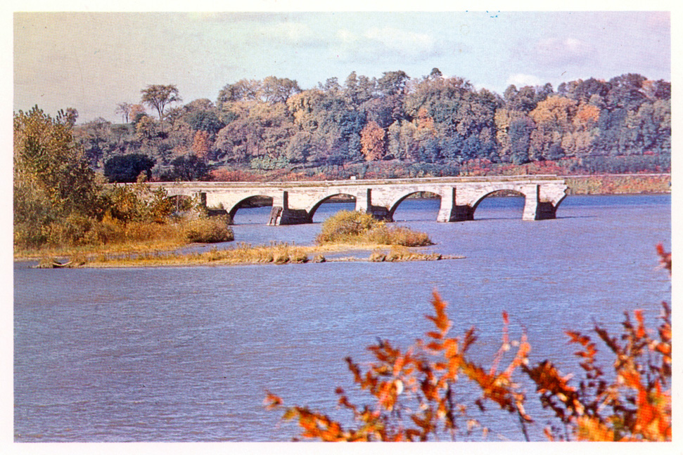
| The aqueduct in 1960 - looking southeast (unknown source) | "Erie Canal (Enlarged), Schoharie Creek Aqueduct, crossing Schoharie Creek 0.4 mile S. of confluence with Mohawk River, Fort Hunter, Montgomery County, New York" / drawn by David Bouse, 1969 (Mohawk-Hudson Area Survey, Historic American Engineering Record - HAER NY-6, sheets 2 and 3). | |
 |
 | |
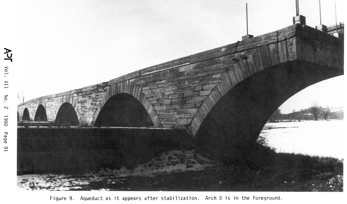
| Schoharie Creek Aqueduct after the 1979 stabilization done by Ryan-Briggs -- from:
Preservation of the Schoharie Creek Aqueduct / J. Thomas Ryan ; in Bulletin of the Association for Preservation Technology, Vol. 12, No. 2 (1980), pp. 80-93. |
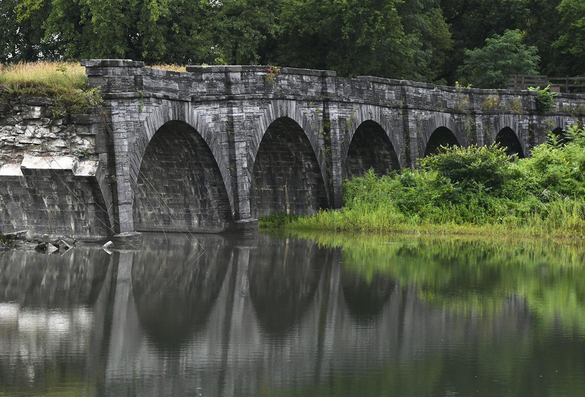
Schoharie Creek Aqueduct - Looking west from the east bank -- Photograph, taken by Bruce Harvey, April 11th, 2018 ; courtesy of The Preservation League of New York. | |
 |
 |
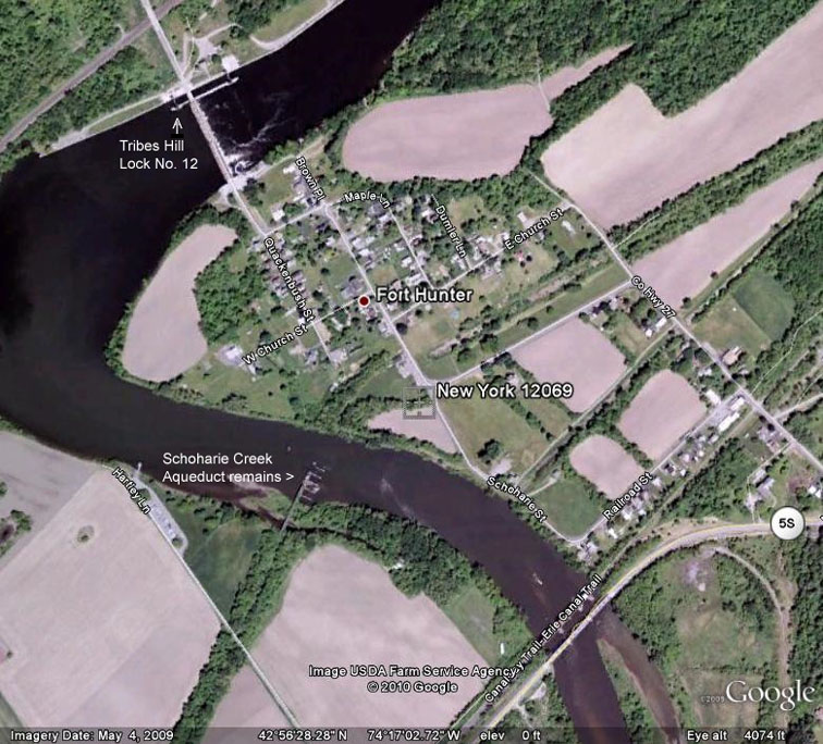 |
| The Schoharie Creek Aqueduct remains - looking west ; 2019Feb18. | The Schoharie Creek Aqueduct remains, 2019Aug7 ; Photographer: Peter R. Barber. | Google Earth view of the Fort Hunter area, showing the position of the Schoharie Creek Aqueduct in relation to the current Erie Canal Lock No. E-12. |
Remains of the Schoharie Creek Aqueduct, Fort Hunter, N.Y. | |||
|---|---|---|---|
 |
 |
 |
 |
 |
 |
 |
 |
 |
 |
 |
 |
 |
 |
||
|

|
Photographs to the left and below are from the National Park Service site (http://pdfhost.focus.nps.gov/docs/ NHLS/ Photos/66000530.pdf). Those below were taken Oct. 1983 by Charles H. Ashton, Heritage Studies, Inc. |
| "Erie Canal - NHL, Montgomery County, NY, Schoharie Aqueduct" -- Looking east from the west bank of Schoharie Creek ; taken Oct. 9, 1960. | "Schoharie Aqueduct - Erie Canal - extending east from west bank of Schoharie Creek" -- taken in 1975. | |
| Particularly evident in the 1975 photograph above is the poor condition of the aqueduct. As can be seen in the photograph below left taken in 1983, the easternmost arch collapsed between 1975 and 1983, and the next arch was in danger of following it. | ||
|
 |
|
| "Erie Canal National Historic Landmark, [Towns of] Glen and Florida, Montgomery Co., NY, ... View E across Schoharie Creek of aqueduct." | "Erie Canal National Historic Landmark, [Towns of] Glen and Florida, Montgomery Co., NY, ... Detail of aqueduct, W end." | "Erie Canal National Historic Landmark, [Towns of] Glen and Florida, Montgomery Co., NY, ... View E across top of aqueduct." |
For more recent pictures of the aqueduct (taken in 2004+), go to the Second Schoharie Creek Aqueduct page.
http://www.eriecanal.org/SchoharieAqueduct.html