
Home | Canal System | Historical Documents | 175th Anniversary | Images | Maps | Tour | Traces | Locks | Boats | Books and Videos | Music | Links

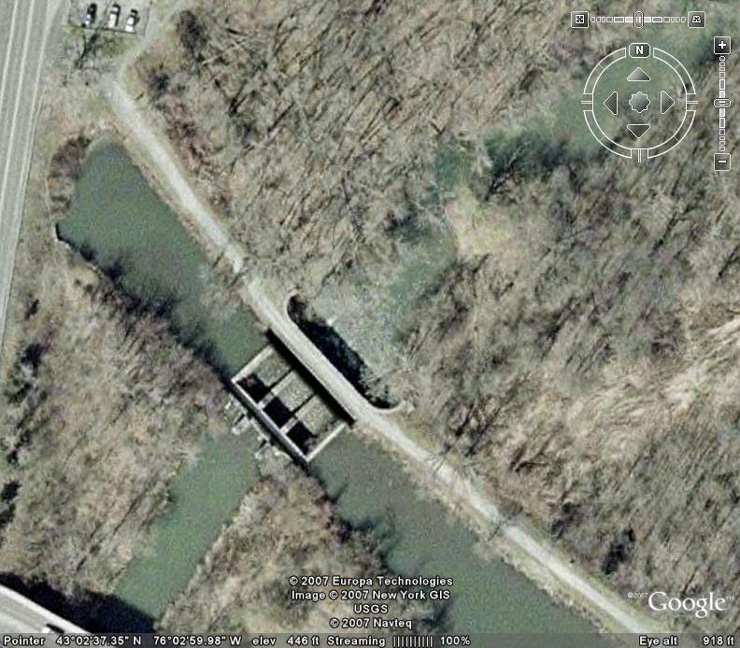
The Butternut Creek Aqueduct is located at the western terminus of the Old Erie Canal State Historic Park in the Town of DeWitt, Onondaga County. The aqueduct was built as part of the Enlarged Erie Canal, and was completed in 1856. The aqueduct is 80 feet long, and has three spans. The original wooden trunk of the aqueduct, which had succumbed to the ravages of time, has been replaced by a narrow concrete channel, which feeds water to the canal.
Below are pictures of the Butternut Creek Aqueduct taken in August 2004 and September 2007. Click on an image below to see the full-size version.
 |
 |
 |
| A Google Earth view of the aqueduct. The prism trunk supports and towpath are most obvious, with the narrow channel which feeds water to the canal seen at the lower left. | A view of the aqueduct from above, looking north from Kinne Road, near its intersection with Butternut Drive. | The trunk of the aqueduct, looking southeast from the towpath. The narrow channel which feeds water to the canal is at the right. |
 |
 |
|
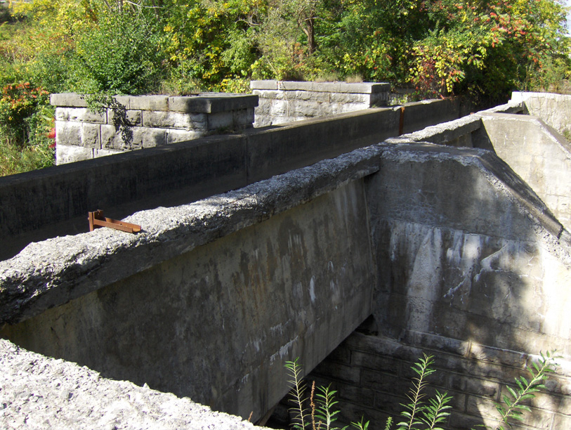
| The trunk of the aqueduct, looking southwest from the towpath. The narrow channel which feeds water to the canal is at the left. | Two views of the narrow channel which feeds water to the
canal. Left: looking southeast ; Right: looking southwest. | |
| In these three views, note the concrete buttresses which have been built on top the trunk supports to support the channel wall. | ||
 |
 |
 |
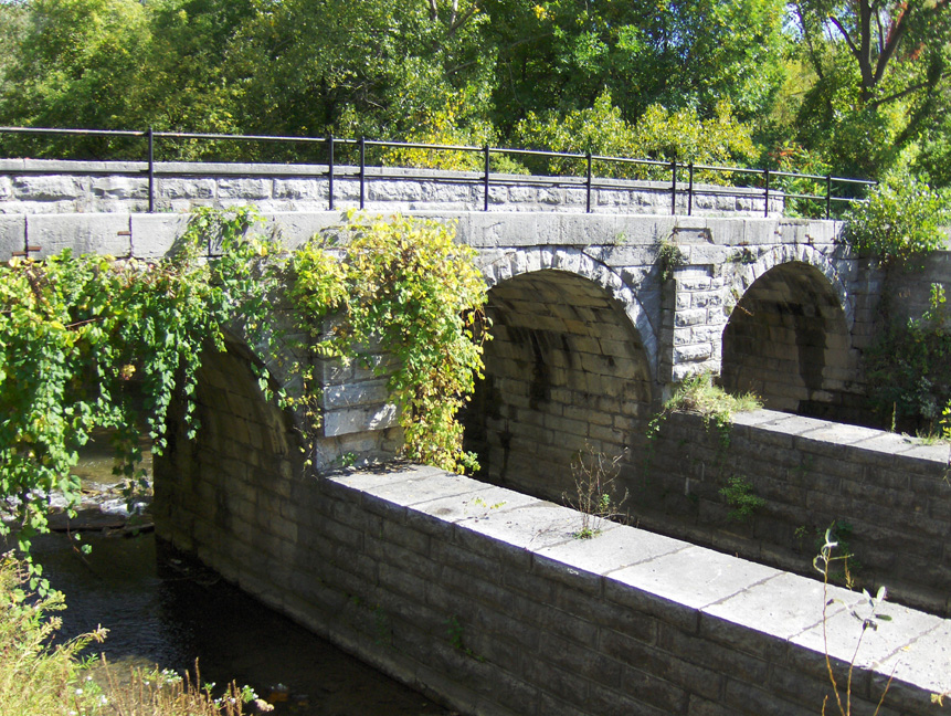
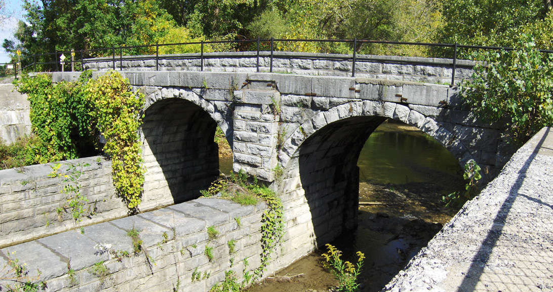
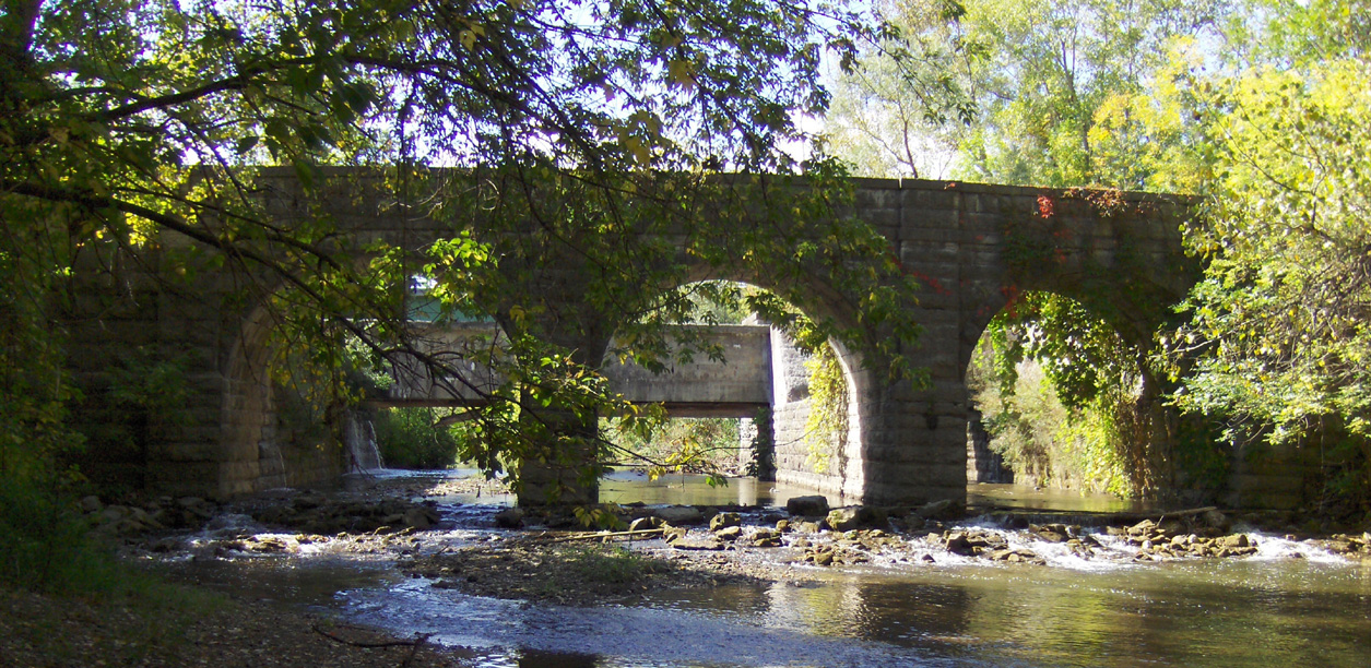
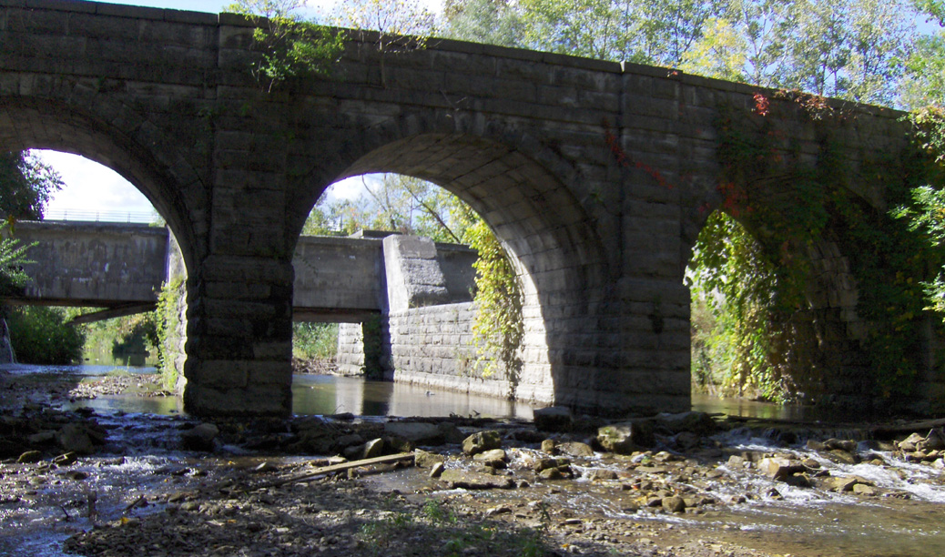
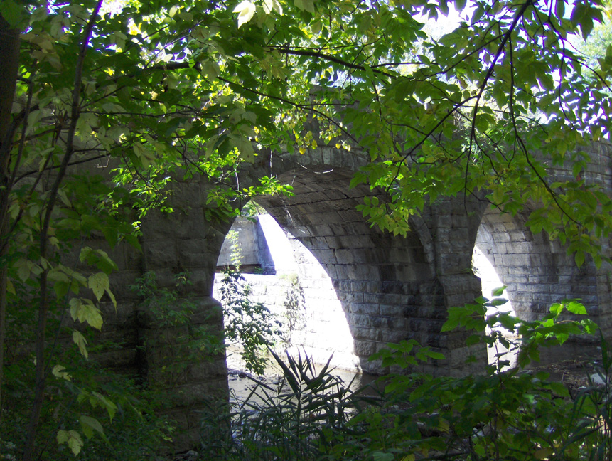
| Looking north at the arches which support the towpath. The prism trunk supports are in the foreground. Left: looking northeast ; Right: looking northwest. | The north (towpath) side, looking southwest from stream level. The prism trunk supports can be seen through the arches. | |
 |
 |
 |
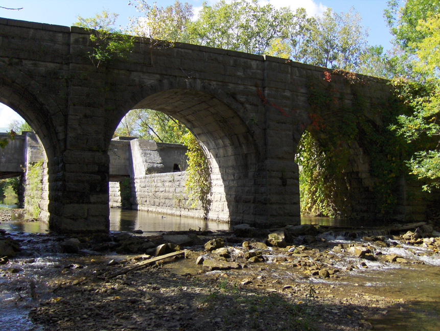
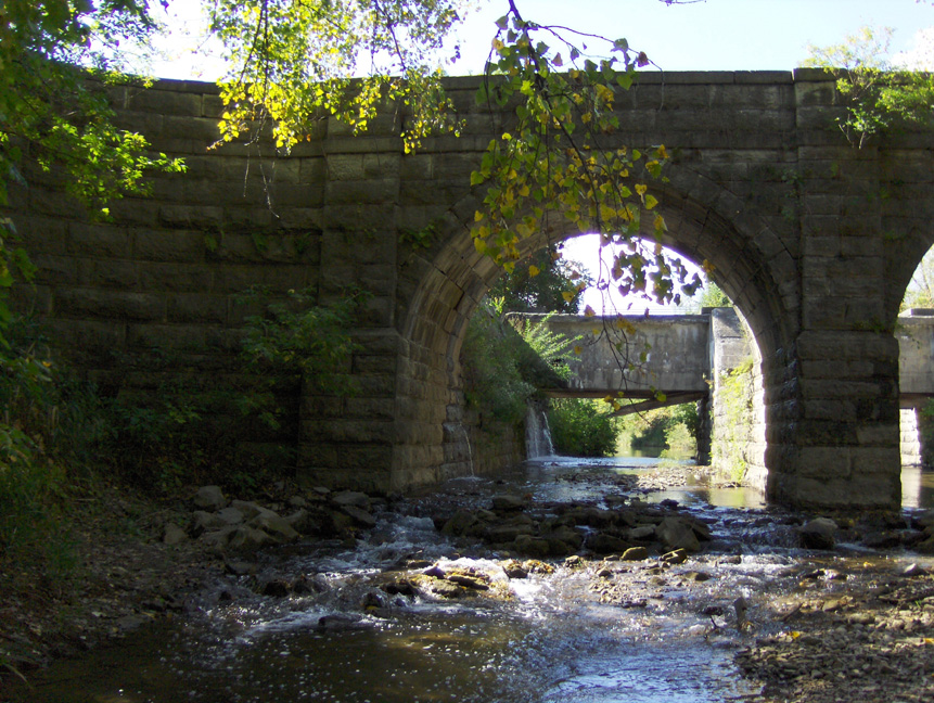
| Three views looking south from Butternut Creek at the arches which support the towpath. | ||
 |
 |
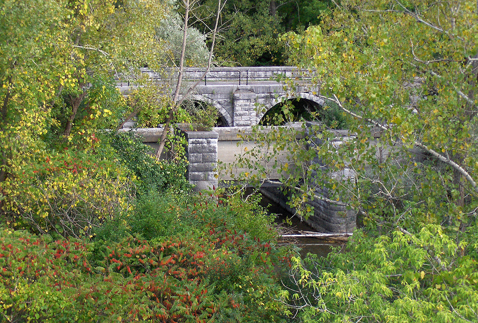 |
| The north (towpath) side, looking southwest from stream level. | Two views of the aqueduct from above, looking north from Kinne Road, near its intersection with Butternut Drive. | |
http://www.eriecanal.org/ButternutCreek.html