
Home | Canal System | Historical Documents | 175th Anniversary | Images | Maps | Tour | Traces | Locks | Boats | Books and Videos | Music | Links

Note: The images noted [CSNYS] below are the property of and used with the permission of The Canal Society of New York State.
East of Schenectady were two aqueducts which crossed and re-crossed the Mohawk River: The Rexford Aqueduct (or Upper Mohawk River Aqueduct) at Rexford, and The Crescent Aqueduct (or Lower Mohawk River Aqueduct) twelve miles downstream at Crescent.
In order to avoid the steep, rocky terrain, Canvass White, C.E. devised the plan, approved in 1821, for the canal route to cross and re-cross the Mohawk River at Alexander's Mills (adjacent to Rexford) and at Fonda's Ferry (near Crescent). Continuing in operation until the new State Barge Canal System opened in 1916, a major portion of the Rexford Aqueduct was removed in 1918. The entire Crescent Aqueduct was removed in 1915, and nothing remains but a few stones at each end.
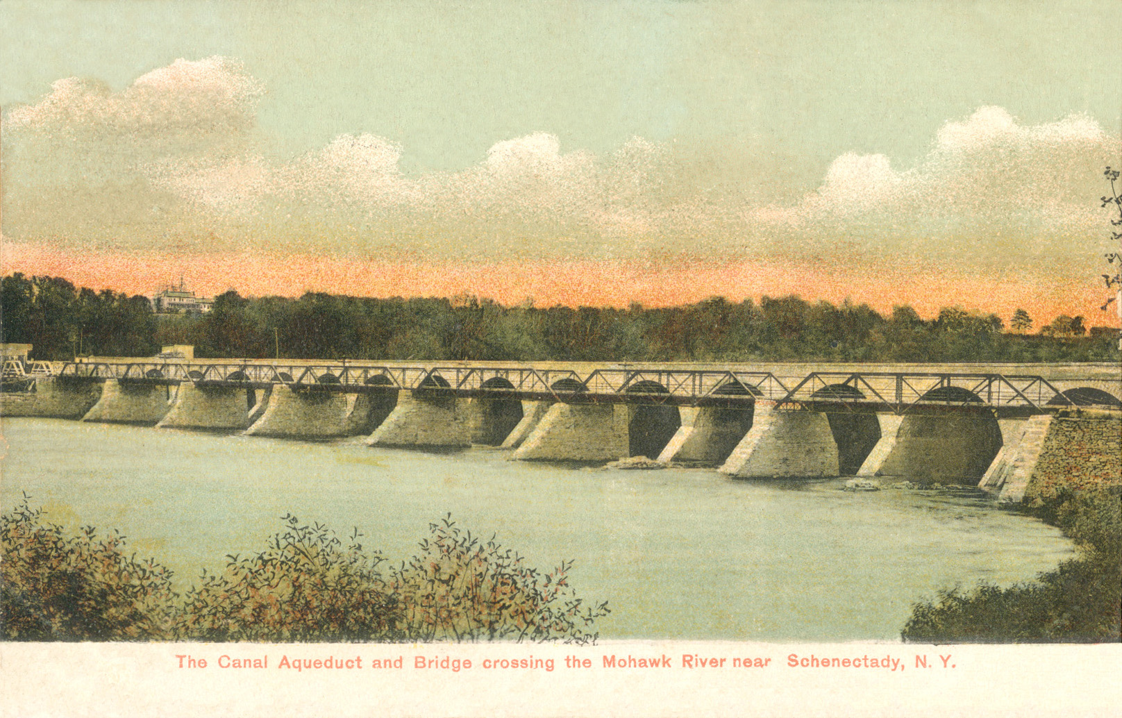
The Rexford Aqueduct, or Upper Mohawk River Aqueduct, crossed the Mohawk River at an angle of about 10 degrees NNE from the south side (west end) in the Town of Niskayuna, Schenectady County, to the north side (east end) in Rexford, Saratoga County. Built in 1842, it replaced the original 1828 Rexford Aqueduct. It was built of random ashlar masonry, probably limestone, and consisted of 14 masonry arches, each spanning approximately 45 feet, to support the towpath, and 14 masonry piers approximately 45 feet wide to support the original timber canal trunk.
 |
 |
|
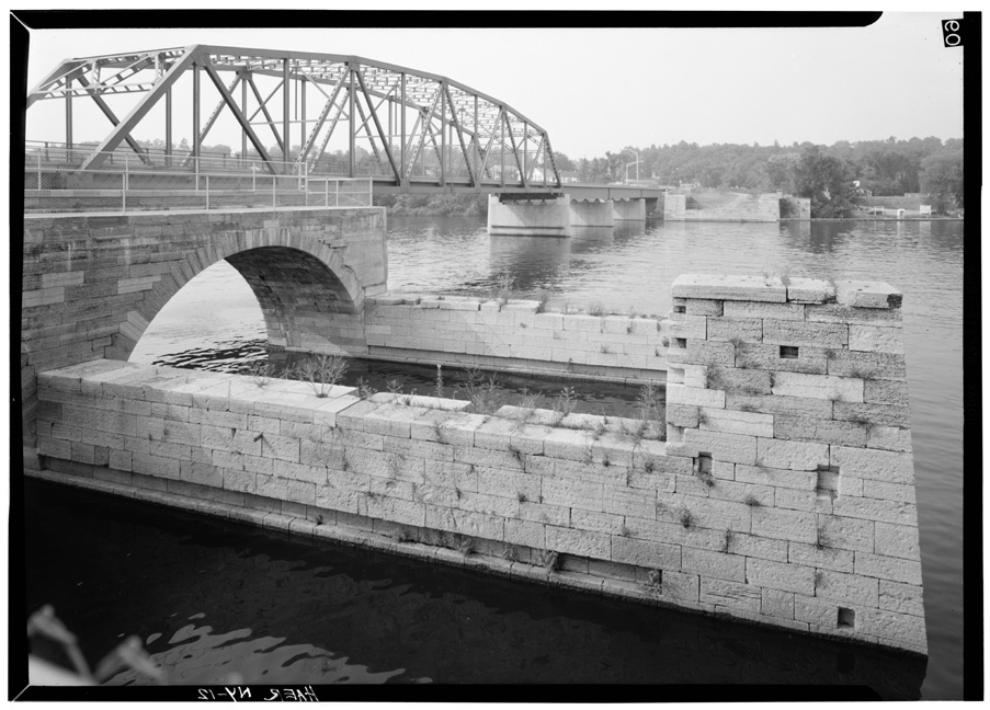
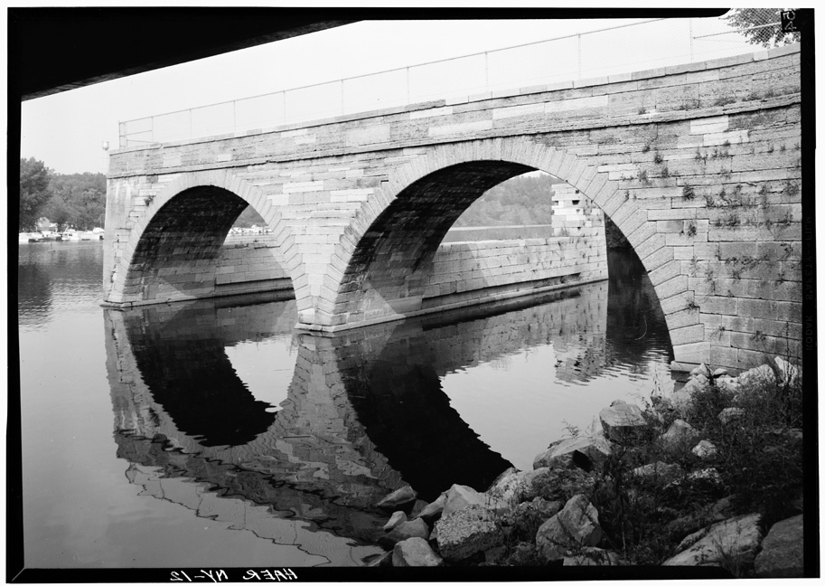
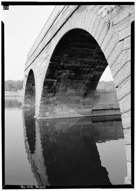
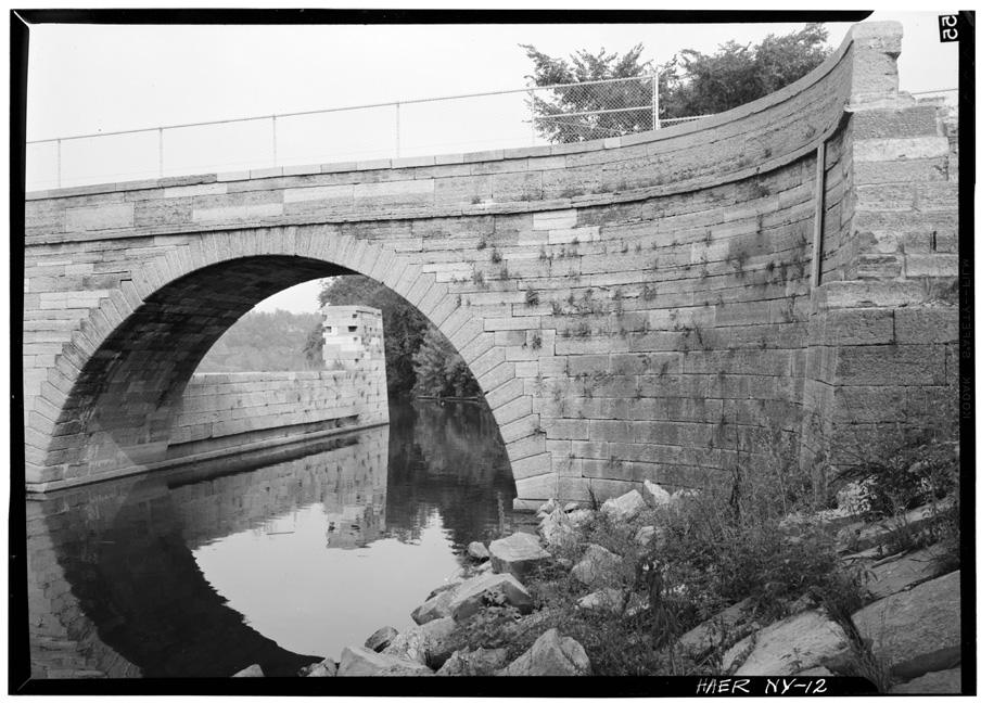
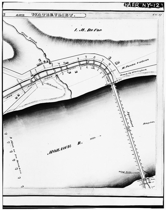
| "Erie Canal (Enlarged), Upper Mohawk River Aqueduct (Rexford
Aqueduct) -- from the Historic American Engineering Record, HAER NY-12 (HAER NY,46-REXFO,1-5) National Park Service, Department of the Interior. |
Plan of the Upper Mohawk River Aqueduct near Schenectady, N.Y. (source unknown). | |
 |
 |
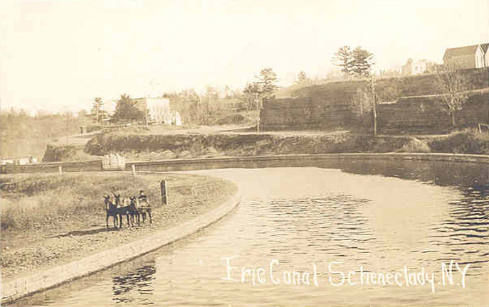 |
| "New vertical wall at entrance to Upper Mohawk aqueduct" - looking east -- from: Annual Report of the State Engineer and Surveyor of the State of New York, for the fiscal year ending September 30, 1897 (Wynkoop Hallenbeck Crawford Co., 1898) [the same curve as that in the postcards to the right and below] | Erie Canal Aqueduct, Rexford, N.Y. - looking north (no publisher information) -- Postcard ; date unknown. [CSNYS] -- Note that Lock 22 can be seen in the right center just beyond the aqueduct. | "Erie Canal, Schenectady, N.Y." - looking east (no publisher information) -- Postcard ; not postmarked ; approximately 1908? |
 |
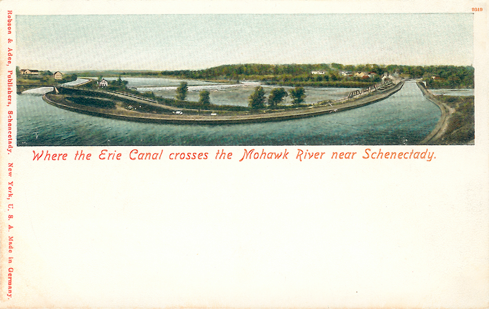 | |
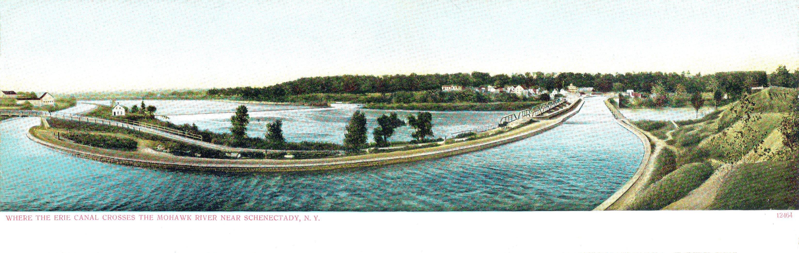
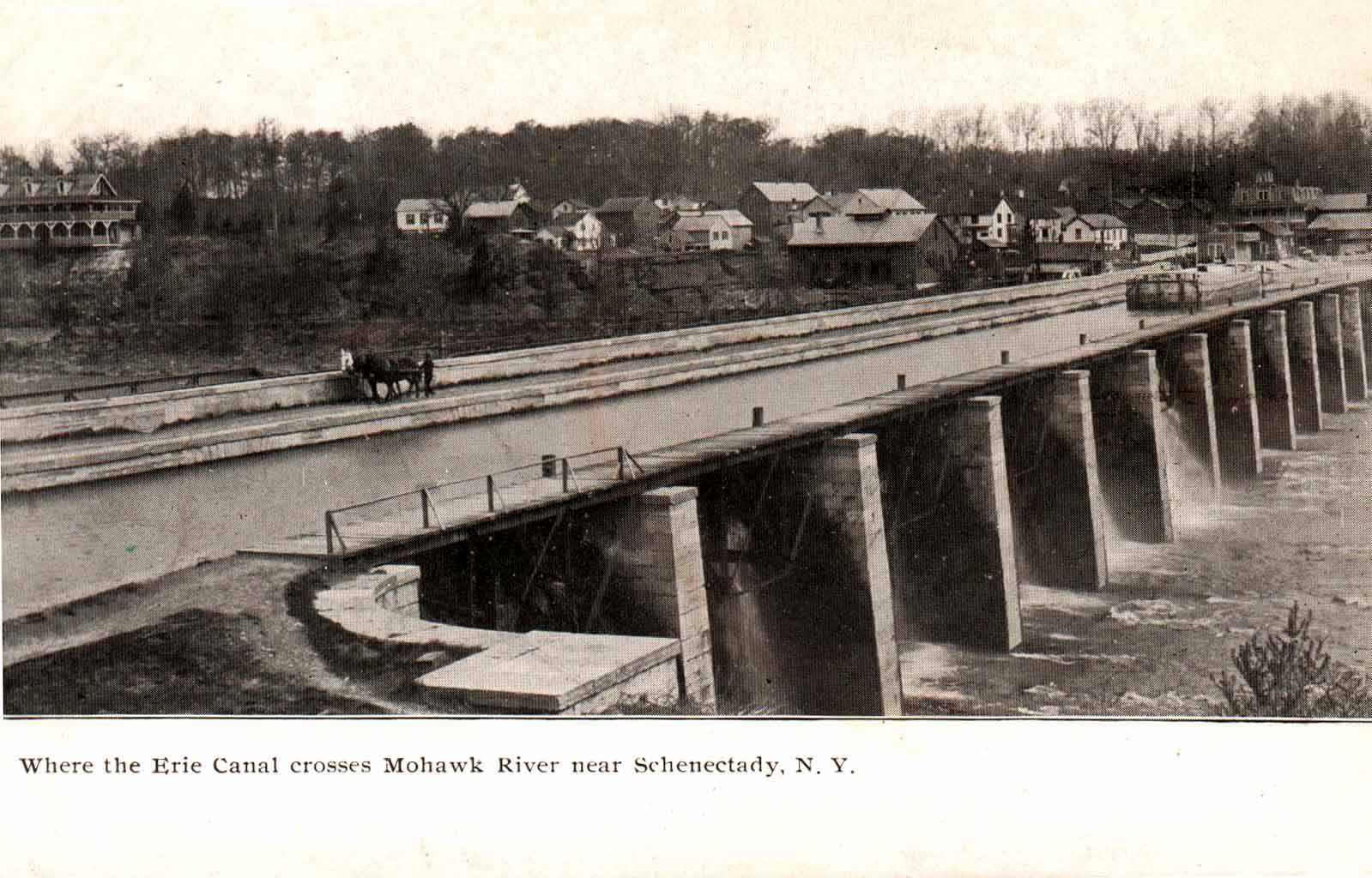
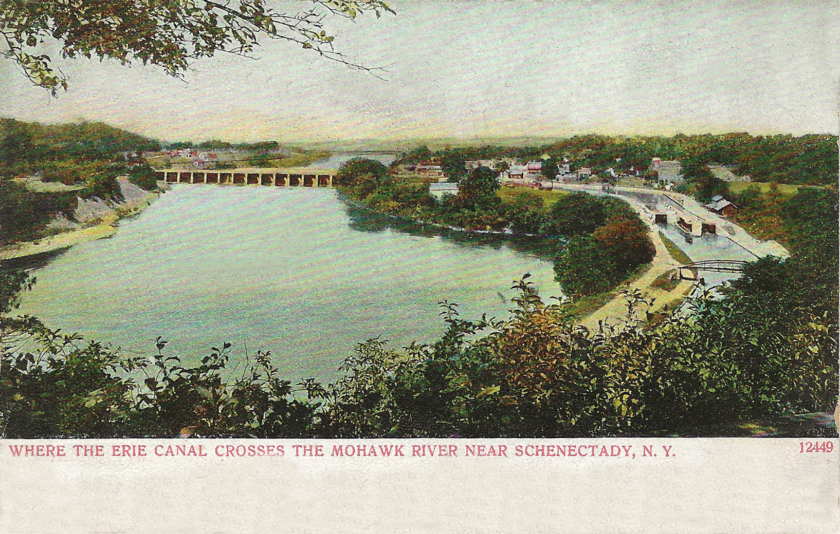
| "Where the Erie Canal crosses the Mohawk River near Schenectady, N.Y." [Looking northwest from the Niskayuna side] (12464 - Robson & Adee, Schenectady, N.Y.) -- Double postcard (UNDB) ; not postmarked ; probably 1906. This same view was also issued as two separate postcards (see the postcard below left), and in reduced size on a standard sized postcard (see the postcard on the right). | "Where the Erie Canal crosses the Mohawk River near Schenectady" (9349 - Robson & Adee, Schenectady) -- Postcard (UNDB) ; not postmarked ; probably 1906. | |
 |
 |
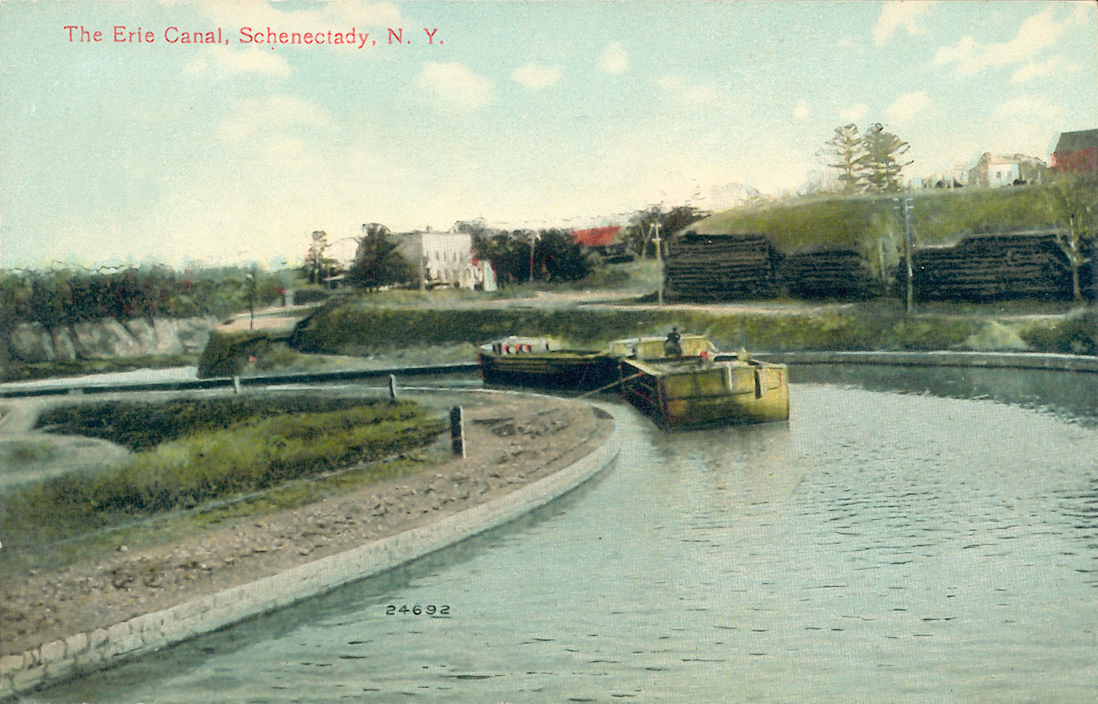 |
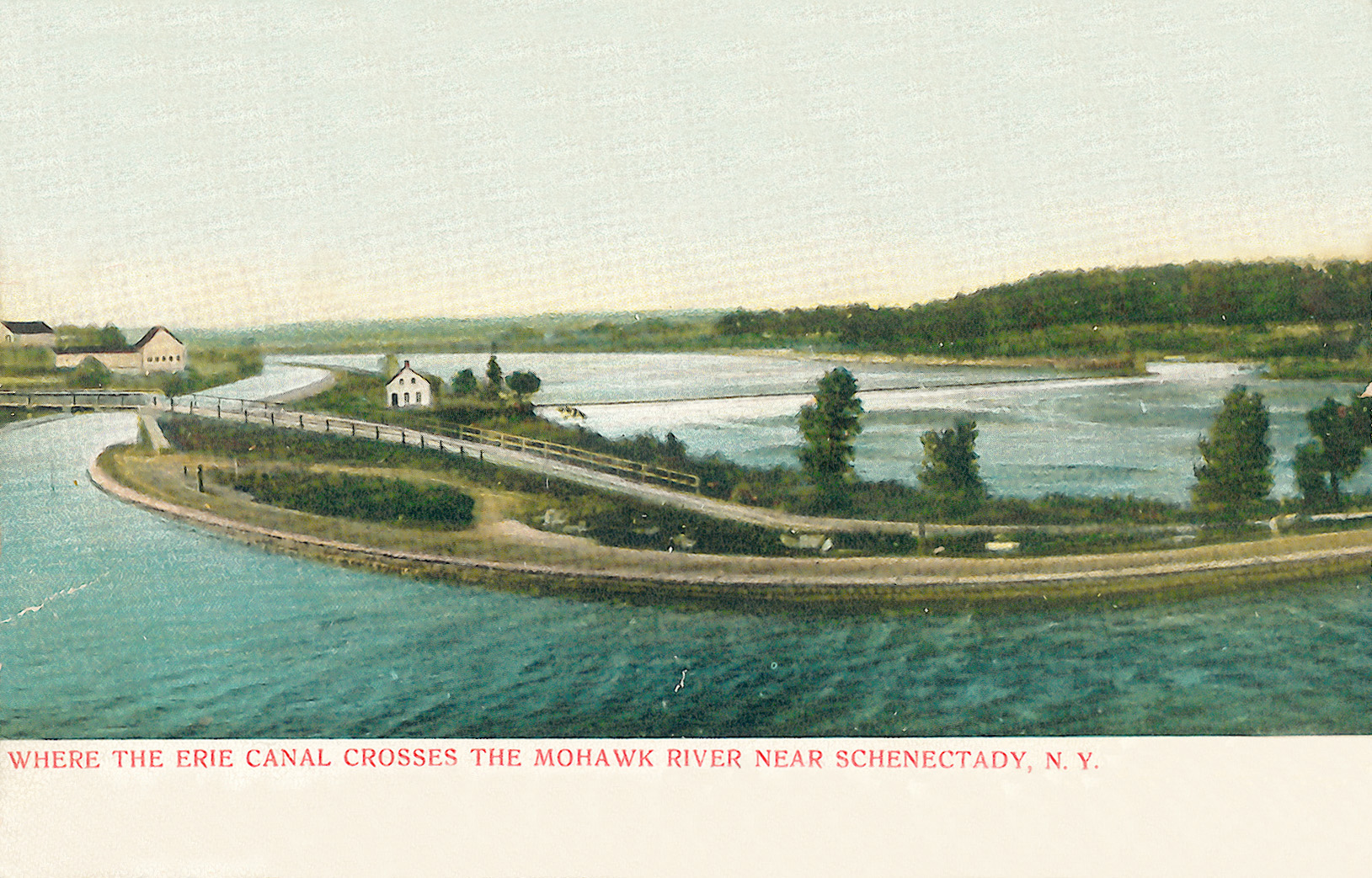
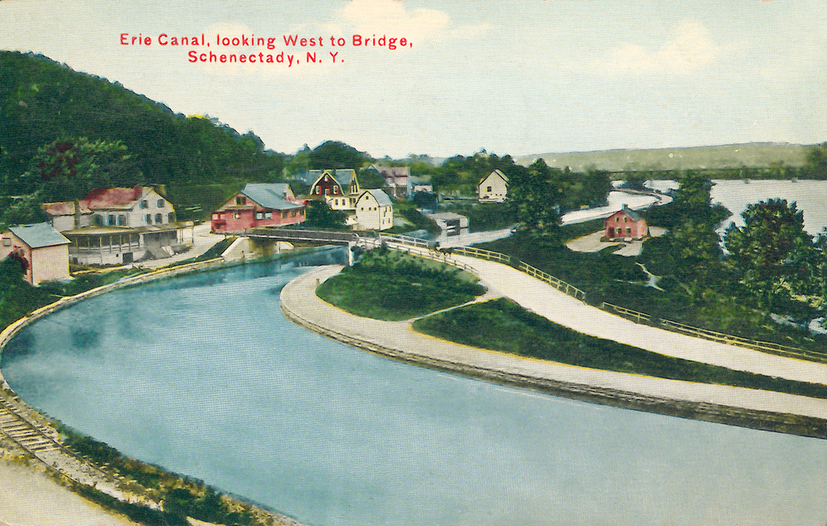
| "Where the Erie Canal crosses the Mohawk River near Schenectady, N.Y." (Robson & Adee, Schenectady, N.Y.) -- Postcard ; postmarked July 27, 1906. | "Erie Canal, looking West to Bridge, Schenectady, N.Y." (no publisher information) -- Postcard ; postmarked Oct. 25, 1911. | "The Erie Canal, Schenectady, N.Y." - looking east (24692 - no publisher information) -- Postcard ; postmarked Aug. 17, 1909. |
 |
 |
 |
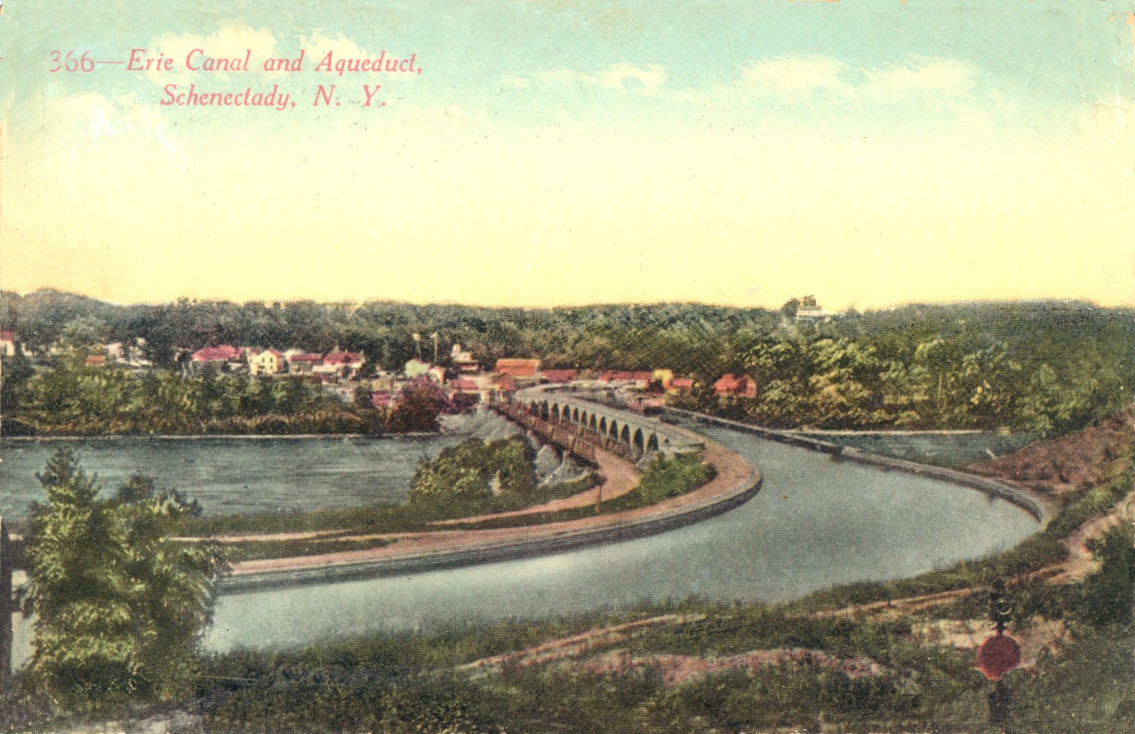
| "Erie Canal and Aqueduct, Schenectady, N.Y." (366 - Rudolph Bros., Syracuse, N.Y.) -- Postcard ; postmarked Nov. 19, 1911. | "Where the Erie Canal crosses Mohawk River near Schenectady, N.Y." (no publisher information) -- Postcard (UNDB) ; not postmarked ; approximately 1906? [CSNYS] | "The Aqueduct, Schenectady, N.Y." (no publisher information) -- Postcard (UNDB) ; not postmarked ; approximately 1906? [CSNYS] |
 |
 |
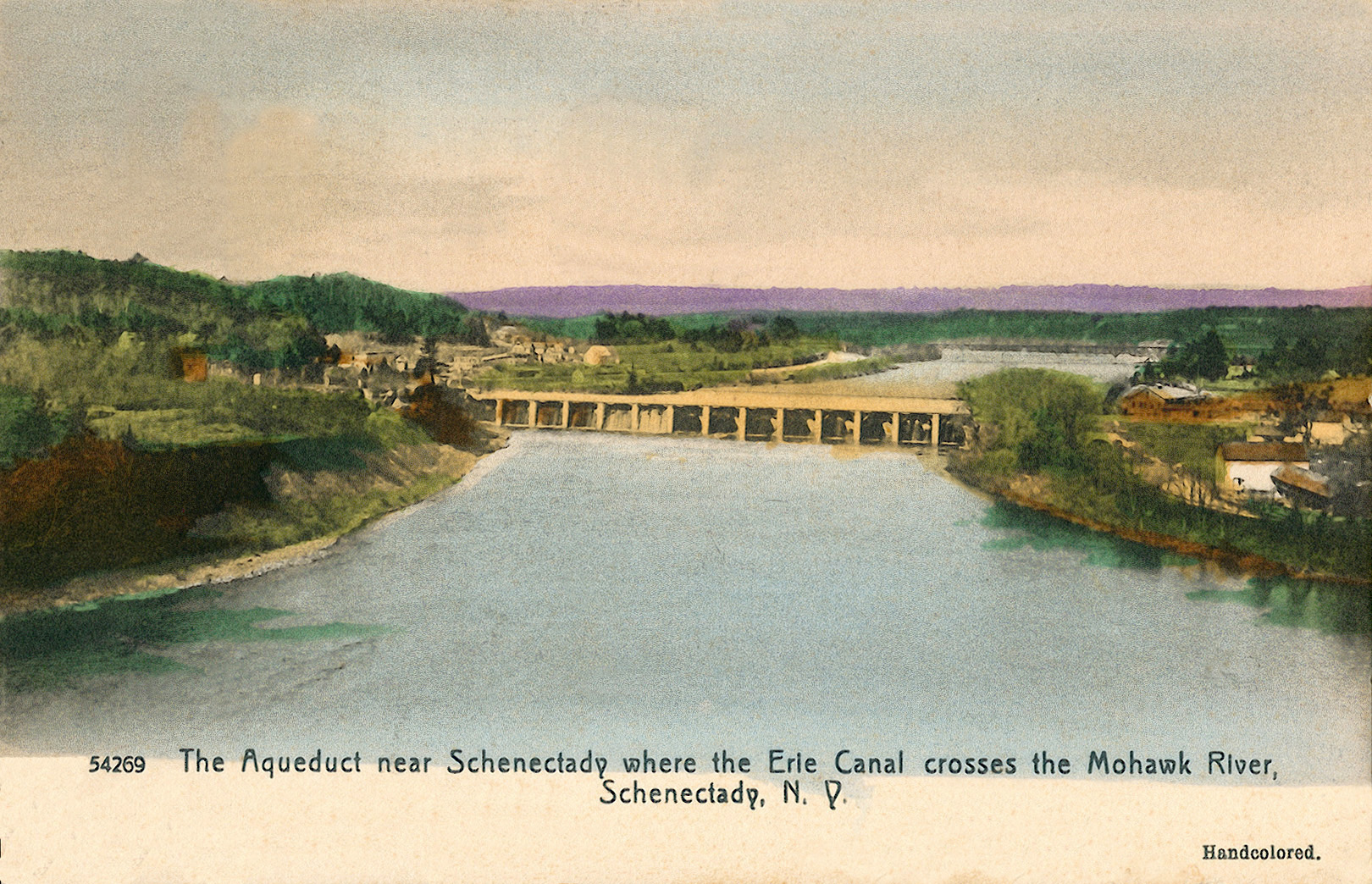 |
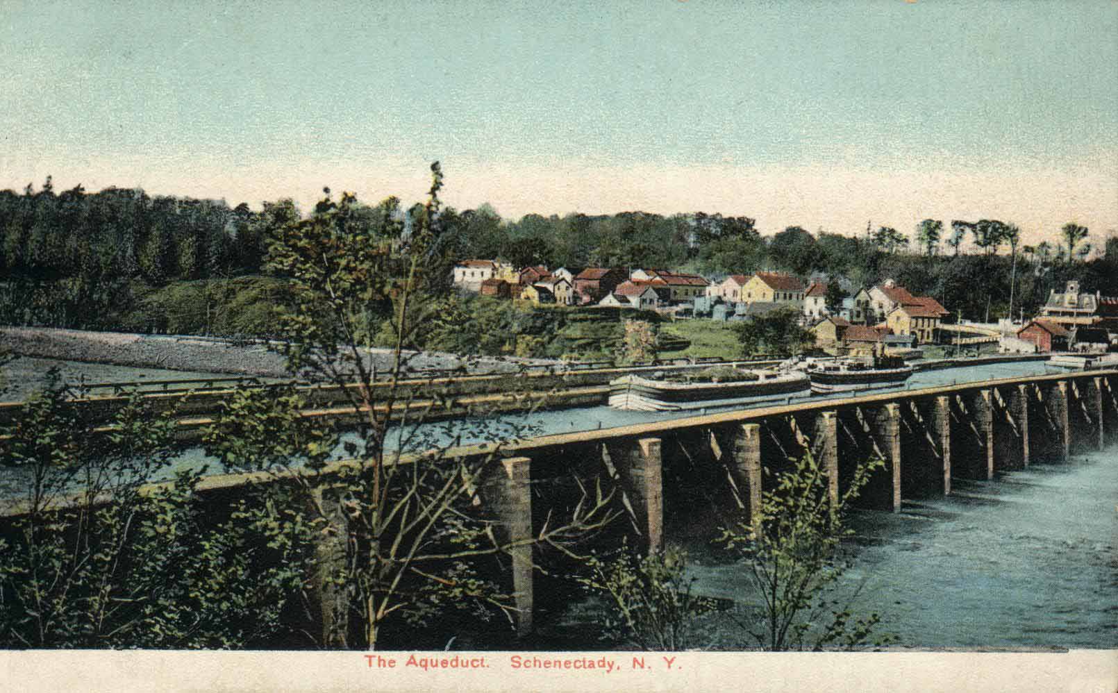
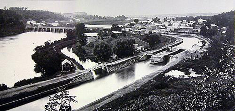
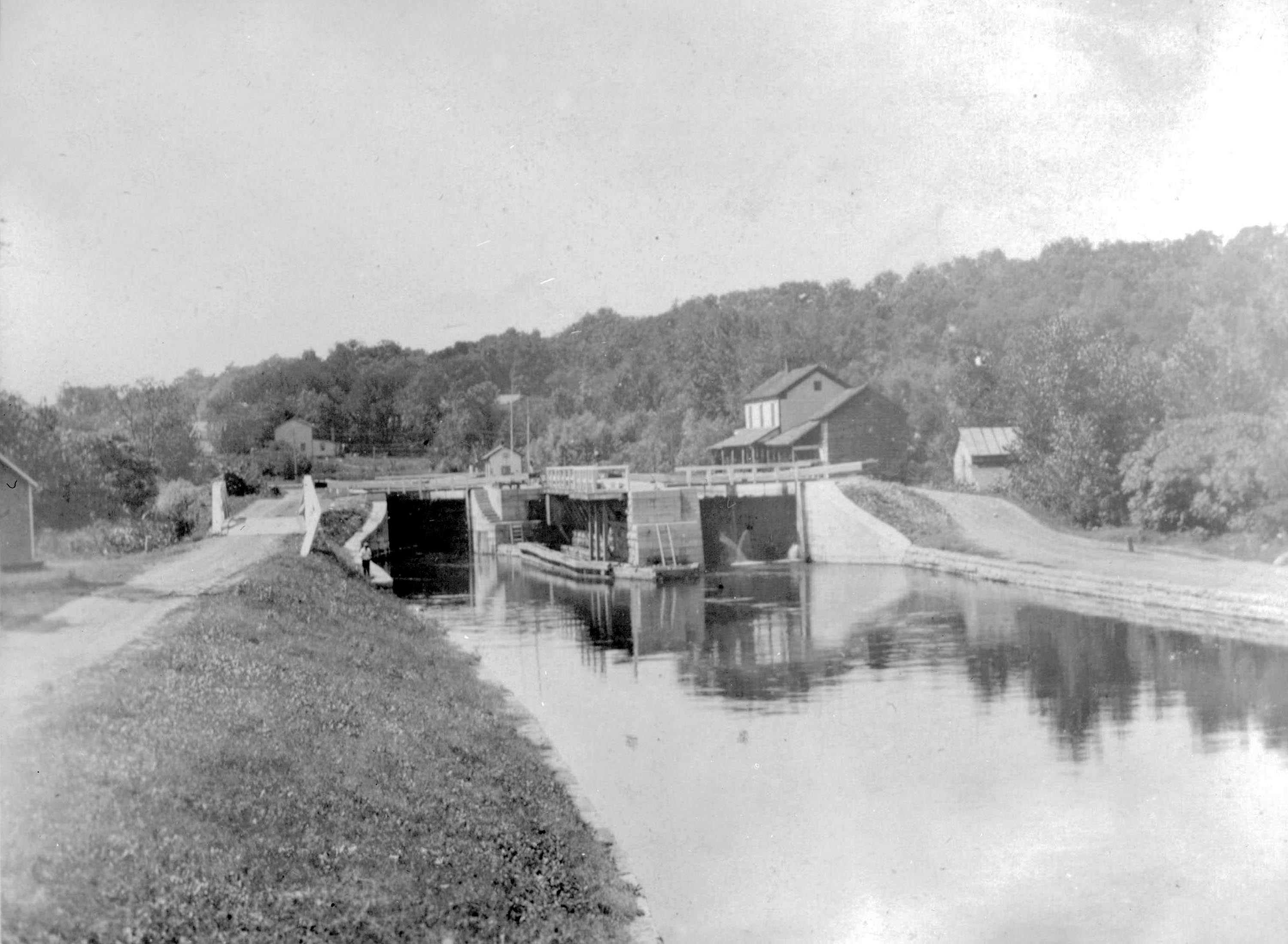
| "The Erie Canal at Rexford" -- Photograph ; circa 1900 ; source unknown. -- Lock 21 (before it was extended) is on the right, the Rexford feeder is at lower left center, and the Upper Mohawk (Rexford) Aqueduct is in the left background. | "Where the Erie Canal crosses the Mohawk River near Schenectady, N.Y." [Looking west from the Rexford (north) side] (12449 - David C. Houck, Schenectady, N.Y.) -- Postcard ; postmarked Oct. 16, 1907. | "The Aqueduct near Schenectady where the Erie Canal crosses the Mohawk River, Schenectady, N.Y." (54269 - The Rotograph Co., N.Y. City) -- Postcard (UNDB) ; postmarked Jul. 3, 1907. |
 |
 |
 |
| "Bluffs on Erie Canal near Schenectady, N.Y." (12457- Robson & Adee, Schenectady, N.Y.) -- Postcard (UNDB) ; postmarked Sep. 11, 1906.* | "The Aqueduct, Schenectady, N.Y." (No. B13348 - Charles Baum, Schenectady, N.Y.) -- Postcard ; postmarked Oct. 3, 1908.* | Lock 21, Erie Canal, Rexford, N.Y. - date unknown, 1910? [CSNYS] |
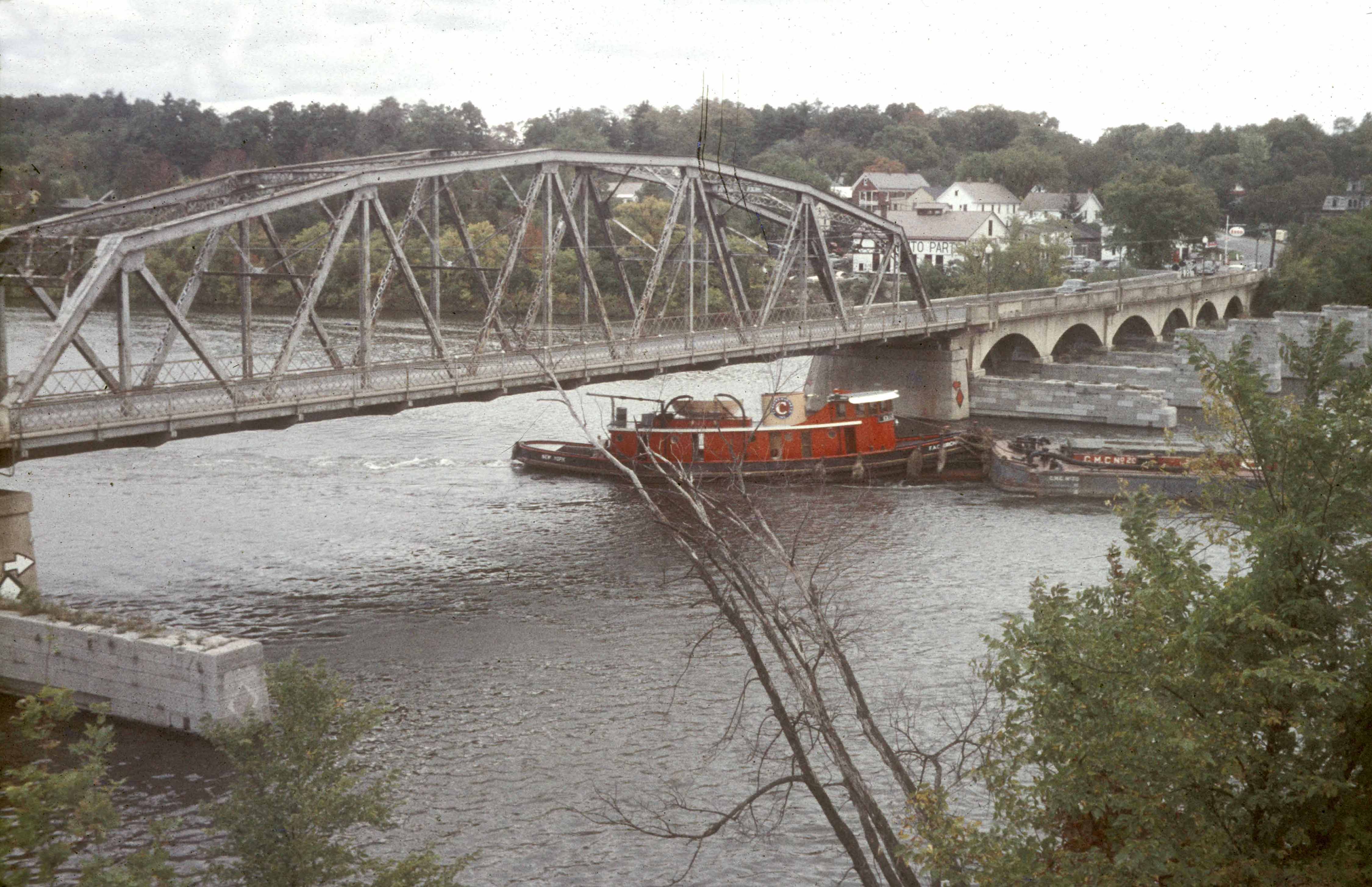
| *Note the change bridge in the mid-distance on the right of the left postcard (which looks to the east), and in the near-distance on the right of the other two postcards (which look to the west). A change bridge allowed the canal path to switch from one side of the canal to the other without the tow ropes becoming entangled (see the Aldrich Change Bridge for further information on change bridges). | ||
 |
 |
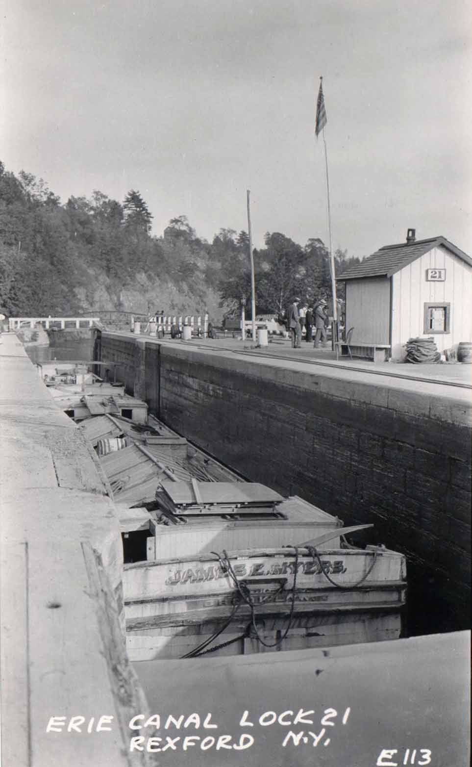 |
| "Erie Canal Boat going into Lock, Rexford Flats, Schenectady, N.Y." [Lock 21] (A27665 - no publisher information) -- Postcard ; postmarked Jul. 8, 1913. | Lock 21, Erie Canal, Rexford, N.Y. - date unknown, 1910? [CSNYS] | "Erie Canal Lock 21, Rexford, N.Y." (E113) -- Real Photo Postcard ; not postmarked ; approximately 1909? [CSNYS] |
 |
 |
 |
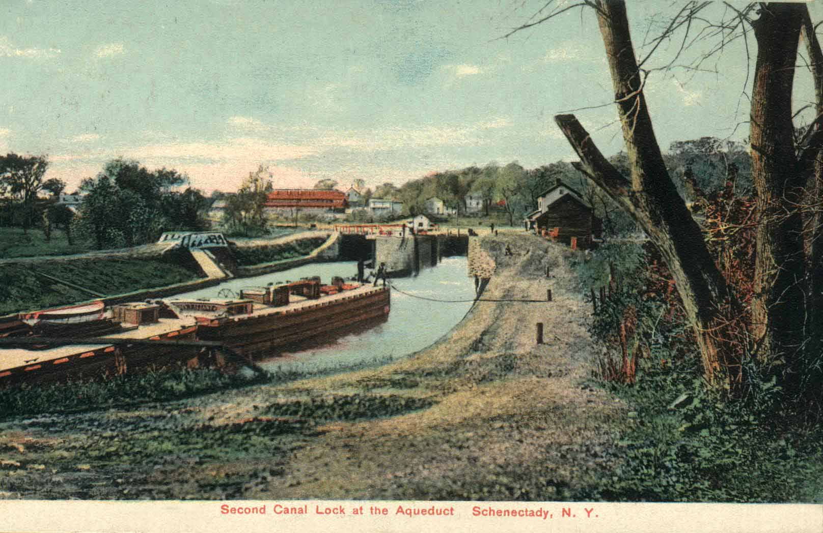
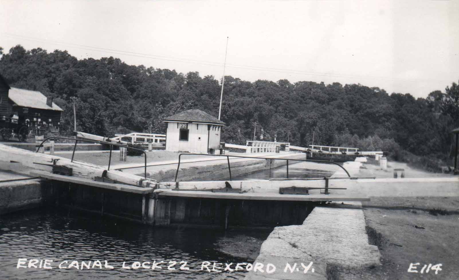
| "Second Canal Lock at the Aqueduct" (no publisher information) -- Postcard ; not postmarked ; approximately 1906? [CSNYS] | "Erie Canal Lock 22, Rexford, N.Y." (E114) -- Real Photo Postcard ; not postmarked ; approximately 1909? [CSNYS] | Old Erie Canal Upper Lock (Lock 22), Rexford, N.Y. - approximately 1915? [CSNYS] |
 |
 |
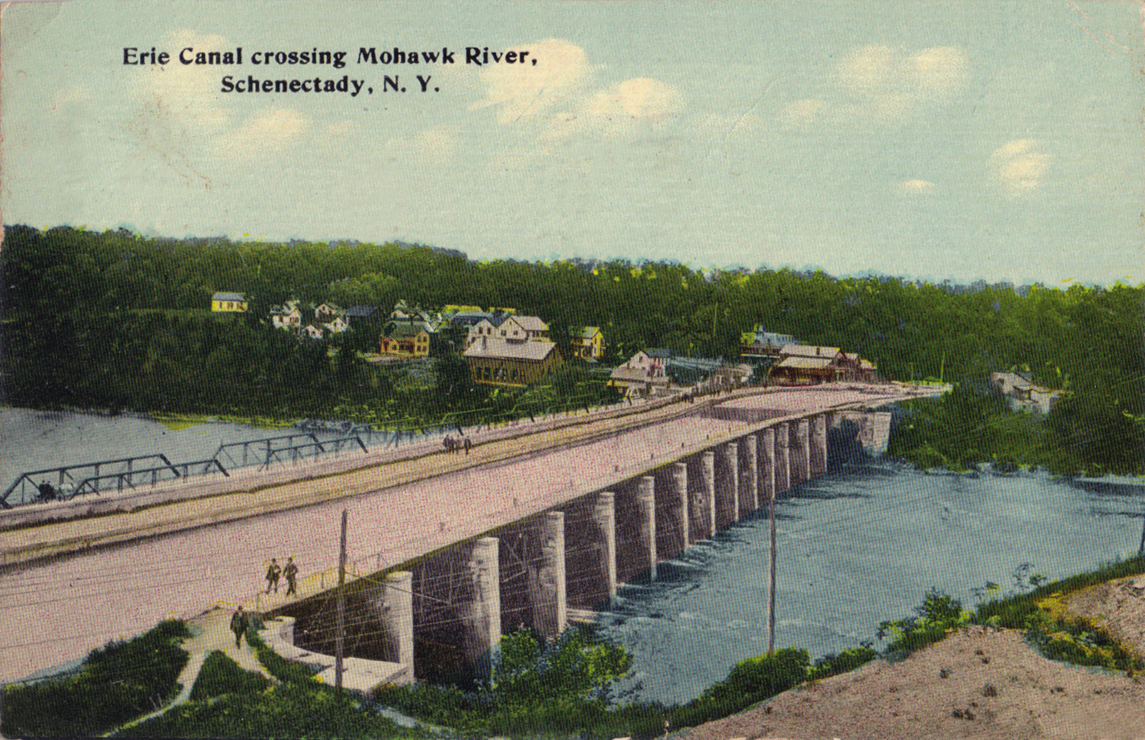 |
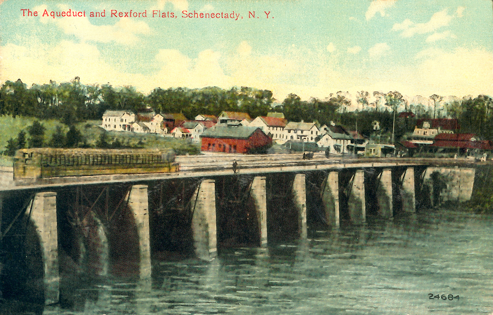
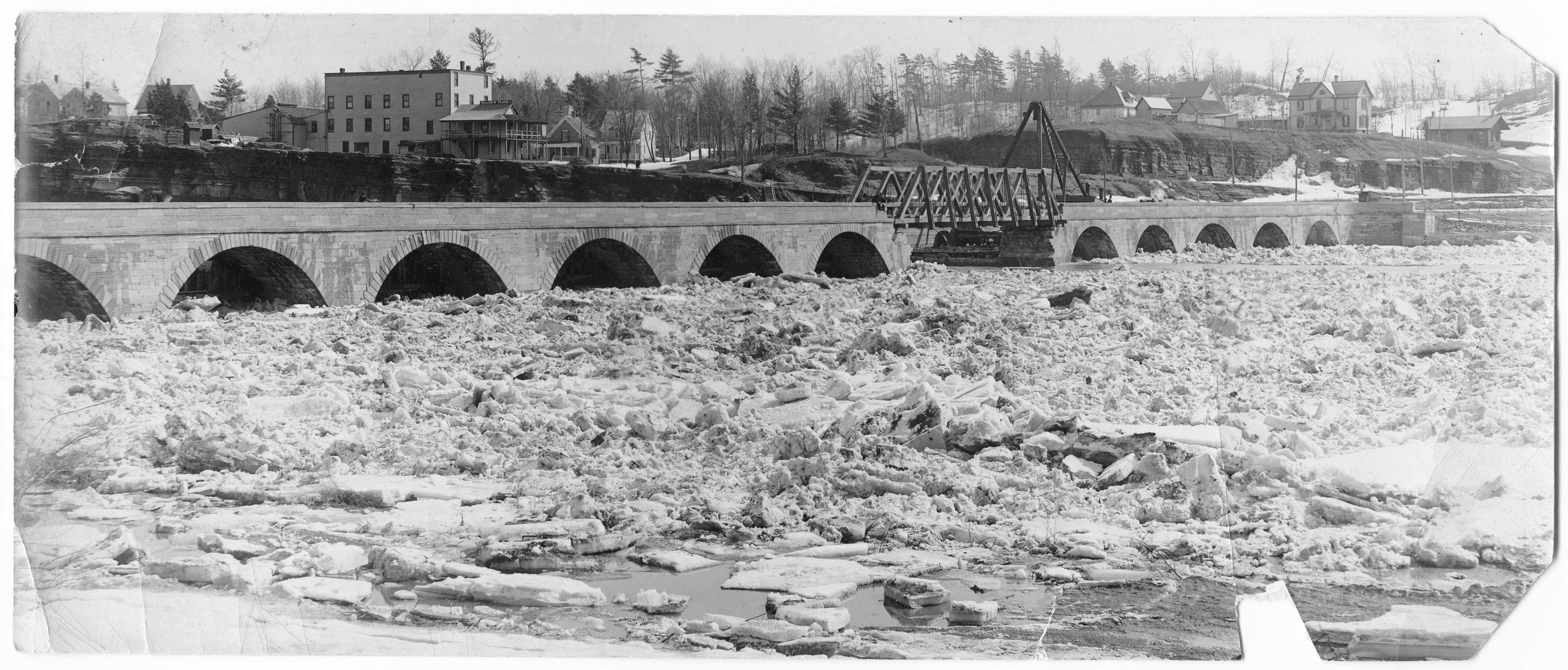
| "The Canal Aqueduct and Bridge crossing the Mohawk River near Schenectady, N.Y." (No. 11634 - J.J. Cunningham, Schenectady, N.Y.) -- Postcard, postmarked Aug. 16, 1907. -- This is the upriver side ; the piers on the aqueduct and parallel bridge are angled to fend off floating objects and ice. | "The Aqueduct and Rexford Flats, Schenectady, N.Y." (24684 - no publisher information) -- Postcard ; postmarked Aug. 25, 1911. -- This is the downriver side ; note the canal boat crossing the aqueduct on the left. | "Erie Canal crossing Mohawk River, Schenectady, N.Y." (J. Bouton & Co.) -- Postcard ; postmarked Apr. 8, 1913. |
 |
 |
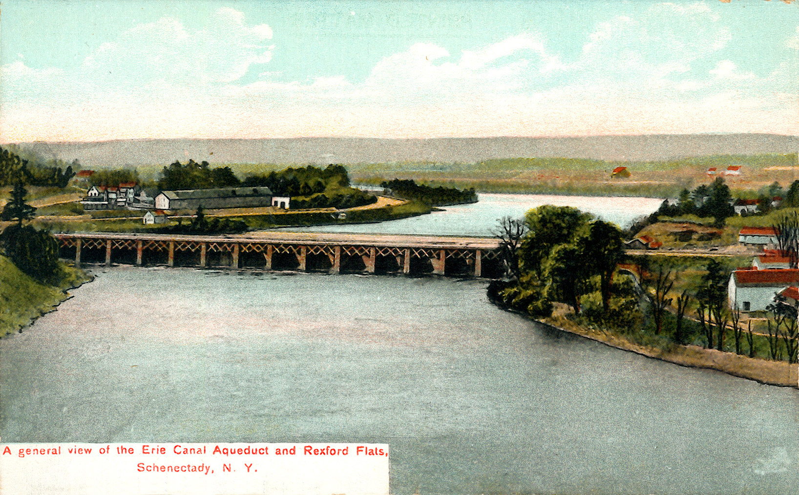 |
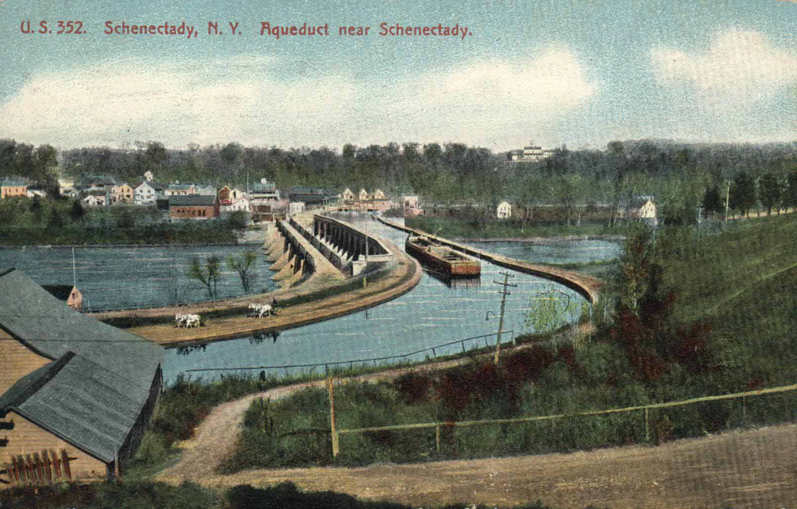
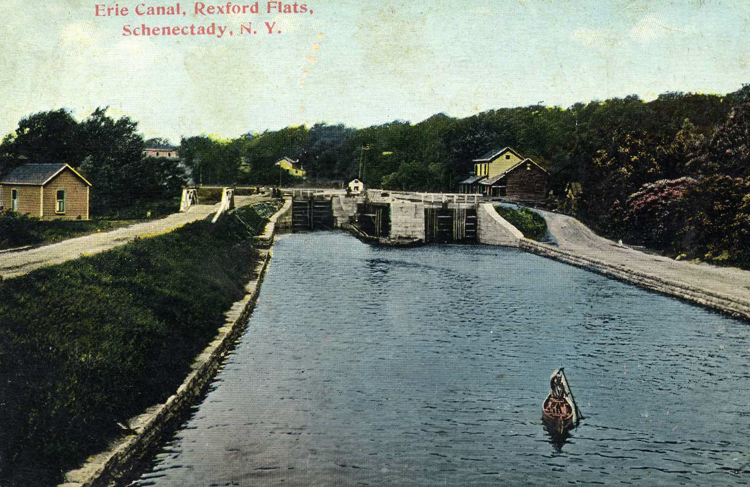
| "Schenectady, N.Y. - Aqueduct near Schenectady" (U.S. 352 - no publisher information) -- Postcard ; not postmarked ; approximately 1910? [CSNYS] | "Erie Canal. Rexford Flats, Schenectady, N.Y." [Lock No. 21] (no publisher information) -- Postcard ; not postmarked ; approximately 1910? | "A general view [looking west] of the Erie Canal Aqueduct and Rexford Flats, Schenectady, N.Y." (No. B 13389 - Albany News Co., Albany N.Y.) -- Postcard ; postmarked Sep. 27, 1912. |
 |
 |
 |
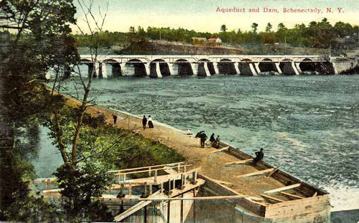
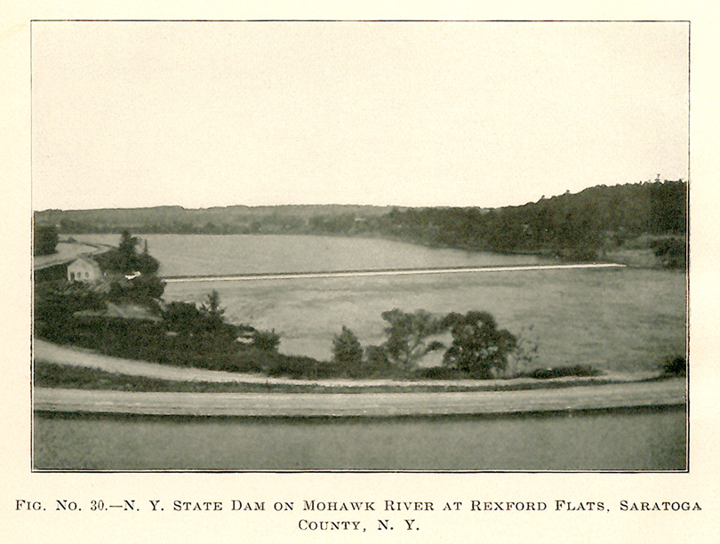
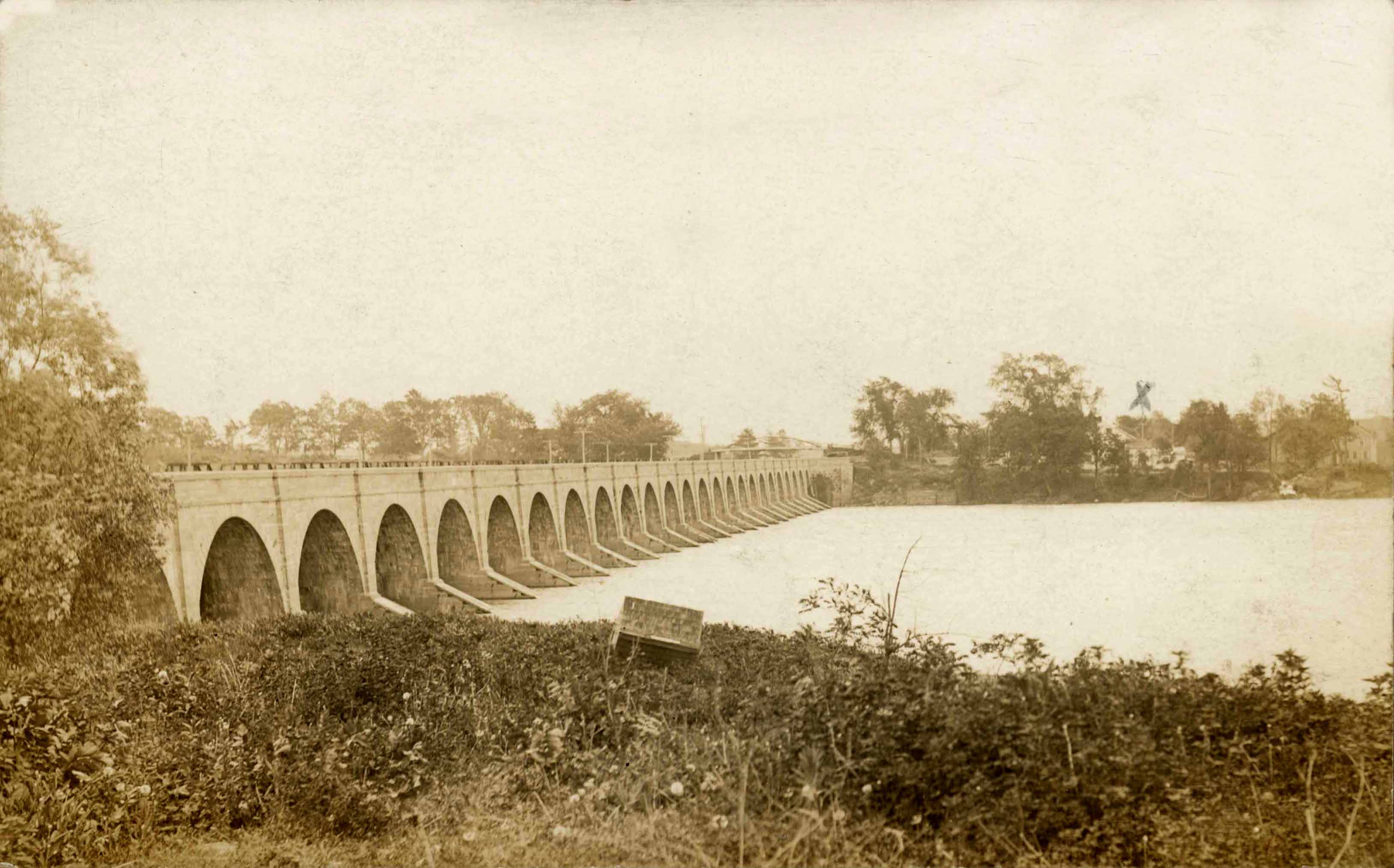
| "Aqueduct and Dam, Schenectady, N.Y." (Albany News Company, Albany, N.Y.) -- Postcard ; not postmarked ; approximately 1911? (see note below*) | "N.Y. State Dam on Mohawk River at Rexford Flats, Saratoga County, N.Y." -- from: Annual Report of the State Engineer and Surveyor of the State of New York, for the fiscal year ending September 30, 1900 (Albany : James B. Lyon, state printer, 1901) -- facing p. 373. | "[Rexford Aqueduct and Highway Bridge, Rexford, N.Y.]" (no publisher
information) -- Postcard ; not postmarked ; approximately 1912? [CSNYS] Note that, in this and other images, the road bridge paralleling the aqueduct is built upon the piers which carried the original Clinton's Ditch aqueduct across the river. |
| *In the postcard above left, the dam is barely visible in the lower right corner. In the image above center, the dam can be seen in the middle of the picture. The dam may also be seen in the "Where the Erie Canal crosses the Mohawk River ..." 1906 image above. The structure at the lower left of the image above left is the Rexford feeder guard lock. The feeder passed under the first arch of the aqueduct and brought water from the dam (which crossed the river just above the aqueduct) eastwards to the main canal between the lower Rexford lock (Lock 21) and the change bridge. The feeder is clearly visible in the left center of the The Erie Canal at Rexford -- circa 1900 photograph above. This water was used for operating all of the canal and the canal locks all the way to a point below the Cohoes Falls. | ||
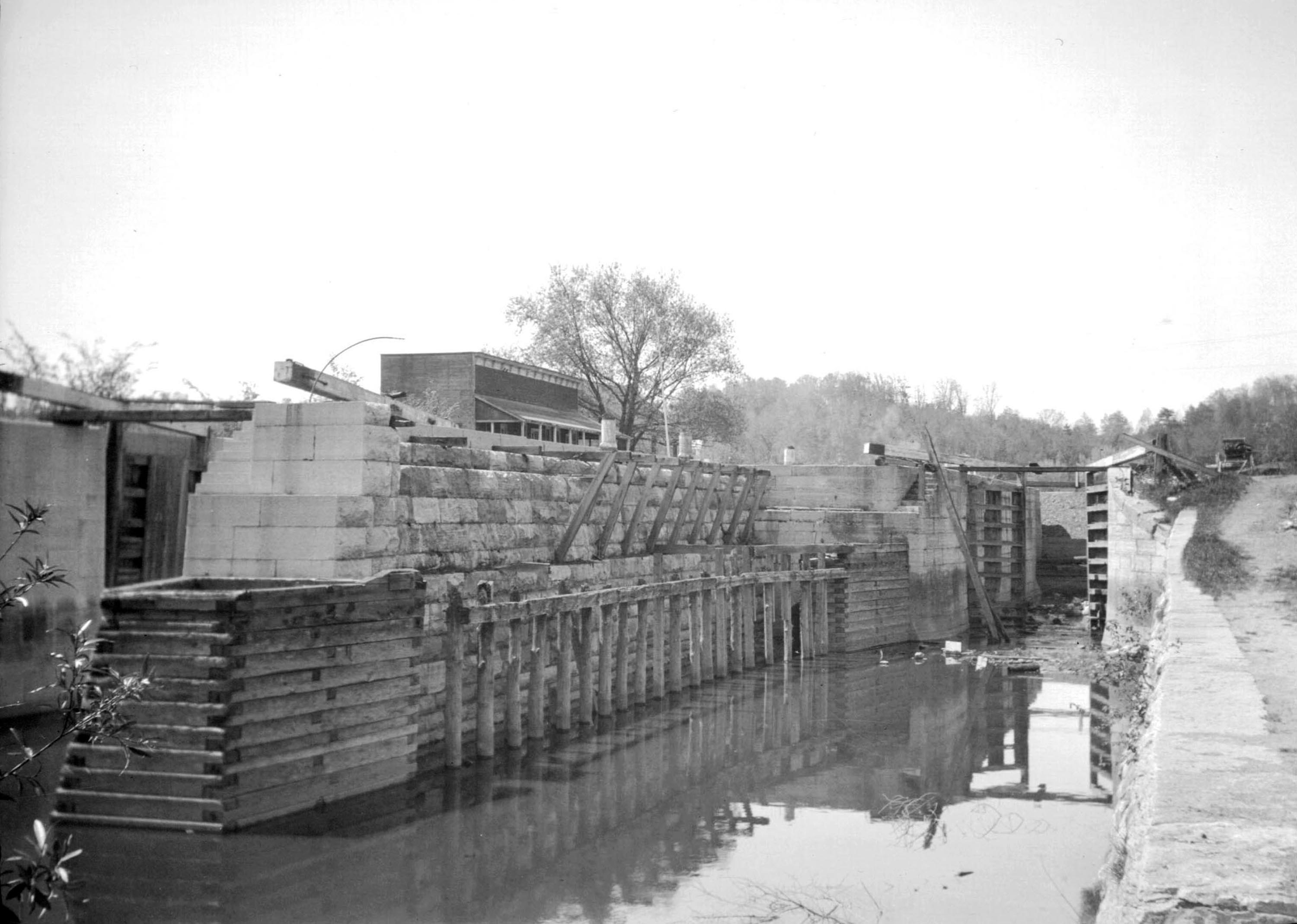
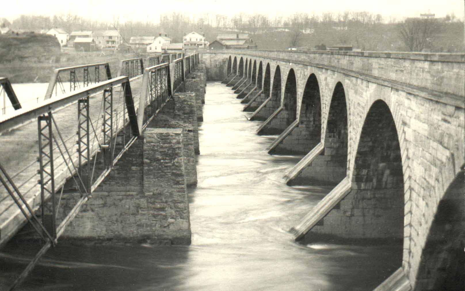
After the new State Barge Canal System opened, a major portion of the Rexford Aqueduct was removed in 1918. Since the Barge Canal used the Mohawk River instead of a separate channel, the aqueduct prism supports were obviously in the way of canal traffic. At first, most of the piers at the southern (Niskayuna) end were removed, while approximately 6 at the northern (Rexford) end were spared (see the first picture below). Later, all but a one-arch portion of the northern end and a two-arch portion of the southern end were removed (see the HAER pictures which follow).
 |
 |
|
| The Rexford Aqueduct, looking southeast - its dismantling has begun in 1916 - two arches have been removed and replaced by a bridge [CSNYS] | "The Rexford aqueduct in 1956" - looking northwest [CSNYS] |
 |
 |
 |
 |
"Erie Canal (Enlarged), Upper Mohawk River Aqueduct (Rexford Aqueduct)" -- images of the remains of the Rexford Aqueduct in 1969 -- from the Historic American Engineering Record, HAER NY-12 (HAER NY,46-REXFO,1-) National Park Service, Department of the Interior | |

For pictures of the present-day remains of the Rexford Aqueduct, see The Rexford Aqueduct page in the Traces of the Old Erie Canal section of this web site.
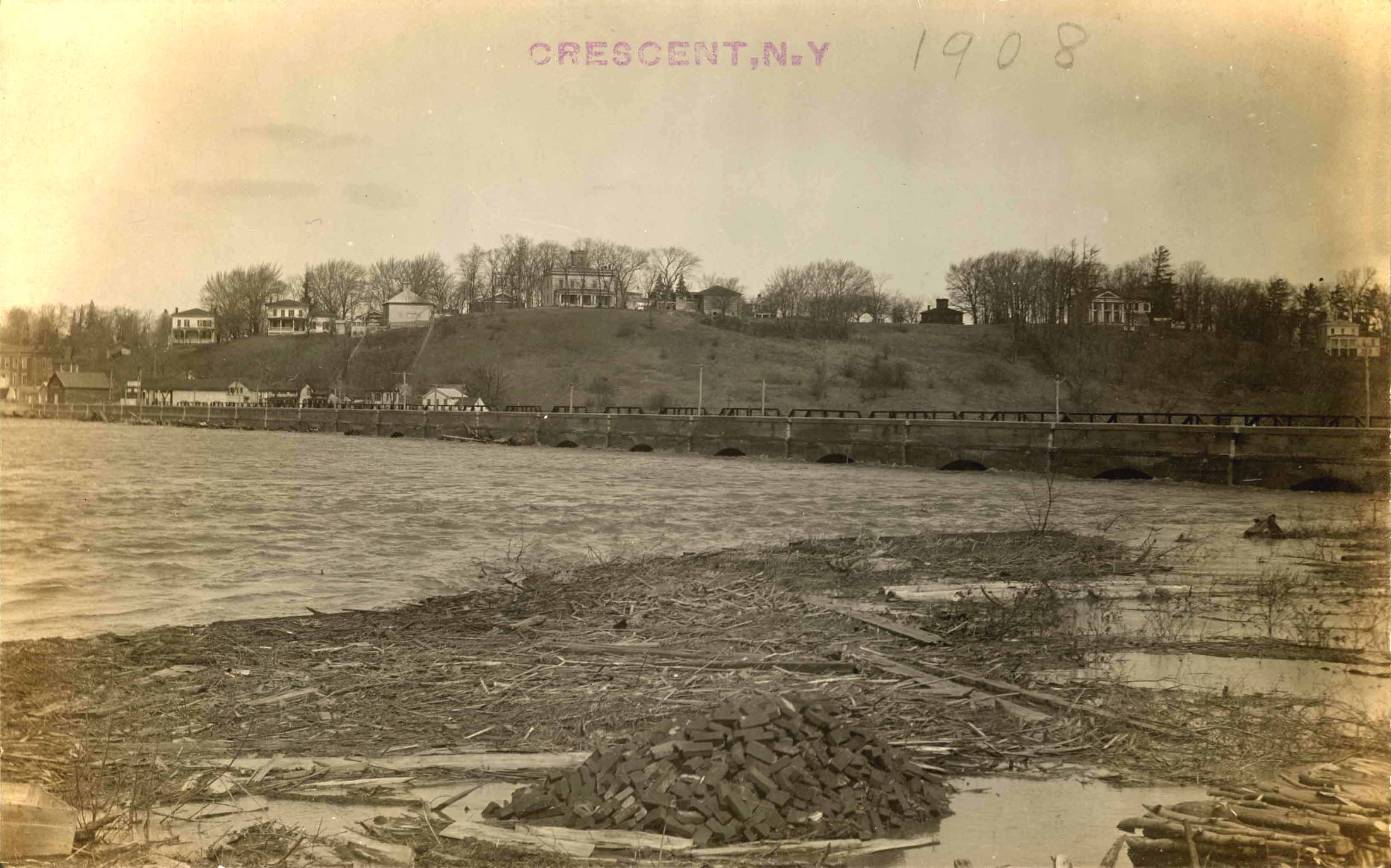
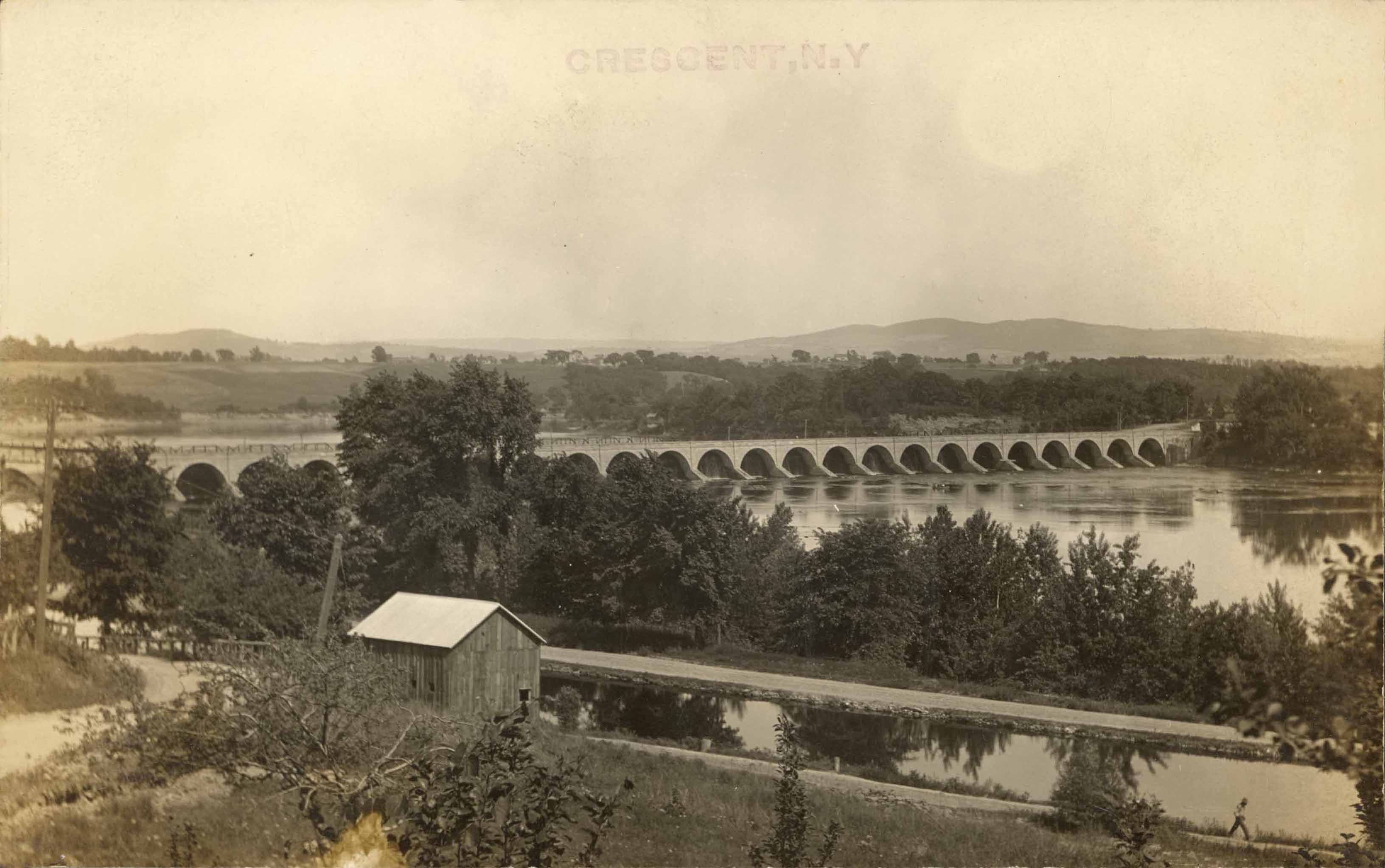
The Crescent Aqueduct, or Lower Mohawk River Aqueduct, re-crossed the Mohawk River 12 miles downstream from the Rexford Aqueduct, from the north side (west end) at Crescent, Saratoga County to the south side (east end) just northwest of Cohoes, Albany County. It was built in 1842 of random ashlar masonry, probably limestone. Its length was 1137 feet, with 25 masonry arches to support the towpath.
 |
 |
 |
| "Erie Canal (Enlarged), Lower Mohawk River Aqueduct (Crescent
Aqueduct) -- from the Historic American Engineering Record, HAER NY-12 (HAER NY,46-REXFO,1-6) National Park Service, Department of the Interior. |
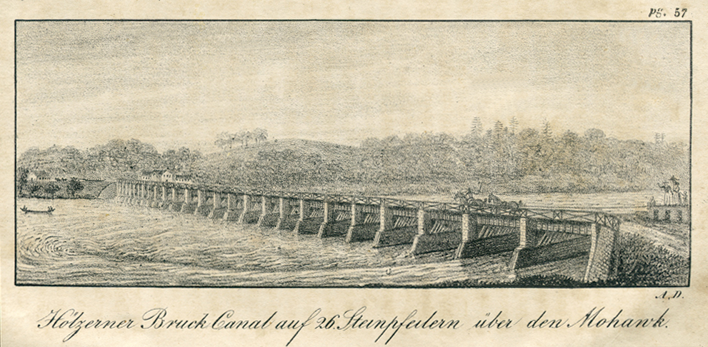
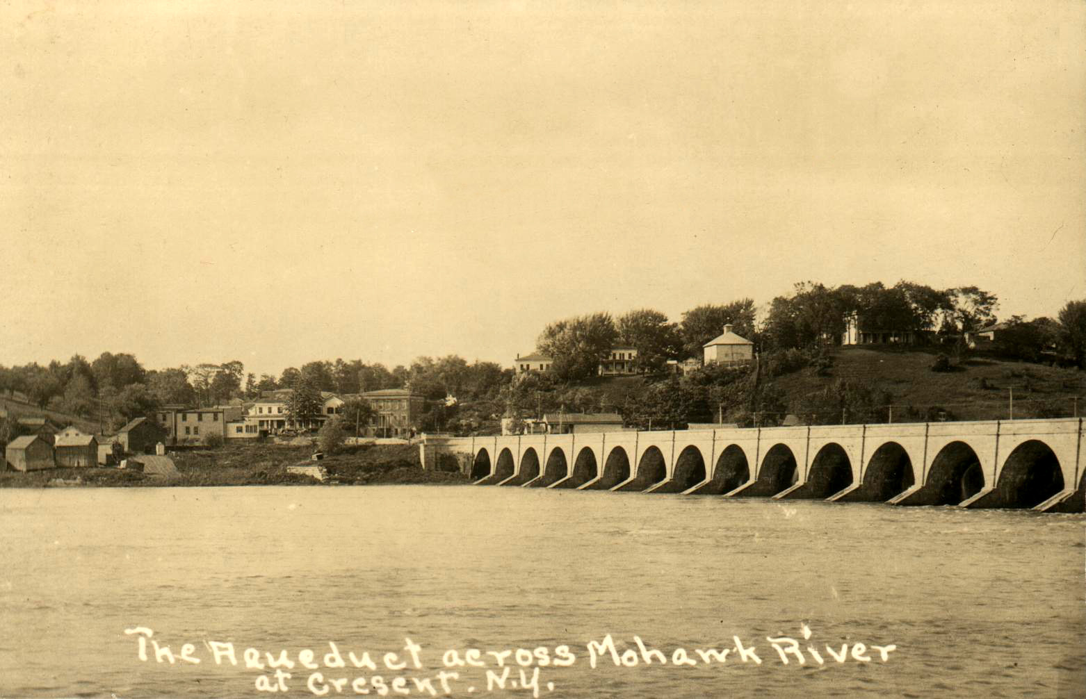
"Holzerner Bruck-Canal auf 26. Steinpfeilern uber den Mohawk (from: Bereisung der Vereinigten Staaten von Nordamerika, mit besonderer hinsicht auf den Erie-canal / von A. Duttenhofer (C.W. Loflund, Stuttgart, 1835) -- pg. 57). | "The Aqueduct across Mohawk River at Crescent, N.Y." (looking north) -- Real Photo Postcard ; not postmarked ; approximately 1907? [CSNYS] |
 |
 |
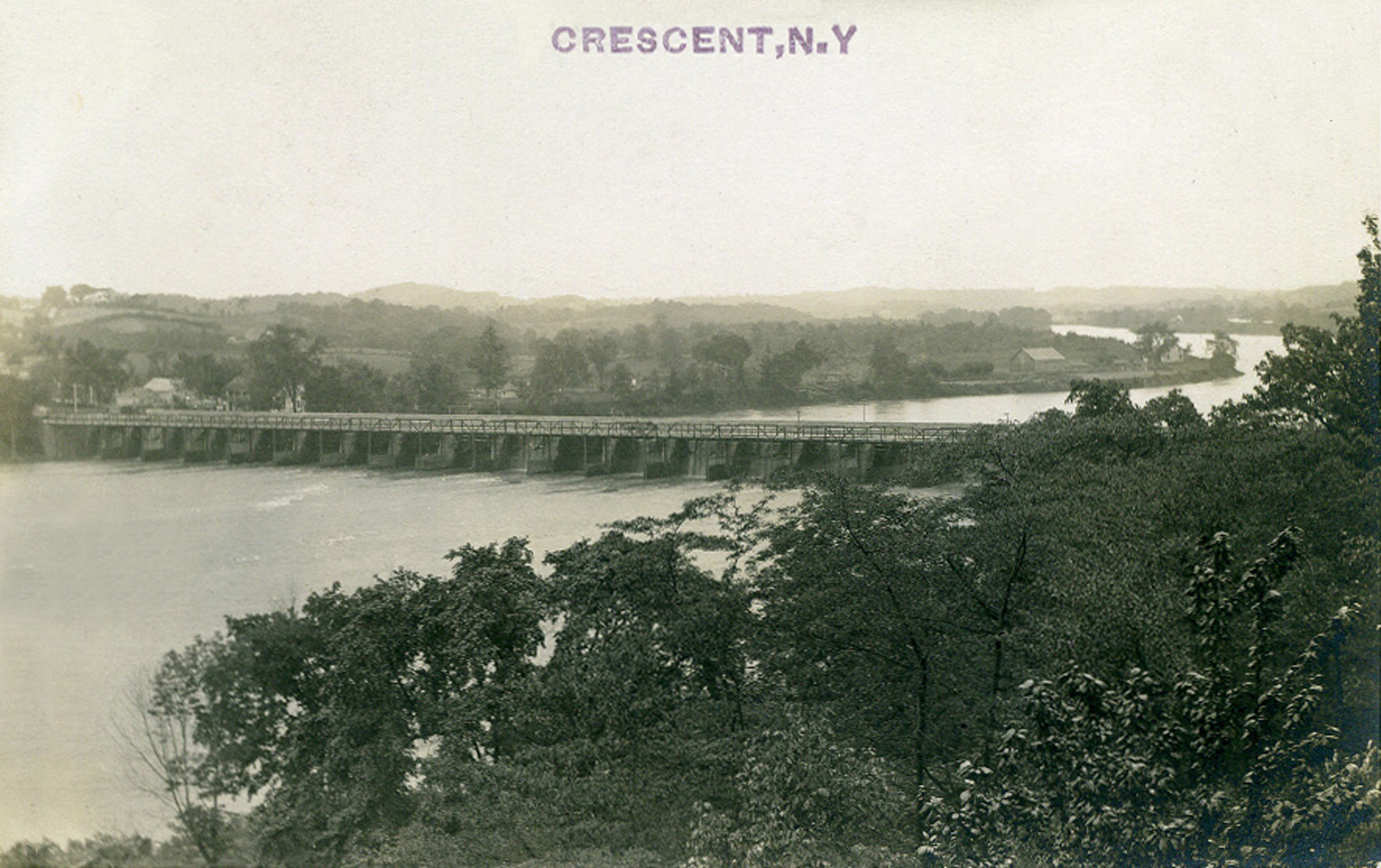 |
| "Crescent, N.Y." (looking north) -- Real Photo Postcard ; not postmarked ; [dated 1908. CSNYS] | "Crescent, N.Y." (looking southeast) -- Real Photo Postcard ; not postmarked ; approximately 1908? [CSNYS] | "Crescent, N.Y." (looking northeast) -- Real Photo Postcard ; not postmarked ; approximately 1910? |
 |
 |
 |
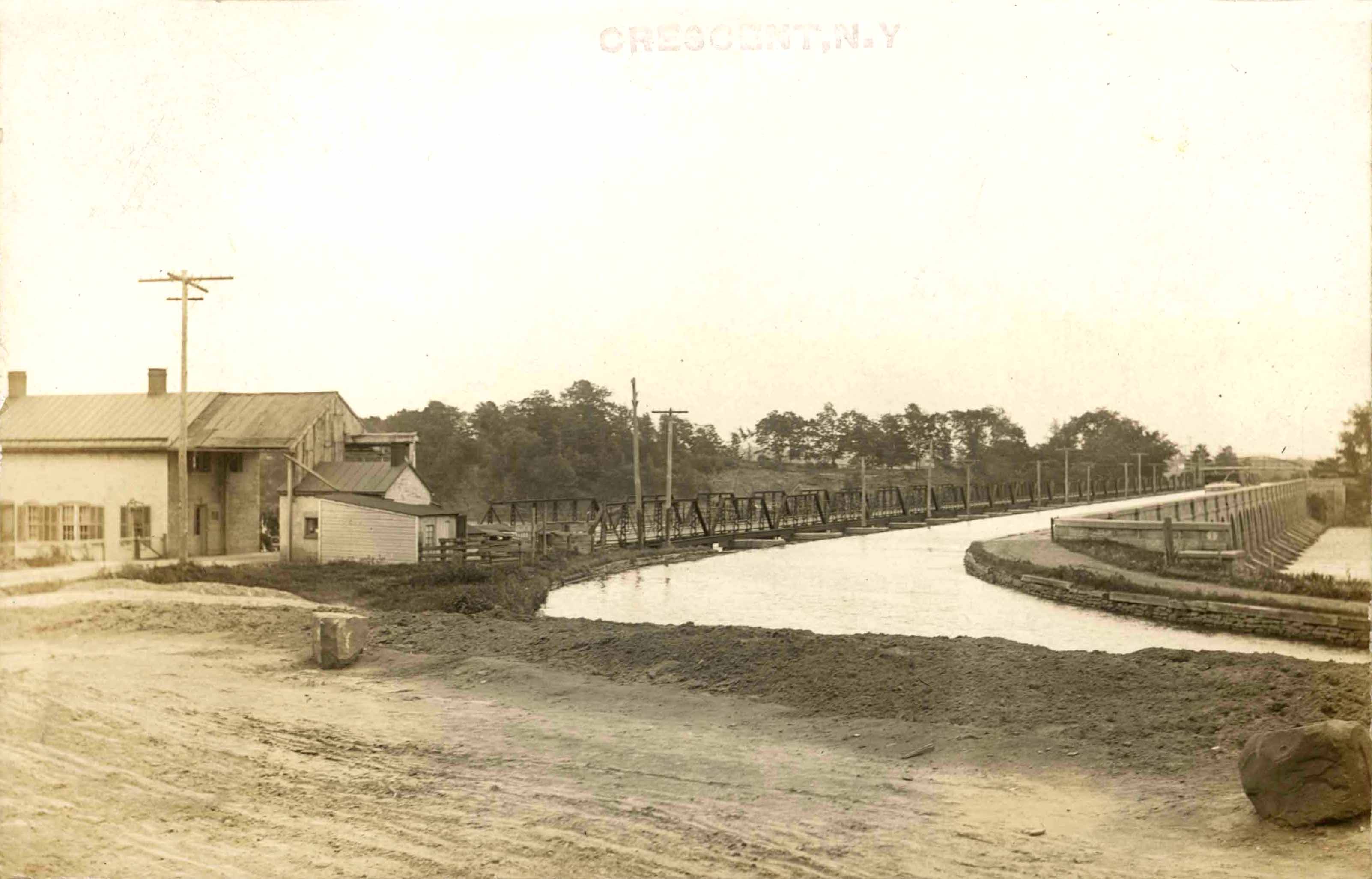
| "Toll gate at Crescent Aqueduct, Crescent, N.Y." (looking south) -- Real Picture Postcard ; not postmarked ; approximately 1909? [CSNYS] | "[On the Crescent Aqueduct]" (looking south) -- Photograph ; approximately 1909? [CSNYS] | "[Crescent Aqueduct, Crescent, N.Y." (looking northeast) -- Real Picture Postcard ; not postmarked ; approximately 1911? [CSNYS] |
 |
 |
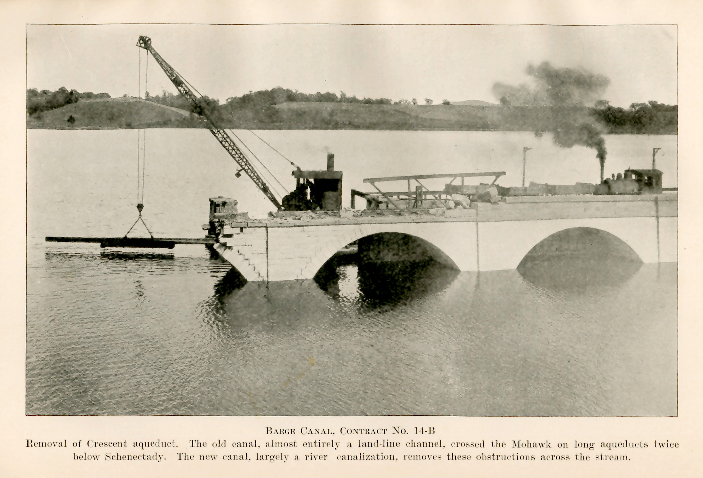 |
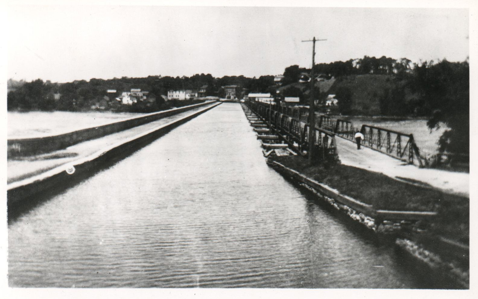
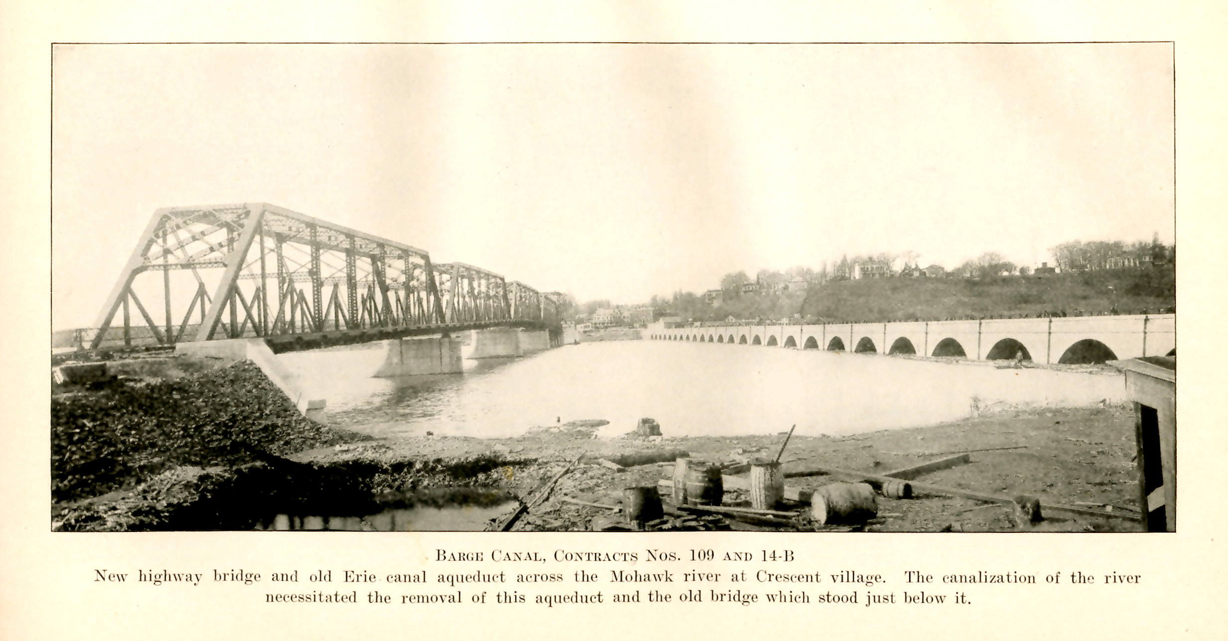
| "Barge Canal Contract no. 109" [Crescent Aqueduct] -- from: Annual Report of the State Engineer and Surveyor of the State of New York for the fiscal year ended September 30, 1914 (Albany : J.B. Lyon Co., printers, 1915) -- facing p. 48. | "Barge Canal, Contracts Nos. 109 and 14-B" [Crescent aqueduct] -- from Annual Report of the State Engineer and Surveyor of the State of New York for the fiscal year ended September 30, 1915 (Albany : J. B. Lyon Co, printers, 1916) -- Left: facing p. 82 (the aqueduct paralleling the new New York Highway 146 bridge) ; Right: facing p. 84 (dismantling the Crescent Aqueduct). | |
 |
Since the Mohawk River was to be used as the Barge Canal, both the Rexford and Crescent Aqueducts needed to be removed to allow passage of the canal boats. The pictures to the left and above right show the Crescent Aqueduct being removed. Unlike the Rexford Aqueduct, which was mostly removed in 1918, the entire Crescent Aqueduct was removed in 1915. Nothing remains but a few stones at each end. | |
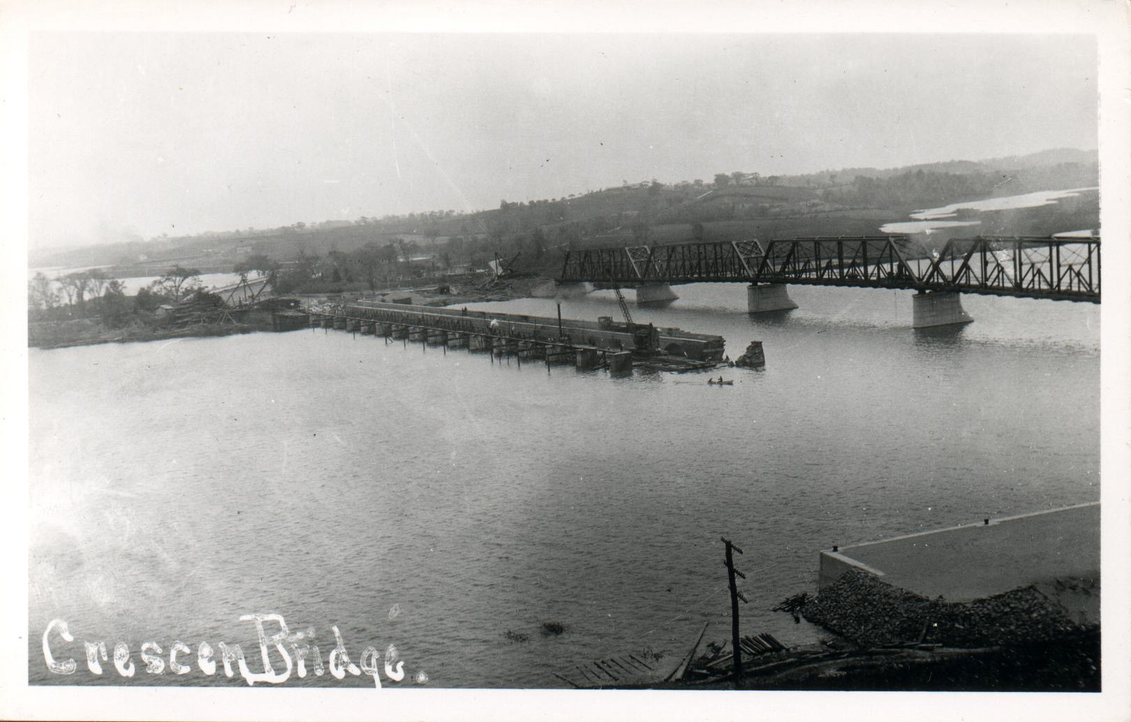
| "Crescent Bridge" -- Real Photo Postcard ; not postmarked ; 1915? [CSNYS] | ||
For pictures of the present-day remains of the Crescent Aqueduct, see The Crescent Aqueduct page in the Traces of the Old Erie Canal section of this web site.
http://www.eriecanal.org/MohawkAqueducts.html

