Nation-Wide Influence of the Erie Canal -- Review of Early, Later and Present Influence -- Testimony to This Influence -- The Barge Canal a Connecting Link -- The Intracoastal Chain on the East -- Its History and Physical Features -- Details of Its Present Status -- Great Lakes and Connected Waterways on the West -- A Rival Project, the St. Lawrence Ship Canal -- Reasons for Desiring a Ship Canal -- Its Strong Appeal -- Contrast between the Rival Projects -- Inception of Present Scheme -- The Progress Made -- Opposition Aroused -- Recent Contest in Congress -- Present Status -- Public Debates by Two Governors -- Claims by Advocates -- Other Details -- Arguments of Opponents -- New York's Position -- Study Showing Wide Influence of Barge Canal.
The Erie canal, in the broad field of its influence, has always been more a national than a state institution. From the day when President Madison, as one of his last official acts, vetoed a measure which would have given national assistance in the form of western lands -- from that day till the present, down through the years of more than a century, in which New York has built and rebuilt and maintained its waterways, the chief branch of the system, the Erie canal, has brought quite as much of benefit to the country at large as to the State itself. After the President's veto the New York commissioner returned from Washington to Albany and recommended that the canal be undertaken by the State alone, remarking that "if the bounty of Congress had granted the entreated boon, it would have been merely the purchase, at less than its cost, of a most valuable object, by paying for it a tract of unsalable land."
It was on March 3, 1817, that the President had refused national aid. On November 4, 1825, eight years, eight months and one day later, there entered New York harbor from the north a fleet of vessels decked in gala attire, the first boats to traverse the length of the completed canal, and the city turned out en masse to welcome them and then joined in a celebration, the like of which had never been seen in the western hemisphere. New York alone and unaided had built a mighty canal, which stood before the world as the model for canal building for a half century and incidentally paid for itself in less than twenty years. The part played by this canal in the development not only of New York state but of the whole territory in touch with the Great Lakes is well-known history and need not be repeated here.
"This canal," said a writer recently, "was the great western trunk-line of America for nearly forty years before any railroad system successfully competed with it. Not only did it provide cheap communication between the Great Lake states and the Atlantic seaboard, but it made possible the development of a large export grain trade. In this capacity it was supreme for another twenty years, but in 1869 the Pennsylvania and the New York Central railroads were completed to Chicago, followed in 1874 by the Baltimore and Ohio and the Grand Trunk. The freight wars which resulted reduced freight charges to a point which nearly bankrupted the railroads and incidentally cut heavily into the traffic of the Erie canal. The situation was adjusted about 1876, but rates never returned to their old level and canal traffic began to suffer. The State of New York endeavored to meet the situation in 1882 by abolishing tolls and further undertook progressive enlargement of the canal to permit the passage of larger boats, carrying heavier cargoes, but the export grain traffic via canal continued stationary or declining. This was due to several changes. Railroad rate-cutting had taken the grain from the canal and it did not return, but more important, perhaps, the territory that originally produced the grain for export was in Ohio, Indiana and Illinois, and as population grew there, the surplus grain fell off. Little by little the grain territory producing a surplus for export was pushed out into the Northwest, whence once loaded on cars, the grain went through without change. At the present time the surplus grain producing area has been pushed from Minnesota through the Dakotas and through the Canadian northwest, where it bids fair to remain. ...
"The reconstruction of the Erie canal, as a Barge canal system, was stimulated in part by the desire to secure through the port of New York the export grain trade from the Great Lakes region, especially the Northwest, but in part also by the realization that industrial development in the northeastern states had reached a point where a trunk-line waterway system was again economically desirable. Transportation by modern barges between the Great Lakes and the seaboard is desired in many other lines than the grain trade. Coal, ore, building material, iron and miscellaneous freight of many kinds can pass between Lake ports and not only the port of New York but all the north Atlantic seaboard territory. This assumes the completion by the Federal government on modern plans of the Atlantic trunk-line waterway, as originally sketched by Franklin and Washington. It enlarges the field of service of the New York system, the distribution of freight making it the connecting link between two great arteries of commerce -- the Great Lakes and the thickly settled industrial and agricultural region between Boston and the North Carolina sounds. It is not alone as a State utility that the best returns on New York's great investment will be secured. This rather depends on making New York, Buffalo and intermediate waterway points a central line for traffic gathered on the way from Buffalo to Duluth and in turn from Boston points, on Long Island Sound and the Connecticut river, from New Jersey points and on the Delaware river, Chesapeake bay and the North Carolina sounds.
"New York representatives in Congress have again a reason to urge Federal activity in waterway construction, not for the purpose of gaining allotments of public lands to pay for a canal built in New York, but for the purpose of urging completion by the Federal government of an improved system of Federal waterways, to take advantage of a great opportunity provided by their public spirited State and at a total cost to the Federal government much less than that willingly incurred by the citizens of New York." 1
The strongest testimonies to the wide-reaching, beneficent influence of the Erie canal have come, not from its most ardent friends, but from those who have had no particular concern in its welfare and in some instances from those even who are counted among its enemies. The testimony from the latter class is most important, because it comes as an unwilling confession rather than as a voluntary tribute and has the binding force of evidence elicited under cross-examination.
The volume of this testimony from what we are terming extraneous sources is exceedingly large, but probably the strongest and the most convincing as well as the best known instance is the report of the Windom investigating committee, to which reference was made in our earlier pages and which declared that the Erie canal had done more to advance the wealth, population and enterprise of the western states than all other causes combined and that the only hope of the people against the combined influence of the power and capital of railroads lay in the Erie canal. Senator Windom himself in a speech on the Senate floor said that Erie canal rates exerted an influence over all other rates from the Gulf States to the St. Lawrence river and from the Atlantic ocean to the foot-hills of the Rockies. In connection with this investigation a railroad man, Albert Fink, doubtless the highest authority on transportation in the country at the time, said that the Erie canal regulated the rates not only on the railroads of New York state but on every trunk line connecting the Lakes with the Atlantic and also in the southern states generally, until it reached the line of influence of low ocean rates.
These words of recognition were spoken of the old Erie canal, but they may be equally true of the new canal, so its friends think, when adequate shipping shall have been provided. But the special purpose of referring to these opinions, which, emanating from persons who were not New Yorkers, were free from local bias, is to show the wide influence exerted by a canal that follows, as does the New York waterway, a certain favored route, the only feasible route in fact in the United States between the Great Lakes and the Atlantic ocean.
Of like import with the opinions just referred to is a speech made by one who had the opportunity by personal experience of knowing thoroughly the commerce of the United States. His sympathies, to be sure, were with New York, but his grasp of the subject and his business relations embraced the whole country. We quote a part of this speech.
"The highway across the state of New York," he said, "from the Atlantic to the Great Lakes and the Mississippi valley is the controlling factor over transportation in North America. Every other route from the base of the Rockies to the coast necessitates mountain climbing. Consequently the rate-making influence of the two New York Central lines and the Erie canal is paramount. Not only are rates to and from the east affected by this competition but the rates south to the Gulf and north to the St. Lawrence also come under its influence. This natural competitive influence is far more effective than the artificial restrictions imposed upon the railroads by the Interstate Commerce Commission for commercial policing purposes, and this is true in spite of the fact that one of the principal aims of these restrictions had been and is directed against the commerce of the Port of New York.
"It is surprising to what a comparatively slight extent this basic natural opportunity of the State has entered into the discussion of its public affairs. The Empire State has never since the early days of the Erie canal availed of its opportunities as it should have done. Had it done so, its wealth and population would exceed present numbers." 2
The office of the New York canal as a connecting link between the Lakes and the ocean is not the least of its good qualities. It has always been such a connecting link, of course, but now, because of the modern renascence of waterways, it has become a link between two great systems of waterway improvements -- improvements which in part have already been accomplished and in part are still only prospective. To some extent these systems are merely enlargements of earlier canals or revivals of former schemes, but never before have plans been so well laid or public sentiment so thoroughly organized for their fulfillment as now, and their fulfillment, moreover, as complete systems.
At the eastern end of the Barge canal lies the system of intracoastal canals reaching from Maine to Florida and thence to the Gulf of Mexico. It was to promote this scheme in all its several parts that the Atlantic Deeper Waterways Association came into being about a decade and a half ago and it is the consummation of this scheme in its entirety, a condition which is essential to its full usefulness, that the Association, aided by a host of interested supporters, is striving zealously to attain.
This is no new scheme. It dates back to colonial times. A great stimulus to canal-building came in America in the days when there were few improved roads in the colonies and railroads were as yet unknown. The small canal was a much more efficient carrier of freight than any road built after the fashion of the time, and as the settlements were principally east of the Alleghanies a water trunk-line along the Atlantic coast was looked upon by many as the best solution of the transportation problem. The advantages of this scheme were pointed out as early as 1769, when Benjamin Franklin and others submitted to The American Philosophical Society in Philadelphia a plan for the construction of connecting ship canals between the various bays and sounds, substantially along the route now agitated by the present Association. Subsequently the movement was strongly encouraged by George Washington, who went much farther and sketched out a plan for connecting the coastal waterways with the Great Lakes and the Ohio river. Also every American President from Washington to Jackson featured canal-building and river improvement as important items in the economical development of the country. But the nation was poor and canal-building on a large scale was beyond Federal resources. Moreover State jealousies were still strong and there was a disposition in Congress to discourage enterprises that would develop one state faster than the others. Under Washington and his immediate successors the Federal government joined in organizing corporations to construct the Chesapeake and Delaware, the Chesapeake and Ohio and the Dismal Swamp canals and purchased large blocks of stock of those corporations, but progress along the whole extent of the coastal project has been but gradual and very slow.
The many bays and sounds and peninsulas and islands along nearly the whole extent of the Atlantic coast form well-nigh ideal conditions for intracoastal canals, making possible an almost continuous system with a minimum of construction. Moreover this chain of protected coastal waterways has many potential benefits, commercial, military and naval, to bestow upon the nation, but of this it is not necessary now to speak. The essential need of a link to connect this system with the great inland seas and their adjoining waterways does, however, concern us. The present plans for the intracoastal canals call for modern and, for the most part, deep channels. The link that connects the system with the Great Lakes, the New York Barge canal, but just now enlarged and thoroughly modernized, occupies the most strategic canal location in the whole country. Aside from its importance in its own right it is almost equally important as a link to join two great systems which together and by means of this connecting link establish a vast system of inland waterways that penetrates to nearly all parts of the eastern half of the country.
Our principal study of course concerns the Barge canal, but it is very important to know what part the New York canal plays in the broad waterway scheme of the whole country, and so it is pertinent to include here an account of the present status of the intracoastal projects.
The Boston-Beaufort section, according to present War Department recommendations, has a minimum depth of 12 feet. From Boston to Sandwich, through Boston harbor and Massachusetts and Cape Cod bays, there is natural open water navigation. From Sandwich to Buzzards bay there runs the Cape Cod canal, 8 miles long with 25 feet depth at low water, built by a private corporation but authorized for Federal acquisition by the 1917 River and Harbor Act, with a report as to price now before Congress. From Buzzards bay to New York, through Buzzards bay, Block Island sound and Long Island sound, there is open water. At New York the further improvement of East river, Bronx kills, Harlem river and Spuyten Duyvil creek has been recommended by the War Department and in part authorized by Congress.
From New York to Raritan bay, through Kill van [original text has "von"] Kull, Arthur kill and Staten Island sound, further improvement has been recommended by the War Department and in part authorized by Congress. From Raritan bay to Delaware river, through the New Jersey intracoastal canal, 33.7 miles long, construction has been recommended by the War Department and right of way pledged by the State of New Jersey. Between Bordentown and Philadelphia, through the Delaware river, a 12-foot Federal channel has been completed from Trenton to Philadelphia.
Between Philadelphia and Delaware City, through the Delaware river, a 35-foot Federal channel is under construction from Philadelphia to the sea. Between Delaware City and Chesapeake City the Chesapeake and Delaware canal, 13.7 miles long, was purchased by the Federal government in 1919 and has been operated as a toll-free waterway. The War Department has recommended improving the canal by removing the locks and bringing it to tide level with 12 feet depth. From Chesapeake City to Norfolk, through Elk river, Chesapeake bay and Hampton Roads, there is open water.
From Norfolk to Albemarle sound navigation is by means of a Federal inland waterway which has been provided by the purchase of the Chesapeake and Albemarle canal by the Government and its conversion into a tide-level waterway of 12 feet depth. From Albemarle sound to Pamlico sound there is navigation in a Federal inland waterway by a present route via Croatan sound, but a project for improvement via Alligator and Pungo rivers has been recommended by the War Department and adopted by Congress and work is under way. From Pamlico sound to Beaufort inlet, N.C., through a Federal inland waterway, the improvement via Neuse river and Beaufort cut has been substantially completed.
The Beaufort-St. Johns river section, according to present War Department recommendations, has a minimum depth of seven feet. From Beaufort inlet to Cape Fear river and from Cape Fear river to Winyah bay, S.C., outside routes are now used and the Federal inland waterway recommended by the War Department follows largely existing sounds and thoroughfares. From Winyah bay to Charleston, S.C., the Federal inland waterway recommended by the War Department is to be secured mainly by deepening existing channels along an inside route now available but of limited depth. From Charleston to Savannah river an inside route of six feet depth at low water now available has been recommended by the War Department for Federal improvement to the standard depth. From Savannah river to St. Johns river, Florida, an inside route of seven feet depth at low water now available has been recommended for Federal improvement mainly by widening at narrow points.
If this intracoastal chain of waterways were all improved, it would afford a continuous navigation of about 1,800 miles.
At the western end of the Barge canal lie the great inland lakes with their natural navigation of about 1,500 miles. But these lakes do not constitute the whole of the waterway system, existing or contemplated, of the Middle West. Numerous canal schemes have been agitated since the Barge canal was begun and some of them have passed from the stage of agitation into that of preliminary surveys. Of these there are four in the region of the Great Lakes which are worthy of notice. These four proposed canals are, first, the Lake Erie and Ohio River canal, which would join the Ohio river at Pittsburg with Lake Erie, and for which complete surveys and estimates have been made by the States of Ohio and Pennsylvania; second, the Lake Erie and Lake Michigan canal, surveyed by the United States engineers and joining the heads of Lakes Erie and Michigan by a line only one-third the length of the present natural route, thus bringing Chicago, Milwaukee and Grand Rapids that much nearer to the eastern states and the ocean; third, the proposed improvement of existing canals in Illinois, which extend between Lake Michigan and the Mississippi river; fourth, a canal from the head of Lake Superior to the cities of Minneapolis and St. Paul.
For all of these projects the Barge canal furnished standards upon which to base both dimensions and plans. The engineers who were about to undertake the surveys visited the New York canal before beginning their work. In some cases also the services of Barge canal engineers were secured to assist in planning the proposed waterways. Of the four projects mentioned, little has been heard recently concerning the Lake Erie and Lake Michigan scheme or the canal from Lake Superior to Minneapolis and St. Paul. The Ohio River and Lake Erie project, however, is still a live issue and, because of the importance of the region to be served and the great volume of prospective traffic, it seems probable that eventually this canal will be built. Illinois is now improving its canals and there are indications that these improvements may be rather extensive before they are all finished.
Thus it appears that both the existing and prospective mileage of waterways connected by the Barge canal and also the extent of territory influenced by its building are very great. Even now the 1,500 miles in the Great Lakes and the 800 miles of New York waterways form a mighty system. If, however, all or even part of the canals and improvements adjacent to the Great Lakes and also the Atlantic intracoastal chain with its navigation of 1,800 miles are eventually built, the area coming under the influence of the Barge canal will indeed be vast.
Since Nature's most favorable route for a canal between the interior and the coast lies in New York, the State in serving itself of necessity, as we have seen, had to serve others. While it is probably true that the primary purpose in its canal-building has been to serve itself, still it cannot be said with truth that New York has been entirely selfish. Rather the opposite is true. Doubtless, however, the State should not have been compelled single-handed to build and maintain for a century and more the waterway which has regulated the freight rates for half of the country and which has been the only means of combating the large outlays made for the avowed object of diverting the traffic of the interior from American to Canadian channels, but to those who are familiar with the circumstances New York's generous purpose has seemed genuine. In spite of this action, however, rival canals have been agitated and the latest of these, the proposed St. Lawrence ship canal, threatens the success of the Barge canal to the extent at least of so diverting attention as to make it difficult for the New York canal to prove its value.
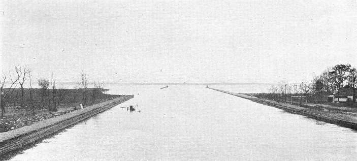
Entrance into eastern end of Oneida lake. Concrete breakwater piers, extending about 1,600 feet into the lake, protect the channel. The shifting sands of this region have added greatly to the problems of construction and maintenance. The sailing course westerly is straight for nearly 14 miles, lying on a line between the Sylvan Beach and Frenchman's island lighthouses. At the breakwater ends appear the cabinets which carry smaller lights.
Soon after the Barge canal was begun there was a movement on foot for a fourteen-foot channel up the Mississippi and on to the Great Lakes. This was known as the Lakes-to-Gulf project and it was sponsored by the Mississippi River Improvement Association. The scheme received a severe blow in June, 1909, when the board of Government engineers, having investigated the section from St. Louis to the Gulf, reported to Congress that such a waterway was not desirable. These engineers estimated the cost of constructing the portion they investigated at $128,000,000 and the annual maintenance charge at $6,000,000. One reason for the failure of this project was the fact that, although it promised to benefit commerce between the Lakes region and the southern hemisphere, it had nothing to offer in the way of better traffic relations with European ports. This fact is most strikingly illustrated when one considers what would happen to a shipment starting from the head of Lake Superior and going to Liverpool by way of the Mississippi. After it had gone 2,000 miles and reached the mouth of the river, it would still be 4,500 miles from its destination, no nearer than at the beginning of its journey.
After the adverse Federal report this Mississippi project lay quiescent and the association became inactive till the St. Lawrence scheme was conceived. Then the organization served as a nucleus about which to build the new movement.
In discussing the St. Lawrence ship canal project, which contemplates a channel of sufficient size to enable ocean-going vessels to penetrate to the Great Lakes, we must remember that an intense [original text has "itense"] controversy has arisen over the matter and that the two sides of the question have little in common; in fact they are almost diametrically opposed. Moreover the subject is rather complex, but stripped of its minor features it resolves itself primarily into the question of ship versus barge canals. It is not, however, a simple question of ship or barge canals; it involves the problem of a ship canal to reach points ranging from a thousand to twenty-five hundred miles inland. Territorially the contest is between nearly a score of states, mostly Middle Western, and the rest of the country, particularly New York, since she, because of her own waterway, is the chief exponent of the barge canal principle, and also since her metropolis would suffer most if any considerable amount of commerce were diverted to the proposed Canadian route.
To understand the enthusiasm the St. Lawrence scheme has evoked we must realize that the Middle West very acutely feels the lack of adequate transportation; also that, through a just pride in the remarkable growth of the region and a feeling that it is too important longer to tolerate inadequacy, these states absolutely refuse to brook further restraint. Moreover in the scramble for world trade the Lakes region evidently appreciates in full measure its serious handicap of remoteness from the coast and is trying to overcome the disadvantage.
This attempt to carry the coast inland is a subject of supreme importance to the whole country as well as to the Middle West. Let us consider one phase of it briefly. The marine commercial development of a country is not solely a matter of bringing ships to its ports and carrying away the products found close to its shores. It is the heart of the country, the vast inland stretches, that must be depended on largely to fill the holds of ships and make their operation possible. In the United States the shape of the country presents a grave difficulty in reaching its heart. We are confronted by a solid block of land, 3,000 miles across from ocean to ocean in a longitudinal direction and 1,600 miles from north to south, without a single salt-water bay or indentation reaching a hundred miles directly inland. In all this vast area, moreover, there are but three navigable slits, the Mississippi, the Hudson and the Columbia rivers, and of these the Hudson and its artificial connecting links form the only watercourse running east and west, the direction most desirable for an outlet to the world's marts. In contrast the countries of Europe, our chief rivals in trade, are lavishly supplied with penetrant arms of the sea. The continent is one fretwork of bays and indentations. Every nation except Russia is thoroughly marine, since the heart of none is more than three hundred miles from salt water. And to supplement their natural advantages the most elaborate systems of artificial waterways and improvements in the world are found there.
This is no new situation; it is as old as the continents and the waters themselves; but it explains several things nevertheless, and the realization of the fact has become more acute of late because of changing conditions at home and abroad in industrial and commercial affairs. A review of the situation, moreover, helps to clarify our understanding of the reason why the ship canal idea is so popular and so persistent and why it is so necessary that a territory two thousand miles inland should have cheap water transportation. We learn from this review also why New York built her canal, but her conclusions and her method of procedure differed widely from those of her sister states.
Looking at this situation from the standpoint of the whole nation we know that, although lacking natural indentations of the sea, we must in effect extend our littoral many miles inland. This is absolutely essential. We must compete for foreign trade. For the sake even of our home trade we must do this. Otherwise we shall relapse into a hermit nation and history tells us that such a condition would be fatal.
There are many evidences that the Middle West never relinquished the idea of eventually having a ship canal from the ocean to the Lakes. And to be sure it is pleasant fancy, not easily given up, and one to tickle the imagination; there is a fascinating glamour enveloping the thought of giant ocean ships sailing to the heart of the continent and there exchanging the products which they have brought from the uttermost parts of the earth for the grain, the lumber and the ore of the vast Northwest. The advocates of the St. Lawrence project have used to the full the magnificent appeal in this idea. They have played upon the almost universal human tendency to prefer the spectacular to the commonplace and have taken advantage of the natural trait, at least the American trait, to regard the biggest of its kind as necessarily the best.
The St. Lawrence promoters affect to despise the Barge canal. Doubtless they would consider it presumptuous to make comparisons between the two projects, especially to the disparagement of the ship canal scheme, but so pronounced is the contrast between them that one who has studied the history of each enterprise cannot fail to be forcibly struck by it. This contrast may be presented in the form of two pictures, one in retrospect, one now in full view, and our description, we think, is not overdrawn.
On the one hand we see New York deliberately and dispassionately considering the problem of building a canal from ocean to Lakes, appointing a commission of unbiased and level-headed business men and capable engineers to evolve the best plan, and then, after careful surveys and full discussion, proceeding resolutely to carry out that plan and moreover to bear alone the whole expense despite the fact that the cost would be enormous and the further fact that others would enjoy the benefits of the enterprise quite as much as would the State itself.
In the other picture we see a score of states wildly enthusiastic over a project that has not the support of scientific investigation to test its practicability or even of accurate surveys to determine its cost. We see these states complaisantly adding a stupendous water-power scheme to the original project in order to gain the help of states not interested in the canal alone. We see them calmly ignoring the fact that the proposed canal if built would be almost useless without the expenditure of a vast sum for deepening lake harbors. Also we see them even depending on the overwhelming power of a project backed by national approval to convince a lukewarm or, it may be, a reluctant sister nation of the advantages of coöperation. Then we see them marching upon Congress and demanding not an unbiased investigation and a thorough survey but an immediate undertaking of the work, the United States to join Canada in paying for the cost, thereby letting the interested states go free, although the total United States expense according to their estimates is only about three-quarters of the amount New York alone paid for its new canal. Finally we see these states endeavoring to push this measure Congress willy-nilly in spite of grave doubts in the minds of all save the advocates themselves that ocean shipping can ever be induced to penetrate to the Lakes and in the face of protests demanding that, before so monstrous and so far-reaching a policy shall be adopted, precisely what is being undertaken must be known and its cost determined beyond reasonable question.
Although there had evidently been slumbering in the minds of middle westerners for a considerable time the idea that some day there would be a ship canal from ocean to Lakes, the genesis of the present movement may be traced to a certain public meeting and to a particular individual. But the proposition, put thus in concrete form, became popular at once and its advocacy spread rapidly. Whole states were enlisted in the cause and their legislatures appropriated funds for its furtherance. After most of the central section of the country had been brought into line the advocates launched out into wider territory. It was to gain New England that the water-power idea was added. In brief the scheme is to provide a 25-foot or possibly a 30-foot channel for ocean vessels and to develop the power incidentally created in canal construction. The length of new channel work needed to carry out this plan is comparatively short, only a few miles, but nearly all such places lie in Canadian territory and also the length of the St. Lawrence river from ocean to Lake Ontario is nearly twelve hundred miles. Moreover by far the greater part of the river flows through Canada, only about a hundred miles at its upper end being a national boundary stream.
National public attention was first focused on the St. Lawrence project when a clause in the Rivers and Harbors bill of the 65th Congress authorized a joint investigation by the United States and Canada. Immediately after the introduction of this measure and before final action could be taken bitter opposition arose, but the ship canal forces were too strong to be defeated in the time then available and all that the opponents could do at that juncture was to have an amendment added for an all-American route, authorizing a survey for a ship canal between the Great Lakes and the Hudson river. The investigation was to determine "what further improvement of the St. Lawrence River ... is necessary to make the same navigable for ocean going vessels." The investigators were ordered also to make recommendations concerning coöperation by the United States with Canada for the improvement.
In accordance with this Congressional mandate the investigation was duly made. The opponents of the project, however, consider that they were not given equal opportunity with their rivals to present their side of the case. The report of the International Joint Commission favored the proposed canal but counseled further and complete investigation. Thereupon, however, a bill was introduced in Congress to take steps immediately for its construction.
But meantime a considerable portion of the country had been aroused to deep interest in the proposition. The advocates had been well supplied with money from the beginning and all through their campaign by means of continuous publicity and agitation they have been tireless in their efforts to gain and keep adherents. The opponents on the other hand have had very little money to spend and have not been so well organized. Still they have been able to reach a large portion of the public through the newspapers. At the suggestion of the Superintendent of Public Works the New York Legislature created a commission to care for the State's interests and Governor Smith appointed as members of this body, Senator L.W.H. Gibbs, chairman, Senator James J. Walker, Assemblymen S.L. Adler and Charles D. Donohue, State Engineer Williams, Superintendent of Public Works Walsh, Murray Hulbert, Commissioner of Docks of New York city, and Henry W. Hill, President of the State Waterways Association. These commissioners appeared at the hearings of the International Joint Commission. Also at other times and in other places they have endeavored to spread abroad information to confute what New York regards as the chimerical and perilous doctrine of a ship canal to the Great Lakes. A valiant champion of the State's cause appeared in the person of Governor Nathan L. Miller. Soon after assuming office Governor Miller showed a deep concern in the affair and through his public utterances he has been able to accomplish more probably than any one else in whatever success the opposition has achieved.
One of the means employed to spread information was an excursion over the Barge canal during the fall of 1921. We have mentioned this event earlier in the volume. It was planned by various commercial bodies and interested individuals of the state and the company taken on the trip comprised Congressmen, shippers and others from a rather wide territory, including the Middle West, the South and the Southwest. Apparently the effort was successful; the visitors seemed to be converted to the barge canal idea. They acknowledged that their previous conception of the New York waterway was that it still was the shallow, old-fashioned canal of the past.
After the bill for the St. Lawrence canal was introduced in Congress counter moves immediately were made. One was for a ship canal all in New York state, to be built by a private corporation. This was not a new scheme; it had been presented to the Federal Power Commission in January, 1921; it was a plan advanced by Millard F. Bowen, of Buffalo, who proposed to form a corporation to be known as the Great Lakes to Hudson Ship Canal Company, which would build and operate at its own expense a toll-free ship canal of thirty-feet depth, traversing New York territory but utilizing Lake Ontario from Olcott to a little east of Oswego, on condition that it receive the income from the water-power to be created and from terminal charges and a few other incidental sources.
Another counter measure was a bill introduced by Representative Ten Eyck of Albany, proposing that Great Britain cede to the United States all Canadian territory south of St. Lawrence river and St. Lawrence bay, the value of this land to be deducted from the war indebtedness owed to the United States by Great Britain. This measure of course could scarcely be taken in earnest except as it showed the justice of the claim that the United States, if it were to pay its share of the proposed St. Lawrence canal, should own all of the land on one side of the channel and thereby be able to have equal rights with Canada. A somewhat similar but more moderate proposition was contained in a resolution introduced by a senator from Utah. This measure called for the cession to the United States of Canadian territory south of the St. Lawrence and west of the Richelieu rivers.
The St. Lawrence measure seems to have been blocked for the present. In consideration for items in the Rivers and Harbors bill for various local improvements sufficient support was arrayed against the canal project to prevent its passage. This action, however, cannot be charged to New York's account; the State has waged only a fair and open fight. President Harding's action has also postponed further legislative progress for a time at least. The President has declared himself in favor of the canal, but he has taken the stand that before anything else is done treaties preliminary to its accomplishment must be made with Canada and Great Britain. He directed Secretary of State Hughes to begin negotiations for such treaties. Canada has in effect declined to enter into such a treaty.
Two events to attract wide-spread national interest since the St. Lawrence bill was introduced were debates on the measure by Governor Miller of New York and Governor Allen of Kansas. These took place, one at the annual convention of the National Rivers and Harbors Congress, held in Washington, and the other at Chicago. The prominence of the debaters as well as the importance of the subject gave the affairs much publicity.
It is not necessary to say much more concerning the St. Lawrence project. The subject is both too large and too complex to treat exhaustively without giving it more than suitable space. There have been arguments almost without end on both sides. Moreover it cannot be denied that there have been foolish thing said on both sides. A believer in the Barge canal, however, can see little excellence or reason in the claims of the advocates, while he can see much to criticise and condemn.
The desperate need of the Middle West for better transportation is conceded by everybody, but that need constitutes no argument to prove that the proposed canal will satisfy it. And yet such plea, reiterated ad infinitum, has been the chief argument in its behalf. One gross overstatement along this line was brought out in one of the debates between Governors Miller and Allen. In refutation of a total tonnage of 200,000,000 tons estimated to be available for export from the Great Lakes region and vicinity it was shown that only 54,000,000 tons were exported annually by the whole country. The other principal argument is the claim that the cities on the Lakes will become seaports. This premise of course is fundamental; on it stands or falls the whole project. The opponents consider that the claim that ocean vessels will penetrate the continent for the hundreds and even thousands of miles necessary to reach these inland ports is absolutely and undeniably without authoritative support and also contrary to all probability. It was the careful investigation by a Federal engineer that first showed the relative economy of a barge canal to the Great Lakes and it was this investigation which brought to naught the United States Deep Waterway plans for a ship canal and which also induced New York to select the barge size for its new waterway. So far as we are aware no other competent investigation has ever been made on this subject and nothing has occurred to disprove the conclusions of the one careful study.
But it is not our province to debate the question. Briefly, however, we may mention a few more incidents. Early in the agitation State Engineer Williams said that if there really must be a ship canal, although in his opinion it was not necessary, the logical course for it was the Oswego-Oneida-Mohawk route, substantially that of the Oswego and eastern Erie branches of the Barge canal. Recently Superintendent of Public Works Cadle has voiced much the same proposal. Also a prominent Canadian engineer has given it as his opinion that the best solution of the problem is a channel for ocean vessels up the Hudson and a meeting between ocean and lake boats in the vicinity of Albany or Troy. This is almost precisely the idea advocated by certain New Yorkers -- a combination of the Deeper Hudson and Barge canal projects. Whether under this scheme the Barge canal is of sufficient size to meet all the needs is as yet undetermined. There have been some attempts to develop a type of boat suitable for both Great Lakes and Barge canal navigation, but entire success has not crowned the venture and also there is question whether such a thing can be done successfully. If, however, it should be necessary to enlarge the Barge canal between Troy and Oswego, the cost would be small in comparison with St. Lawrence ship canal. It will be recalled that State Engineer Bensel in 1912 recommended a widening of the narrow portions of this stretch so as to allow two of the larger lake boats to pass one another.
This view of the Canadian engineer reveals a condition which the advocates have ignored. Canada is by no means entirely convinced of the desirability of a joint project. Moreover in all probability a new treaty would seek to readjust the allotment of Niagara waters, and Canada will be very slow to relinquish her present share, which is almost twice that allowed the United States. Also there are evidences of desertion even from the ranks of the Middle West. The city of Cleveland recently received an adverse report from a committee it appointed to make a careful investigation of the whole subject. The general discussion and the wide publicity the topic has evoked since it came before Congress are evidently showing results. And this publicity by the way should redound to the benefit of the Barge canal by advertising its importance and usefulness. A strong name lately to appear among the list of St. Lawrence opponents is that of General Goethals, the builder of the Panama canal. His opposition was based on the ground of the impracticability of a ship canal to meet the particular need.
Very briefly we shall marshal a few facts which the opponents of the ship canal project have brought forward. In the first place they declare that ocean-going ships, because of their heavier construction and higher cost to build and operate, their method of loading through small hatches and their comparatively slow speed in restricted channels, can never be induced to make such a long trip inland and moreover if they could be induced to give the plan a trial the smaller boats would so outstrip them in economy that further trips would be abandoned. Also the possibility of bringing in and taking out full cargoes without stopping to gather them at several ports would be remote. The absence of accurate data on which to base an estimate of cost is a grave defect. The figures given by the rival contestants are wide apart. The fact, which by the way cannot be denied, that the lake harbors are not deep enough for ocean ships and would have to be improved at a vast added expense, has been a most serious handicap to the success of the scheme. Then too the difficulties of international control, the shorter navigation season and more perilous channel of the northern route, the inability of Montreal to absorb as well as to furnish full cargoes, if ocean ships should not pass beyond that city, these are all objections hard to answer. The necessity for duplicating port facilities to care for ocean traffic during the months when the ship canal would be closed is a great drawback to the acceptance of the plan. Moreover the joining of the canal and the power projects has been a subject of severe criticism. It is said that certain New England power companies are deeply interested because of the probability of gaining substantial profits from the venture. This fact, when known, has not added to the zeal of the people on either side of the border in the vicinity of the prospective power sites.
We spoke of New York as being opposed to the St. Lawrence project because she believes in the barge canal theory and because her commerce might suffer from a diversion of traffic, but there other as weighty reasons. Assuming that the proposed ship canal were built and ocean ships were regularly plying upon it, then probably New York would lose much of her commerce and with it much of her prestige. But if such change should benefit a large section of the land, New York could not well complain. The State, however, does not believe that ocean shipping would use the canal if built and therefore objects to such a large and useless expenditure, especially as she would be called upon to bear a great part of the cost. What is more likely to happen is this: Ocean vessels would stop at Montreal and lake freighters would meet them there. Not only would this divert commerce from New York, but it would take it entirely out of the country. Such an outcome is most undesirable, New Yorkers think, in view of the possibility of securing equal or better facilities wholly within our own borders and at much less expense. But New York's share of the cost is perhaps the most serious consideration. Because of her wealth and her large population the State pays nearly a third of all Federal expenditures. But of greater import, New York owns the power rights on the American side of the St. Lawrence. If the canalization scheme should be accomplished, the United States would take over these rights as a part of the requirements for navigation and the State would lose a most valuable asset. If it should happed, as the enthusiasts declare, that the returns from power development will repay the whole cost, then New York would find herself in the position of paying the entire United States share by means of the water-powers now owned by her but taken away under guise of navigation requirements. If, as the advocates say, these powers can finance the whole project, then their potential value to the State must now be equal to the enormous cost of the enterprise.
In a word this is New York's position: After having spent her hundreds of millions through a century to build and maintain a canal and then well towards two hundred millions more to rebuild it in such a manner as in her opinion to enable it to relieve the traffic congestion from the west or at least to go a long way towards that end -- after having done all this, knowing full well that all through the century the states to the west have shared and for the future may continue to share the benefits equally with herself, New York is confronted with the prospect of being compelled against her will to pay nearly a third and perhaps the whole of the cost of a rival canal, and meanwhile to lose priceless water-power rights, although she firmly believes that the expected ocean vessels will not use such canal, that the money will virtually be wasted and that the canal will accomplish little if any more than her own waterway except to divert traffic to a foreign route. What wonder then that New Yorkers are fighting the St. Lawrence project or that they seem determined to continue their battle to the bitter end!
Just one more instance of the wide influence of the Barge canal before we finish. This was brought out in a study made during construction. One result of the opening of the Panama canal was to bring pointedly to the minds of shippers the difference in rates between rail and water-borne transportation. In the lumber trade this difference was seen very clearly. The forests of the East have become so nearly exhausted that for some time the East has had to draw much of its supply from the Pacific coast states. As soon as the Panama canal was opened this traffic began to turn, western lumber coming by boat to Atlantic or Gulf ports and then being reshipped by water or rail to the interior of the whole eastern half of the country. And this came about because the saving in cost was a considerable sum on every thousand feet. A study as to how the Barge canal would extend the limits to which Pacific coast lumber might profitably be shipped by the water route brought some interesting facts. Two routes were considered, one overland from the Pacific coast by rail and the other by water east through the Panama canal, then back west through the Barge canal and the Great Lakes and continuing west by rail. If we assume that the lumber which has come by boat from the Pacific coast to New York city continues to move by water, reversing its general course and going back through the Barge canal and on through the Great Lakes as far as they extend, and then if we compare the cost of transportation by this route with the cost to ship the same lumber overland by rail to the same points at the western extremities of the Lakes, we find a balance in favor of the water route, although the distance traveled is several times that by land. Now, if we spend this balance to move this water-borne cargo still farther to the west, using railroads of course, we shall reach a point where the cost of transporting this cargo will exactly equal the cost of the cargo coming overland by rail. Drawing a line through several points obtained in like manner, we shall obtain a boundary which we may call the "line of equal costs." The interesting fact about this line is that it is away to the west of the Mississippi river, scores and in some cases hundreds of miles. The area thus benefitted by the Barge canal includes most of the northeastern quarter of the United States, embracing the territory east of this line of equal costs and north of the Ohio river. This area would extend farther south were it not for the fact that the cargo approaches the country from the south and so the Mississippi river and southern railroads from the coast become competing factors.
Experience since the new canal has been in operation has shown that not only lumber but other products of the Pacific coast as well are being shipped to advantage by the all-water route, the combination made possible by the Panama and Barge canals. This is simply one of the many instances which go to show the truth of the statement made at the beginning of this chapter, that the Erie canal in the broad field of its influence has always been more a national than a state institution. The friends of the new Erie, what we have come to call the Barge canal, predict for it as glorious and as useful a service as ever the old Erie had. This end has not as yet been attained, but it is possible. It means, however, unflagging zeal and tireless work -- in building up an adequate fleet and making the public canal-minded.
1 Article by Wilfred H. Schoff, Secretary of the Atlantic Deeper Waterways Association.
2 Calvin Tomkins, Commissioner of Docks, New York city; paper read at convention of New York State Waterways Association, November 2, 1911.
http://www.eriecanal.org/Texts/Whitford/1921/chap31.html