
Home | Canal System | Historical Documents | 175th Anniversary | Images | Maps | Tour | Traces | Locks | Boats | Books and Videos | Music | Links

The remains of the Lyons Aqueduct are located a short distance west of the center of the Village of Lyons. Built as part of the Enlarged Erie Canal, the aqueduct contract was awarded in 1841 to Peter Boyce for $24,708 with construction supervision by Zebulon Moore. Completed in 1848, the aqueduct was 130 feet long with 5 spans, and crossed Ganargua Creek just north of its confluence with the Clyde River, and just west of current Lock No. 27 and the junction of the Canandaigua Outlet with the Clyde River.
Bruce Stephens, who owned the marina by the aqueduct for some time, summarized the history of the aqueduct as follows:
"The aqueduct over Ganargua Creek was built for the second Erie Canal. I've been told the stones were cut miles away, fitted for each position, taken apart and then transported to the site in Lyons by canal barge on the first canal (Clinton's Ditch). They were joined by steel pins and placed over hemlock support pilings. As [were] the other aqueducts on the canal, it was a marvel of engineering.
"After years, it became apparent that the structure needed additional support; so steel pilings were placed underwater at the base of the stonework. A portion was not finished at the west end. When the creek was low, water rushed through the unfinished space, washing out the creek bed. After that second canal was abandoned for the present canal location, the structure carrying the old canal water over Ganargua deteriorated, leaving the towpath intact and the columns standing on the north side ....
"During the 23+ years I had the boatyard, and even years before, the upright columns were leaning and appeared ready to fall over. One evening, I was talking with one of the overnight boat customers, discussing the story of the aqueduct. The boater felt certain it would fall in at any moment. I stated, 'It's been like that for years and will probably be there for many more.' The words were hardly out of my mouth when one of the columns keeled over with a huge splash, sending a tidal wave through the boats at dockside, over to the opposite side of the canal and back. It almost threw the boats up on the docks as the waves bounced around for quite a while after.
"After the collapse, the aqueduct was deemed a hazard and was dismantled. The #2 steam crane, with Bunkey Lauster as the operator, usually was at the dry dock or dredging the canal periodically. This time it was used to lift and remove the aqueduct stones. Our kids called #2 Digger Dan. The sound and power of the steam machinery was memorable. It was remarkable that when the stones were removed, the hemlock pilings floated to the surface and were as good as they were over 100 [years] before.
"Before the aqueduct fell, some of the stone from the railing and other parts was removed to build the retaining wall on Maple Street. ....
Many of us have felt bad that the original plan to shore up the base of the aqueduct was not finished properly years ago. The aqueduct was a great loss to all of us."
At present, all that remains of the Lyons aqueduct are the piers on the two shores. The western side is incorporated into a private garden, and the eastern side is part of a village park.
Below, are pictures of the abandoned Lyons Aqueduct before it was dismantled, followed by pictures of the remains. Click on an image below to see the full-size version.
 |
 |
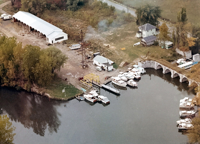 |
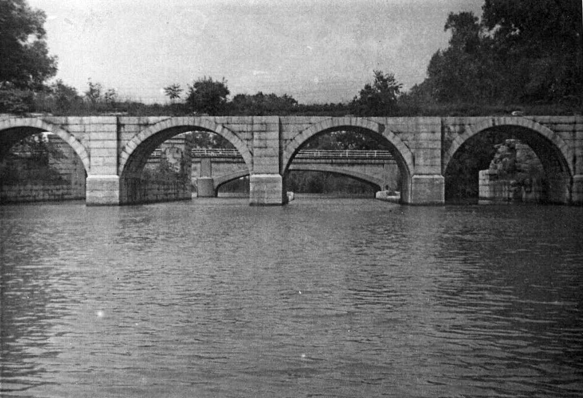
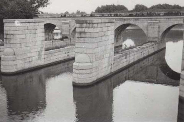
| The Lyons Aqueduct after it was abandoned and before it was demolished -- taken in the 1940s or 1950s? (Picture courtesy of Allyn Perry) | Lyons Aqueduct looking south, taken by David Ennis -- approximately 1935. (Picture courtesy of Edson Ennis) | Aerial view of Stephens' Marina in 1965(?), with the Lyons Aqueduct on the right. |
 |
 |
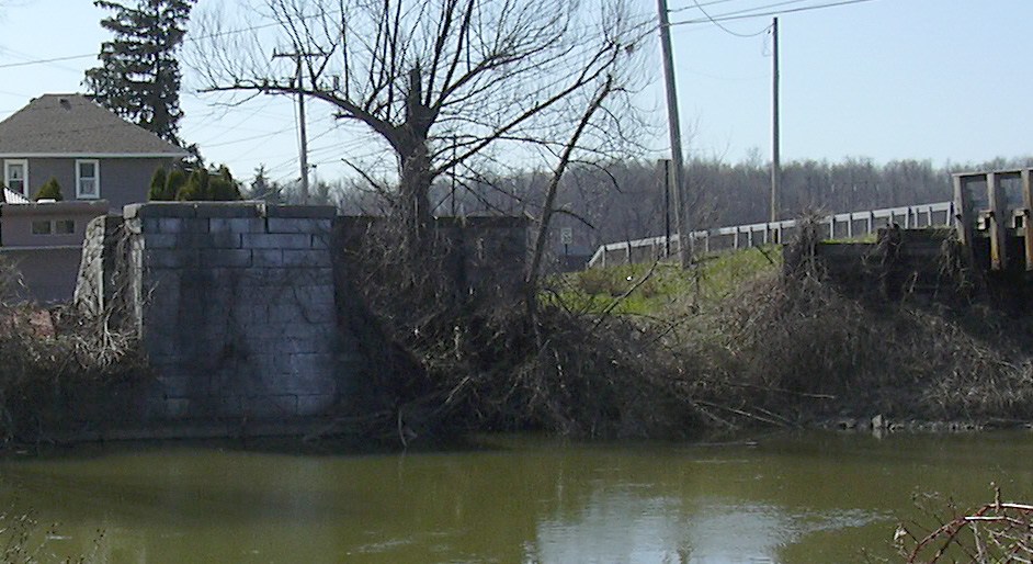 |
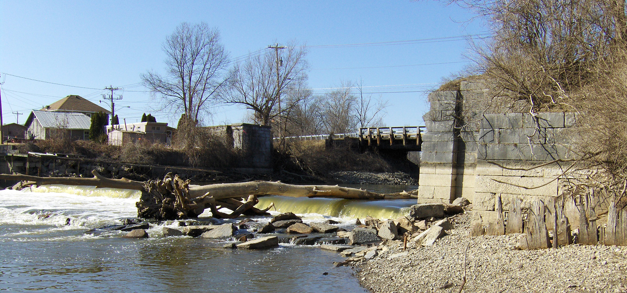
| Remains of the Lyons Aqueduct, from the south -- Taken March 2009. | The remains of the Lyons Aqueduct -- Taken April 2007. Left: the eastern end ; Right: the western end. | |
For other older pictures of the Lyons Aqueduct, see the Images of the Erie Canal in Lyons section of the Tour the Old Erie Canal pages.
http://www.eriecanal.org/LyonsAqueduct.html